Atghar اتغر | |
|---|---|
 Atghar Location within Afghanistan | |
| Coordinates: 31°43′30″N67°23′6″E / 31.72500°N 67.38500°E | |
| Country | Afghanistan |
| Province | Zabul |
Atghar District is a district of Zabul province in southern Afghanistan. [1]
Atghar اتغر | |
|---|---|
| Atghar Location within Afghanistan | |
| Coordinates: 31°43′30″N67°23′6″E / 31.72500°N 67.38500°E | |
| Country | Afghanistan |
| Province | Zabul |
Atghar District is a district of Zabul province in southern Afghanistan. [1]
The population in 2005 was estimated 8,400 in 2013. [1] The district is mostly populated by the Hotak tribe of Ghilji Pashtuns. [2]
The district's military base was evacuated on December 22, 2020, indicating an incoming the Taliban presence there [3]

Zabul is one of the 34 provinces of Afghanistan, located in the south of the country. It has a population of 249,000. Zabul became an independent province from neighbouring Kandahar in 1963. Historically, it was part of the Zabulistan region. Qalat serves as the capital of the province. The major ethnic group are Pashtuns. Primary occupations within Zabul are agriculture and animal husbandry.

Paktika is one of the 34 provinces of Afghanistan, located in the eastern part of the country. Forming part of the larger Loya Paktia region, Paktika has a population of about 789,000, mostly ethnic Pashtuns. The town of Sharana serves as the provincial capital, while the most populous city is Urgun.
Barai Ghar are a group of mountains in the southeast of Zabul province, Afghanistan - 200 km (124 mi) northeast of Kandahar. It is in proximity to Ata Ghar and Shinkay mountains. Topically, the region was used following the U.S. invasion of Afghanistan as a hiding place by some Taliban insurgents.

The districts of Afghanistan, known as wuleswali, are secondary-level administrative units, one level below provinces. The Afghan government issued its first district map in 1973. It recognized 325 districts, counting wuleswalis (districts), alaqadaries (sub-districts), and markaz-e-wulaiyat. In the ensuing years, additional districts have been added through splits, and some eliminated through merges. In June 2005, the Afghan government issued a map of 398 districts. It was widely adopted by many information management systems, though usually with the addition of Sharak-e-Hayratan for 399 districts in total. It remains the de facto standard as of late 2018, despite a string of government announcements of the creation of new districts.
Daman District is situated in the central part of the Kandahar Province, Afghanistan. It borders Panjwai and Kandahar districts to the west, Shah Wali Kot District to the north, Zabul Province to the northeast, Arghistan and Spin Boldak districts to the east and Reg District to the south. The population is 30,700 (2006). The center is the village of Daman, located in the central part of the district. The area is irrigated by the Helmand and Arghandab Valley Authority.
Maruf District, also Ma'ruf or Maroof, is a district in Kandahar Province, Afghanistan. It borders Arghistan District to the west, Zabul Province to the north and Pakistan to the east and south. The population was 200,000 in 2006. The district center is the town of Maruf, located in the northern part of the district. It is a boundary mountainous district with many rugged mountain passes towards Pakistan. It is located almost 190 km from any provincial city. This district has 360 villages. It has very agricultural land.
Nawa is a large district in the far south of Ghazni Province, Afghanistan. It is 100 km south from Ghazni in a mountainous region. The salt lake Ab-i Istada is located in the northern part of the district. Nawa's population was estimated at 29,054 in 2002, of whom around 45% were children under 12. The district center is the village of Nawa. Military operations in the district were featured in articles in the Washington Post and the New York Times in October 2009. The district was controlled by the Taliban until 17 July 2017.
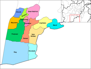
The Arghistan District is a district in the northeastern part of Kandahar Province, Afghanistan. It borders Spin Boldak District to the south and west, Daman District to the west, Zabul Province to the north, Maruf District to the east and Pakistan to the south. The population is 30,500 (2006). The district's center is the village of Arghistan, in the physical center of the district in the Arghistan River valley.
Shah Wali Kot District is situated in the northern part of Kandahar Province, Afghanistan. It borders Khakrez District to the west, Naish District and Oruzgan Province to the north, Zabul Province to the east and Daman and Arghandab districts to the south. The population is 38,400 (2006). The district center is located in the most southern part of the district. The district has been known as a stronghold of the Taliban forces.
Dey Chopan, also spelled as Daichopan, is the northernmost district in Zabul province of Afghanistan. Historically the district belonged to Hazaras, which was occupied by Abdur Rahman Khan in the 19th century. In 2013, it had a population of about 38,300.

Arghandab District is a District of Zabul Province, Afghanistan. The population in 2019 was estimated at 36,298.
Mezana or Mizan is a district of Zabul province in southern Afghanistan.
Qalat District is a district of Zabul Province in southern Afghanistan. Its district seat is Qalat, the capital of the province.

Shahjoy District is a district of Zabul province in southern Afghanistan. It is located in the eastern part of the province, next to Ghazni province.
Shamulzayi District is a district of Zabul province in southern Afghanistan.
Shinkay District is a district of Zabul province in southern Afghanistan.
Tarnak Aw Jaldak, or Tarnak Wa Jaldak, is a district of Zabul province in southern Afghanistan.
Kakar District, , also Khak-e Afghan is a district of Zabul province in southern Afghanistan. It has a population of about 23,400 as of 2013. The majority of the population belong from Kakar tribes and the other tribes of the district are Khowazak, Kharoti and Hatwal. The district is very famous by their Agriculture especially dry fruits and hospitality. This is the second educated district of Zabul province. The most influential persons of Zabul province like member of Parliament Sardar Khodai dad Khan, Sardar Karim dad Khan, the writer and poet Sardar Izatullah Kakar, Ishaq Akhondzada, the president of Zabul University Rahmatullah Kakar are belong to this district.
Naw Bahar District is a district of Zabul province in southern Afghanistan.
| Districts |  | |
|---|---|---|
| Populated places | ||
| Other | ||
| | This Zabul Province, Afghanistan location article is a stub. You can help Wikipedia by expanding it. |