Kunduz is one of the 34 provinces of Afghanistan, located in the northern part of the country next to Tajikistan. The population of the province is around 1,136,677, which is mostly a tribal society; it is one of Afghanistan's most ethnically diverse provinces with many different ethnicities in large numbers living there. The city of Kunduz serves as the capital of the province. It borders the provinces of Takhar, Baghlan, Samangan and Balkh, as well as the Khatlon Region of Tajikistan. The Kunduz Airport is located next to the provincial capital.
Baghlan is one of the 34 provinces of Afghanistan. It is in the north of the country. As of 2020, the province has a population of about 1,014,634.

Balkh is one of the 34 provinces of Afghanistan, located in the north of the country. It is divided into 15 districts and has a population of about 1,509,183, which is multi-ethnic and mostly a Persian-speaking society. The city of Mazar-i-Sharif serves as the capital of the province. The Mawlana Jalaluddin Mohammad Balkhi International Airport and Camp Marmal sit on the eastern edge of Mazar-i-Sharif.

Bamyan Province, also spelled Bamiyan, Bāmīān or Bāmyān, is one of the thirty-four provinces of Afghanistan with the city of Bamyan as its center, located in central parts of Afghanistan.

Nangarhār, also called Nangrahar or Ningrahar, is one of the 34 provinces of Afghanistan, located in the eastern part of the country and bordering Logar, Kabul, Laghman and Kunar provinces as well as having an international border with Pakistan. It is divided into 22 districts and has a population of about 1,735,531, the third highest of the country's 34 provinces. The city of Jalalabad is the capital of Nangarhar province. Nangarhar province is famous for its fish and karahi dishes.

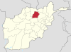
Samangan is one of the thirty-four provinces of Afghanistan, located north of the Hindu Kush mountains in the central part of the country. The province covers 11,218 square kilometres (4,331 sq mi) and is surrounded by Sar-e Pol Province in the west, Balkh in the north, Baghlan in the east, and Bamyan in the south.

Sar-e Pol, also spelled Sari Pul, is one of the thirty-four provinces of Afghanistan, located in the north of the country. It borders Ghor and Bamyan to the south, Samangan to the east, Balkh and Jowzjan to the north, and Faryab to the west. The province is divided into 7 districts and contains 896 villages. It has a population of about 632,000, which is multi-ethnic and mostly a tribal society. The province was created in 1988, with the support of northern Afghan politician Sayed Nasim Mihanparast. The city of Sar-e Pol serves as the provincial capital.

Panjshir is one of the thirty-four provinces of Afghanistan, located in the northeastern part of the country containing the Panjshir Valley. The province is divided into seven districts and contains 512 villages. As of 2021, the population of Panjshir province was about 173,000.

The districts of Afghanistan, known as wuleswali, are secondary-level administrative units, one level below provinces. The Afghan government issued its first district map in 1973. It recognized 325 districts, counting wuleswalis (districts), alaqadaries (sub-districts), and markaz-e-wulaiyat. In the ensuing years, additional districts have been added through splits, and some eliminated through merges. In June 2005, the Afghan government issued a map of 398 districts. It was widely adopted by many information management systems, though usually with the addition of Sharak-e-Hayratan for 399 districts in total. It remains the de facto standard as of late 2018, despite a string of government announcements of the creation of new districts.
Kahmard District is a district of Bamyan province in central Afghanistan. The District Capital is Kahmard. It is located at an altitude of 1,475 meters, with a population of 31,042 as of 2003. Kahmard is situated 140 km from Bamiyan city, in the north of the province, and is divided into five valleys.
Sayghan District, also spelt Saighan, Seyghan and other variant spellings, and also known as Saraik or Sarayek, and other variant spellings of this name, is an administrative district of Bamyan province, Afghanistan.

Dushi district is located in the central part of Baghlan Province, Afghanistan. It lies on the major Kabul-Kunduz highway. The population of the district was estimated to be around 57,160 in 2004. Hazaras are around 60% of the population and make up the majority in the district, followed by Tajiks (39%). The centre of the district is Dushi. Dushi was considered contested between the Afghan Government and the Taliban in late 2018.

Balkhab is a district of Sar-e Pol Province, Afghanistan. The district seat lies at Balkhab, also known as Tarkhoj.

Bādghīs is one of the thirty-four provinces of Afghanistan, located in the northwest of the country, on the border with Turkmenistan. It is considered to be one of the country's most underdeveloped provinces, with the highest poverty rate. The capital is Qala e Naw, while the most populous city and the district are Bala Murghab. The ruins of the medieval city of Marw al-Rudh, the historical capital of the medieval region of Gharjistan, are located in the province near the modern city of Bala Murghab.
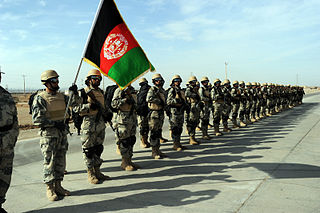
The Afghan Border Force (ABF) was responsible for security of Afghanistan's border area with neighboring countries extending up to 30 miles (48 km) into the interior and formed part of the Afghan National Army. In December 2017, most of the Afghan Border Police (ABP) personnel of the Afghan National Police were transferred to the Afghan National Army to form the Afghan Border Force. The ABP retained 4,000 personnel for customs operations at border crossings and international airports such as checking documents of foreigners entering the country or deporting them.

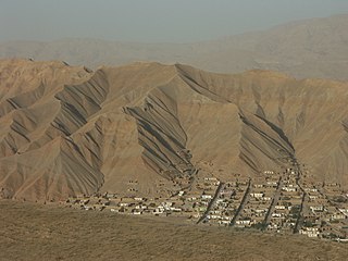
Afghanistan, which is about two-thirds mountainous, contains many valleys. The majority of the valleys are located in parts of northeastern, central, southern and southeastern Afghanistan. The southeastern areas are wetter and are covered by forest with trees such as cypress, oak, poplar, pine etc. The valleys are the most populated regions in the country, and much of the agriculture done takes place either in the valleys or on the high plains.
Darah Sof was a district of Samangan Province in Afghanistan. It was located about 130 kilometres (81 mi) from the city of Samangan and 200 kilometres (120 mi) from the city of Mazar-i-Sharif, in Balkh Province. In 2005, the district was split into Dara-i Sufi Bala District or Darah Sof Balla District, and Dara-i Sufi Payin District or Darah Sof Payan District.
Dara-i Sufi Payin District is a district in Samangan Province, Afghanistan, and it has an eponymous district center. It was created in 2005 from Darah Sof District.
Events in the year 2023 in Afghanistan.