Baharak District, Takhar

Last updated

Baharak District
Baharak District Map.svg
Location of the district in Takhar Province
Coordinates: 36°48′18″N69°24′36″E / 36.805°N 69.41°E / 36.805; 69.41
CountryFlag of the Taliban.svg  Afghanistan
Province Takhār Province
Established1992 [1]
Functioning2002
Area
[2]
   District 231 km2 (89 sq mi)
Elevation
[3]
703 m (2,306 ft)
Population
 (2019) [4]
   District 34,339
  Density149/km2 (390/sq mi)
   Urban
0
   Rural
34,339
Ethnicity
[1]
  Uzbek83%
  Pashtun10%
  Tajik5%
  Hazara2%
Time zone UTC+4:30 (Afghanistan Standard Time)
Post code
3762 [5]

Baharak District is a district of Takhar Province, Afghanistan. The district was split-off from Taluqan District in 2005. [6] Most people work in agriculture. The district has been the site of fighting between the Afghan Government and the Taliban; Baharak was considered to be contested in late 2018 and taken by the Taliban by August 2021. [7] [8]

Contents

Geography

Map of Takhar Province Takhar District Map.png
Map of Takhar Province

Baharak has an area of 231 square kilometers, comparatively equivalent to the area of São Vicente. [9] There are secondary roads that connect the district to the provincial capital, Taloqan, and a smaller road connecting the district with Khwaja Ghar District. It is 15 kilometers away from Taloqan. [3]

Baharak is bordered by Khwaja Ghar District to the north, Hazar Sumuch District to the east, Taluqan District to the south, and Bangi District with Dashti Archi District to the west. Dashti Archi is located in Kunduz Province, with all other districts located in Takhar Province. [10] Baharak may also border Aqtash District, [11] but Aqtash is a temporary district. [4]

There is another Baharak District in Badakhshan Province.

Demographics

Baharak has a population of 34339 and a sex ratio of 101 males for every 100 females. Most of the district is made up of Uzbeks, with Pashtun, Tajik, and Hazara minorities. [1] The median age is 16.6 and 57.6% of the population is unemployed. 13% of the unemployed are seeking work. Baharak has about 4800 households, with an average size of 7.1 people. [12]

Economy

Close to half of employed people in Baharak work in agriculture, forestry, or fishing. [12] Wheat and rice are the main crops, with barley, sorghum, sesame, corn, cotton, and melon also being grown. [3] However, there is a lack of seeds, machinery, cold storages, and fertilizer. [2] There used to be livestock, but much was lost because of war and drought. [1]

Handicraft is another trade present in Baharak. [2]

Education and healthcare

Baharak has a 35% literacy rate among people ages 15–24. [12] There is one madrasa, two high schools, and several primary schools in the district. The education situation has been improving- in 2002 there were only a handful of schools. [1] However, there is a lack of teachers, supplies, and anti-government opposition to schools.

There are two health centers in Baharak: one by the district center and another by the village of Qara Kamar. [10] There is also an ambulance to transport patients to Taloqan if needed. Tuberculosis and malaria remain an issue. [1] [3] Baharak suffers from a lack of medical knowledge, money, doctors, and medical equipment. [2]

Related Research Articles

<span class="mw-page-title-main">Nimruz Province</span> Province of Afghanistan

Nimruz or Nimroz is one of the 34 provinces of Afghanistan, located in the southwestern part of the country. It lies to the east of the Sistan and Baluchestan Province of Iran and north of Balochistan, Pakistan, also bordering the Afghan provinces of Farah and Helmand. It has a population of about 186,963 people. The province is divided into five districts, encompassing about 649 villages.

<span class="mw-page-title-main">Takhar Province</span> Province of Afghanistan

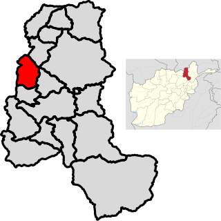
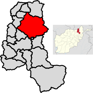
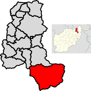
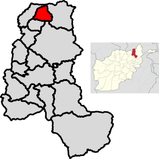
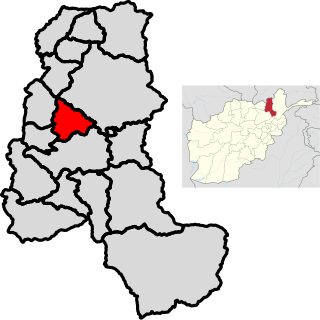
Takhar is one of the thirty-four provinces of Afghanistan, located in the northeast of the country next to Tajikistan. It is surrounded by Badakhshan in the east, Panjshir in the south, and Baghlan and Kunduz in the west. The city of Taloqan serves as its capital.

<span class="mw-page-title-main">Panjshir Province</span> Province of Afghanistan

Panjshir is one of the thirty-four provinces of Afghanistan, located in the northeastern part of the country containing the Panjshir Valley. The province is divided into seven districts and contains 512 villages. As of 2021, the population of Panjshir province was about 173,000.

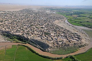
Taloqan is the capital of Takhar Province, in northeastern Afghanistan. It is located in the Taluqan District. The population was estimated as 196,400 in 2006.

<span class="mw-page-title-main">Bangi District</span> District in Takhār Province, Afghanistan

Bangi District is a district of Takhar Province, Afghanistan.

<span class="mw-page-title-main">Chah Ab District</span> District in Takhār Province, Afghanistan

Chah Ab District is a district of Takhar Province, Afghanistan. Its district center is Chah Ab. The district's economy is primarily based on agriculture and livestock.

<span class="mw-page-title-main">Chal District</span> District in Takhār, Afghanistan

Chal District is a district of Takhar Province, Afghanistan. It was considered to be largely under control of the Afghan government in 2018.

<span class="mw-page-title-main">Darqad District</span> District in Takhār Province, Afghanistan

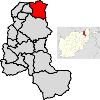
Darqad District is a district of Takhar Province, Afghanistan. The district has 34 villages. Darqad did not change between the 325 and 398 district sets. Near the end of 2018, the district was considered to be Taliban-influenced, as opposed to the Afghan government. The district was Taliban-controlled by August 2021.

<span class="mw-page-title-main">Farkhar District</span> District in Takhar, Afghanistan

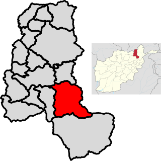
Farkhar District is a district in Takhar Province of Afghanistan. It is located southeast of Taloqan. The Khanabad River flows inside this valley. Around 99% of the people in Farkhar speak Dari. Farkhar has about 50,000 people and 75 villages.

<span class="mw-page-title-main">Kalafgan District</span> District in Takhār Province, Afghanistan

Kalafgan District is a district of Takhar Province, Afghanistan. The district is well governed, with self-governance in parts of Kalafgan because of how remote they are. 42 villages are located in the district. In 2017, Kalafgan was considered to be under full control by the Afghan Government. However, the Taliban had taken full control by August 2021.

<span class="mw-page-title-main">Khwaja Ghar District</span> District in Takhār Province, Afghanistan

Khwaja Ghar District is a district of Takhar Province, Afghanistan. The district was badly destroyed during the 1996-2001 Afghan Civil War in fighting between the Taliban and the Northern Alliance.

<span class="mw-page-title-main">Rustaq District, Afghanistan</span> District in Takhār Province, Afghanistan

Rustaq District is a district of Takhar Province, northern Afghanistan. The district centre is the town of Rostaq. As recently as 2020, the district was considered to be under government control, as opposed to control by the Taliban. However, the district has had issues with illegal armed men.

<span class="mw-page-title-main">Warsaj District</span> District in Takhār Province, Afghanistan

Warsaj District is a district of Takhar Province, northern Afghanistan.

<span class="mw-page-title-main">Yangi Qala District</span> District in Takhār Province, Afghanistan

Yangi Qala District is a district in Takhar Province, Afghanistan. Economically the population of this district is primarily involved in agriculture. The main crops are rice and wheat, and the surplus rice is exporting to neighboring districts and provinces. There are 64 villages in the district. As of August 2021, the Taliban has full control over this district.

<span class="mw-page-title-main">Dashti Qala District</span> District in Takhār Province, Afghanistan

Dashti Qala District is a district of Takhar Province, Afghanistan. It split from Khwaja Ghar District in June 2005. This district borders Tajikistan. Ai-Khanoum, probably founded by the Seleucid Empire, is located in this district. In 2018, this district was considered contested between the government and the Taliban.

<span class="mw-page-title-main">Namak Ab District</span> District in Takhār Province, Afghanistan

Namak Ab District is a district of Takhar Province, Afghanistan. The district was split-off from Taluqan District. In late 2018, Namak Ab was considered to be government influenced, as opposed to the Taliban.

<span class="mw-page-title-main">Hazar Sumuch District</span> District in Takhār Province, Afghanistan

Hazar Sumuch District is a district of Takhar Province, Afghanistan. The district was split-off from Taluqan District. Most people in the district work in agriculture. In late 2018, Hazar Sumuch was considered to be government influenced as opposed to the Taliban.

<span class="mw-page-title-main">Khwaja Bahauddin District</span> District in Takhār Province, Afghanistan

Khwaja Bahauddin District is a district of Takhar Province, Afghanistan. The district was created from a portion of Yangi Qala District in 2005. 25 villages are located in Khwaja Bahauddin.

Andkhoy District is a district in Faryab province, Afghanistan. The district center is the Andkhoy city, and there are a total of 81 villages in the district. Most people farm or raise livestock in the district. The district is considered to be government-influenced, as opposed to the Taliban.

<span class="mw-page-title-main">Shahjahan Noori</span> Afghan Police Chief (1965–2011)

Shahjahan Noori, also known as General Shahjahan Noori, He was an Afghan guerrilla, military and police commander, during resistance against Soviet invasion and fight against terrorist groups such as Taliban and Al-Qaeda between 1981 and 2011.

References

  1. 1 2 3 4 5 6 "District Profile: Baharak" (PDF). mrrd-nabdp.org. 12 September 2002. Archived from the original (PDF) on 18 July 2014. Retrieved 12 August 2020.
  2. 1 2 3 4 "Baharak District Development Plan" (PDF). mrrd-nabdp.org. 2006. Archived from the original (PDF) on 3 March 2016. Retrieved 12 August 2020.
  3. 1 2 3 4 "Baharak District". takhar.gov.af. Retrieved 14 August 2020.
  4. 1 2 "Estimated Population of Afghanistan 2019-20" (PDF). nsia.gov.af. 2019. p. 29. Archived from the original (PDF) on 9 June 2020. Retrieved 12 August 2020.
  5. "Baharak Post Codes". worldpostalcode.com. Retrieved 12 August 2020.
  6. "398 District Division Matching to 329 District Division". aims.org. Archived from the original on 22 March 2016. Retrieved 14 August 2020.
  7. "Quarterly Report to the United States Congress" (PDF). SIGAR. 30 January 2019. p. 71. Retrieved 14 August 2020.
  8. "Mapping the advance of the Taliban in Afghanistan". BBC News. 5 August 2021. Retrieved 5 August 2021.
  9. "Islands by Land Area". unep.ch. 1998. Archived from the original on 1 December 2015. Retrieved 13 August 2020.
  10. 1 2 "Takhar Province Reference Map". humanitarianresponse.info. United Nations Office for the Coordination of Humanitarian Affairs. 9 February 2014. Retrieved 13 August 2020.
  11. "Afghanistan District Maps". www.arcgis.com. Retrieved 5 October 2020.
  12. 1 2 3 UNFPA (5 January 2015). "Takhar Socio-economic and Demographics Survey". unfpa.org. Retrieved 14 August 2020.