Saghar District

Last updated

Saghar
ساغر
Afghanistan adm location map.svg
Red pog.svg
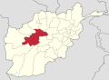
Saghar
Location within Afghanistan
Coordinates: 33°41′29″N63°52′01″E / 33.6914°N 63.8669°E / 33.6914; 63.8669
Country Flag of the Taliban.svg  Afghanistan
Province Ghor
Center Titan
Area
  Total2,644 km2 (1,021 sq mi)
Elevation
2,160 m (7,090 ft)
Population
 (2012) [1]
  Total33,700

Saghar District is situated in the most southwestern part of Ghor province, Afghanistan with district center Titan. The population is 33,700 people. [1] The district, as the other mountainous districts in the province, suffers long and severe winters and continuing drought during the summer.

Contents

Economy

The district suffers from poverty and weak economy due to spread of diseases, low agriculture and livestock productions and poor access to basic infrastructural, social, economical and educational services. [2]

Related Research Articles

<span class="mw-page-title-main">Herat Province</span> Province of Afghanistan

Herat is one of the thirty-four provinces of Afghanistan, located in the western part of the country. Together with Badghis, Farah, and Ghor provinces, it makes up the north-western region of Afghanistan. Its primary city and administrative capital is Herat City. The province of Herat is divided into about 17 districts and contains over 2,000 villages. It has a population of about 3,780,000, making it the second most populated province in Afghanistan behind Kabul Province. The population is multi-ethnic but largely Persian-speaking. Herat dates back to the Avestan times and was traditionally known for its wine. The city has a number of historic sites, including the Herat Citadel and the Musalla Complex. During the Middle Ages Herat became one of the important cities of Khorasan, as it was known as the Pearl of Khorasan.

<span class="mw-page-title-main">Ghor Province</span> Province of Afghanistan

Ghōr, also spelled Ghowr or Ghur, is one of the thirty-four provinces of Afghanistan. It is located in the western Hindu Kush in central Afghanistan, towards the northwest. The province contains eleven districts, encompassing hundreds of villages, and approximately 764,472 settled people. Firuzkoh is the capital of the province.

<span class="mw-page-title-main">Daykundi Province</span> Province of Afghanistan

Daykundi, also spelled as Daikundi, Daikondi, or Daykondi, is one of the thirty-four provinces of Afghanistan, located in the central part of the country. It has a population of about 516,504 and is a Hazara dominated province.

<span class="mw-page-title-main">Chaghcharan</span> City in Ghor, Afghanistan

Chaghcharān, also called Firozkoh, is a town and district in central Afghanistan, which serves as the capital of Ghor Province. It is located on the southern side of the Hari River, at an altitude of 2,230 m above sea level. Chaghcharan is linked by a 380 kilometres (240 mi) long highway with Herat to the west, and a 450 kilometres (280 mi) long highway with Kabul to the east. The town is served by Chaghcharan Airport.

Sangi Takht or Sang‐e‐Takht, is a district in Daykundi Province in central Afghanistan. It was created in 2005 from Daykundi district.

Charsada District is a District of Ghor province, Afghanistan. It was created from the northwestern part of Chaghcharan District in 2005. The district center is Qale-Zobayd. The population is 26,600.

Dawlat Yar is a district in Ghor Province, Afghanistan. It was created in 2005 from the southeastern part of Chaghcharan District. The administrative center of the district is Delak, but the largest town is Dawlat Yar at 2503 m altitude.

Du Layna or Duleena is a district in Ghor province, Afghanistan. It was created from part of the much larger Chaghcharan District in 2005.

Lal wa Sarjangal, is a district in the north-east of Ghor province in central Afghanistan. The district center is the town of La'l.

Lal (La'l) sometimes called Lal wa Sarjangal is a town and the administrative center of Lal wa Sarjangal District, Ghor province in central Afghanistan.

Pasaband District is located in Ghor province, Afghanistan. The population is 92,900. Located in the southern part of Ghor province, Pasaband District borders Helmand province to the south, Daykundi province to the east, and Farah province to the southwest. The district center is Shinkot.

Titan is the district center of Saghar District, Ghor province, Afghanistan. It is located at 33.6914°N 63.8669°E at 2,166 m altitude. Very close to Titan is the village of Saghar which gives the name of the district.

<span class="mw-page-title-main">Shahrak District</span> District in Ghor, Afghanistan

Shahrak District is located in the western part of Ghor province, Afghanistan. The population is 58,200. The district center is Dahan-e Falezak.

Taywara (Teyvareh) district is located in the southern part of Ghor province in Afghanistan. The population is 88,900 people. The district center is the town of Taywara.

Tulak District is located in the southwestern part of the Ghor province, Afghanistan. It is a mountainous district like the whole province. The population is 103,612 and the district center is Kwajaha.

Chishti Sharif District District in Herat Province, Afghanistan

Chishti Sharif District, also known as Chisht District, is the most easterly district in Herat Province, Afghanistan, situated along the Hari River and one of its northern tributaries. It borders with Obe District to the west, Badghis Province to the north and Ghor Province to the east and south. The population was estimated at 23,100 in 2012. The district administrative center is the village of Chishti Sharif.

Farsi is a district the west of Herat Province, Afghanistan. It borders on Obe District to the north, Adraskan District to the west, Shindand District to the south and Ghor Province to the south and east. The population was estimated at 29,800 in 2012. The district center is the village of Farsi.

Saghar is a village in Saghar District in Afghanistan's Ghor Province. It is located at 33°42'0N 63°52'0E with an altitude of 2235 metres (7335 feet).

<span class="mw-page-title-main">Badghis Province</span> Province of Afghanistan

Bādghīs is one of the thirty-four provinces of Afghanistan, located in the northwest of the country, on the border with Turkmenistan. It is considered to be one of the country's most underdeveloped provinces, with the highest poverty rate. The capital is Qala e Naw, while the most populous city and the district are Bala Murghab. The ruins of the medieval city of Marw al-Rudh, the historical capital of the medieval region of Gharjistan, are located in the province near the modern city of Bala Murghab.

<span class="mw-page-title-main">Marghab District</span> District in Ghor Province, Afghanistan

Marghab District , is a district located in Ghor Province, Afghanistan, created on 26 November 2019. Shorabak area serves as the district center. President Ghani decreed the creation of the district through decree No. 632 from the Presidential Palace. It was the people's demand. The district encompasses 32 villages and around 19,000 people, Marghab District has approximately 40000 inhabitants and is mainly populated by Tajiks.

References

  1. 1 2 "Settled Population of Ghor Province" (PDF). Central Statistics Organization. Retrieved 23 November 2015.
  2. "Summary of District Development Plan" (PDF). Saghar District Development Assembly. Archived from the original (PDF) on 24 November 2015. Retrieved 23 November 2015.