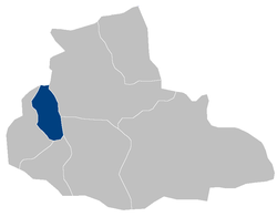
Ab Kamari is a district in the west of Badghis Province, Afghanistan. Its population was estimated at 36,300 in 2002, the ethnic makeup of which was approximately 80% Tajik with a Pashtun minority. The district capital is Sang Atesh. Other localities include Ab Khuda'i, Alkhan, Anjir, Duzdanak, Gana Gul, Khalifa, and Papal. Ab Kamari is known for its pistachio forests.

Qala-e-Naw, also Qalay-e-Naw or Qalanou, is a district in the west of Badghis Province, Afghanistan. Its population was estimated at 82,525 in 1990; the ethnic makeup is approximately 80% Tajik, Hazara and Aimaq Hazara, with small numbers of Pashtun, Baloch, Uzbek and Turkmen.
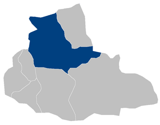
Bala murghab is a district situated in the northeast of Badghis Province, Afghanistan. The district capital is Bala Murghab city which is located along the Murghab River. Bala Murghab is surrounded by some other important districts such as Ab Kamari, Muqur, Jawand, and Qadis.
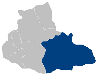
Jawand is the largest district of Badghis Province, Afghanistan, located in the southeast. Its population is estimated at 186,000, although a 1990 estimate by the United States Agency for International Development (USAID) puts the population at 46,403. Its capital is Jawand.

Ghormach is a district situated in the northwest of Faryab Province of Afghanistan. The district centre is Ghormach.

Ab Khuda'i or Abzi Khuda'i is a village in the west of Ab Kamari District in Herat Province, of north-west Afghanistan. Its population, consists of approximately 90% Tajik with a small Pashtun, Aimaq and Uzbek minority. Other localities include Alkhan, Anjir, Duzdanak, Gana Gul, Khalifa, and Papal. The village used to be in Badghis Province.

Kishim District is one of the 29 districts of Badakhshan Province in eastern Afghanistan. The district is located in the Keshem Valley, a primarily rural area on the western edge of the province, and is home to approximately 89,833 residents, making it the second most populous district of the province.

The Qadis District is located in the southern part of Badghis province, Afghanistan, between the districts Jawand in the East, Qala i Naw in the west, Muqur and Bala Murghab in the North. In the South is the Herat province. The capital is Qadis.

Qala-e-Naw is a town in Qala e Naw District and the capital of Badghis Province, of north-west Afghanistan. Its population was estimated 9,000 in 2006, of which 80% are Tajiks, Hazaras and Aimaq Hazara Other significant communities include Pashtuns, Balochs and Uzbeks.

Waghaz is a district in Ghazni Province, Afghanistan. It was formed in 2005 from part of Muqur District, and has a population estimated at 27,900. The district center is the town of Waghaz at 33.42°N 68.2939°E.

Kohband District is situated in the northwestern part of Kapisa Province, Afghanistan. It borders Kohistan District to the west, Parvan Province to the north, Nijrab District to the east and Mahmud Raqi District to the south. The population is 26,133 (2019). The district center is Hajjikheyl located in the western part of the district. The people mostly speak Pashayi language.
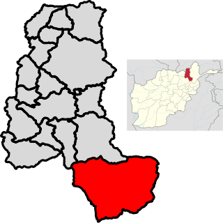
Warsaj District is a district of Takhar Province, northern Afghanistan.

Bayah is a town in Badghis Province, Afghanistan.

Ab Bakhsh is a village in Badghis Province in north-western Afghanistan. It is located in Qadis district.

Bazartu is a village in Badghis Province in north western Afghanistan.

Chakav is a village in Badghis Province in north western Afghanistan.

Chaman-e Bid is a village in Badghis Province in north western Afghanistan.

Senjetak is a village in Badghis Province, Afghanistan, located near Qala i Naw City, but officially under the administrative jurisdiction of the Muqur District.

Bādghīs is one of the thirty-four provinces of Afghanistan, located in the northwest of the country, on the border with Turkmenistan. It is considered to be one of the country's most underdeveloped provinces. The capital is Qala i Naw, while the most populous city and district is Bala Murghab. The ruins of the medieval city of Marw al-Rudh, the historical capital of the medieval region of Gharjistan, are located in the province near the modern city of Bala Murghab.
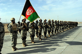
The Afghan Border Police (ABP) secure Afghanistan's 5,529 kilometres (3,436 mi) border with neighboring countries and all its international airports. It also administers immigration services such as checking documents of foreigners entering the country or deporting them. The ABP's anti-narcotic efforts are a prominent concern to the international community at present. The ABP and other divisions of the Afghan National Police jointly patrol a 55 km-wide corridor along the entirety of Afghanistan's border, particularly the longest and porous Durand Line border in the southeast with neighboring Pakistan.
