Kunduz is one of the 34 provinces of Afghanistan, located in the northern part of the country next to Tajikistan. The population of the province is around 1,136,677, which is mostly a tribal society; it is one of Afghanistan's most ethnically diverse provinces with many different ethnicities in large numbers living there. The city of Kunduz serves as the capital of the province. It borders the provinces of Takhar, Baghlan, Samangan and Balkh, as well as the Khatlon Region of Tajikistan. The Kunduz Airport is located next to the provincial capital.

Khatlon Region, one of the four provinces of Tajikistan, is the most populous of the four first-level administrative regions in the country. It is situated in the southwest of the country, between the Hisor (Gissar) Range in the north and the river Panj in the south and borders on Afghanistan in the southeast and on Uzbekistan in the west. During Soviet times, Khatlon was divided into Kurgan-Tyube (Qurghonteppa) Oblast – with the Kofarnihon and Vakhsh river valleys – and Kulob Oblast – with the Kyzylsu and Yakhsu river valleys. The two regions were merged in November 1992 into today's Khatlon Region. The capital city is Bokhtar, formerly known as Qurghonteppa and Kurgan-Tyube.

Badakhshan Province is one of the 34 provinces of Afghanistan, located in the northeastern part of the country. It is bordered by Tajikistan's Gorno-Badakhshan in the north and the Pakistani regions of Lower and Upper Chitral and Gilgit-Baltistan in the southeast. It also has a 91-kilometer (57-mile) border with China in the east.

Vanj District or Nahiya-e Vanj is a district in eastern Tajikistan, in the north-west of the Gorno-Badakhshan Autonomous Region, with administrative capital Vanj.

Imam Sahib District is situated in the northern part of Kunduz Province, Afghanistan. It borders with Qalay-I-Zal District to the west, Tajikistan to the north, with Archi District to the east and Kunduz District to the south. It has an estimated population of 232,846 as of 2021, which include ethnic Uzbeks at 45%, Pashtuns at 25%, Tajiks at 25% and Hazaras at 1%. The district center is the town of Imam Sahib, located in the northern part of the district. The other main town in the district is Sher Khan Bandar, which serves as Afghanistan's main port of entry to Tajikistan.

Qalay-I-Zal District, also spelled Qala-i-Zal, is situated in the western part of Kunduz Province, northern Afghanistan. It borders Balkh Province to the west and Tajikistan to the north along the Panj, Vakhsh and Amu Darya rivers. To the east it borders Imam Sahib District and to the south Kunduz and Chahar dara districts. Qalay-I-Zal River flows through the district and divides it in two parts. The population is 60,600 (2006) - 60% Turkmen and 40% Pashtun. The district is almost a desert and only the irrigated land is arable. The agriculture and carpet weaving are the most important sources of income.

Bangi District is a district of Takhar Province, Afghanistan.
Chah Ab District is a district of Takhar Province, Afghanistan. Its district center is Chah Ab. The district's economy is primarily based on agriculture and livestock.

Chal District is a district of Takhar Province, Afghanistan. It was considered to be largely under control of the Afghan government in 2018.

Kalafgan District is a district of Takhar Province, Afghanistan. The district is well governed, with self-governance in parts of Kalafgan because of how remote they are. 42 villages are located in the district. In 2017, Kalafgan was considered to be under full control by the Afghan Government. However, the Taliban had taken full control by August 2021.
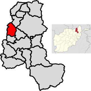
Khwaja Ghar District is a district of Takhar Province, Afghanistan. The district was badly destroyed during the 1996-2001 Afghan Civil War in fighting between the Taliban and the Northern Alliance.
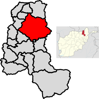
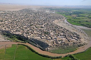
Rustaq District is a district of Takhar Province, northern Afghanistan. The district centre is the town of Rostaq.
Warsaj District is a district of Takhar Province, northern Afghanistan.
Yangi Qala District is a district in Takhar Province, Afghanistan. Economically the population of this district is primarily involved in agriculture. The main crops are rice and wheat, and the surplus rice is exporting to neighboring districts and provinces. There are 64 villages in the district. As of August 2021, the Taliban has full control over this district.

The Kokcha River is located in northeastern Afghanistan. A tributary of the Panj river, it flows through Badakhshan Province in the Hindu Kush. It is named after the Koksha Valley. The city of Feyzabad lies along the Kokcha. Near the village of Artin Jelow there is a bridge over the river.

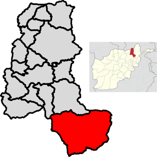
Baharak District is a district of Takhar Province, Afghanistan. The district was split-off from Taluqan District in 2005. Most people work in agriculture. The district has been the site of fighting between the Afghan Government and the Taliban; Baharak was considered to be contested in late 2018 and taken by the Taliban by August 2021.

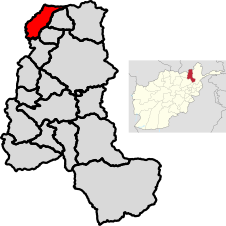
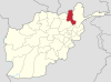
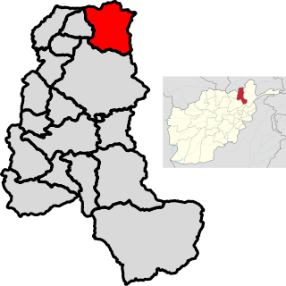
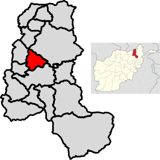
Dashti Qala District is a district of Takhar Province, Afghanistan. It split from Khwaja Ghar District in June 2005. This district borders Tajikistan. Ai-Khanoum, probably founded by the Seleucid Empire, is located in this district. In 2018, this district was considered contested between the government and the Taliban.

Namak Ab District is a district of Takhar Province, Afghanistan. The district was split-off from Taluqan District. In late 2018, Namak Ab was considered to be government influenced, as opposed to the Taliban.
Hazar Sumuch District is a district of Takhar Province, Afghanistan. The district was split-off from Taluqan District. Most people in the district work in agriculture. In late 2018, Hazar Sumuch was considered to be government influenced as opposed to the Taliban.
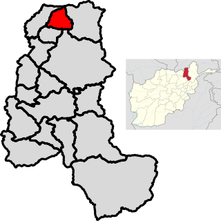
Khwaja Bahauddin District is a district of Takhar Province, Afghanistan. The district was created from a portion of Yangi Qala District in 2005. 25 villages are located in Khwaja Bahauddin.