Gelan District

Last updated

Gelan
گیلان
Ghazni districts.png
Gelan District in bright green
Afghanistan adm location map.svg
Red pog.svg
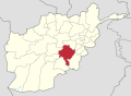
Gelan
Location within Afghanistan
Coordinates: 32°43′52″N67°38′11″E / 32.730974°N 67.636271°E / 32.730974; 67.636271
Country Flag of the Taliban.svg  Afghanistan
Province Ghazni Province
Elevation
2,000 m (7,000 ft)

Gelan is a district in the south of Ghazni province, Afghanistan. Its population was estimated at 78,408 in 2002. The district capital is Janda. [1]

Contents

The district is within the heartland of the Tarakai tribe of Ghilji Pashtuns. [2]

Politics and Governance

Geography

Healthcare

Education

Demographics

Afghan children walk along a road near a bazaar in the Gelan district, Ghazni province, Afghanistan, Nov. 2, 2013 Afghan children walk along a road near a bazaar in the Gelan district, Ghazni province, Afghanistan, Nov. 2, 2013 131102-A-YF193-079.jpg
Afghan children walk along a road near a bazaar in the Gelan district, Ghazni province, Afghanistan, Nov. 2, 2013

Infrastructure

Natural Resources

Related Research Articles

<span class="mw-page-title-main">Ghazni Province</span> Province of Afghanistan

Ghazni is one of the 34 provinces of Afghanistan, located in southeastern Afghanistan. The province contains 19 districts, encompassing over a thousand villages and roughly 1.3 million people, making it the 5th most populous province. The city of Ghazni serves as the capital. It lies on the important Kabul–Kandahar Highway, and has historically functioned as an important trade center. The Ghazni Airport is located next to the city of Ghazni and provides limited domestic flights to Afghanistan's capital, Kabul.

<span class="mw-page-title-main">Districts of Afghanistan</span> Second-level administrative subdivision of Afghanistan

The districts of Afghanistan, known as wuleswali, are secondary-level administrative units, one level below provinces. The Afghan government issued its first district map in 1973. It recognized 325 districts, counting wuleswalis (districts), alaqadaries (sub-districts), and markaz-e-wulaiyat. In the ensuing years, additional districts have been added through splits, and some eliminated through merges. In June 2005, the Afghan government issued a map of 398 districts. It was widely adopted by many information management systems, though usually with the addition of Sharak-e-Hayratan for 399 districts in total. It remains the de facto standard as of late 2018, despite a string of government announcements of the creation of new districts.

<span class="mw-page-title-main">Jaghori District</span> District in Ghazni, Afghanistan

Jaghori is one of the main districts of the Ghazni province in Afghanistan. It is located in the highlands in the southern fringes of the Hazaristan region. It occupies 1,855 km2. in the upper Arghandab valley. The population is estimated to be around 560,000 in 2015. The district capital, Sange-e-Masha, is where major business transactions take place. The district is heavily dependent on agriculture, and migrant workers as the main sources of income. Other major marketplaces are in Ghojor and Anguri.

<span class="mw-page-title-main">Ab Band District</span> District in Ghazni Province, Afghanistan

Ab Band is a district in Ghazni province, Afghanistan. Its population, which is almost entirely Pashtun, was estimated at 41,340 in 2002. The district is within the heartland of the Tarakai tribe of Ghilji Pashtuns. Ab Band is on the main road from Kabul to Kandahar. The district capital is Āb Band.

<span class="mw-page-title-main">Nawur District</span> District in Ghazni, Afghanistan

Nawur is one of the districts of Afghanistan, which is located in the northern part of Ghazni Province. With an area of approximately 5,234 km2 (2,021 sq mi), Nawur is the largest district of Ghazni province. Its population was estimated at 91,778 in 2002. Nawur's inhabitants are ethnic Hazaras followed by Kochis. The Jikhai River originates here.

<span class="mw-page-title-main">Ajristan District</span> District in Ghazni Province, Afghanistan

Ajristan, also known as Dāya (دایه), or Dāya wa Folād, Ajristan also spelled as Ajeristan, is a district in the western part of Ghazni province, Afghanistan. Its population was estimated at 62,028 in 2001, of which 90% are Pashtun people with others from the Hazara people. Sangar, in the center of the district, is the capital. Most of the population live in the Jikhai River valley and depend upon agriculture, the main source of its economy. The last decade of severe winters and droughts have affected the economy and quality of life..

Malistan or Malestan, is a district in Ghazni province, Afghanistan. Its population, which is 100% Hazara, was estimated at 350,000 in 2009. The district capital is Mir Adina.

Nawa is a large district in the far south of Ghazni Province, Afghanistan. It is 100 km south from Ghazni in a mountainous region. The salt lake Ab-i Istada is located in the northern part of the district. Nawa's population was estimated at 29,054 in 2002, of whom around 45% were children under 12. The district center is the village of Nawa. Military operations in the district were featured in articles in the Washington Post and the New York Times in October 2009. The district was controlled by the Taliban until 17 July 2017.

Muqur is a district in the southwest of Ghazni province, Afghanistan. Its population was estimated at 70,900 in 2002, of whom 19,538 were children under 12.

<span class="mw-page-title-main">Qarabagh District, Ghazni</span> District in Ghazni, Afghanistan

Qarabagh or Qara Bagh, is a district in Ghazni province, 56 km to the south-west of Ghazni city in eastern Afghanistan. The 1,800 km2 area is one of the most populated at 109,000; some reports count more than 218,000. The ethnic composition of the district includes Hazaras and Pashtuns. The landscape varies in different parts of the district - deserts in the southwest, plains in the southeast and mountains in the north. The district is seriously affected by drought, especially farming and animal husbandry. Health and education need serious improvement.

<span class="mw-page-title-main">Giro District</span> District in Ghazni Province, Afghanistan

The Giro District is located within southeastern Ghazni province in Afghanistan, 50 km South East of Ghazni city. The district is a wide plain with scattered low mountains. More than 40 000 residents are estimated, according to 2002 year's data. The district is within the heartland of the Tarakai tribe of Ghilji Pashtuns. The district center is Pana.

<span class="mw-page-title-main">Andar District</span> District in Ghazni Province, Afghanistan

Andar is one of the eastern districts of Ghazni Province in Afghanistan. The population has been estimated at 88,300, all Pashtun. The district center is Miray while the other main town is Andar. The district is named after the Andar Ghilji tribe of the Pashtuns. The district also contains the town of Sardeh Band on its edge near the border with Paktika Province.

<span class="mw-page-title-main">Dih Yak District</span> District in Ghazni Province, Afghanistan

Deh Yak is a rural district in the eastern part of Ghazni Province, Afghanistan, 30 km east from the city of Ghazni. The district has an area of 715 km2, containing 66 villages and a population of about 44,386. Ramak serves as the district's headquarters.

Zana Khan district is a mountainous district in Ghazni province, Afghanistan with more than 12,000 people living there. The district center is Dado.

<span class="mw-page-title-main">Ghazni District</span> District of Afghanistan

Ghazni District, is a district of Ghazni province, Afghanistan situated in the northeast part of the province. Capital of the district is Ghazni, which is also capital of Ghazni Province.

<span class="mw-page-title-main">Mata Khan District</span> District in Paktika, Afghanistan

Mata Khan District is a district of Paktika Province, Afghanistan. The district is within the heartland of the Andar tribe of Ghilji Pashtuns. The estimated population in 2019 was 26,720.

<span class="mw-page-title-main">Shahjoy District</span> District in Zabul, Afghanistan

Shahjoy District is a district of Zabul province in southern Afghanistan. It is located in the eastern part of the province, next to Ghazni province.

Jaghatu, is one of the largest and most populated district of Ghazni province in Afghanistan, west of the city of Ghazni.

Gulbawri is a residential area in Afghanistan, located in Jaghatu District of Ghazni Province.

References

  1. "District Profile" (PDF). UNHCR. Archived from the original (PDF) on 27 October 2005. Retrieved 25 April 2006.
  2. Ghazni Province Tribal Map (Page 4). Naval Postgraduate School.