Kalafgan District | |
---|---|
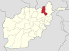
Location of Kalafgan in Takhar Province | |
Coordinates(the district center): 36°46′23″N69°56′28″E / 36.773°N 69.941°E Coordinates: 36°46′23″N69°56′28″E / 36.773°N 69.941°E | |
Country | Afghanistan |
Province | Takhār Province |
Established | 1973 [1] |
District Center | Kalafgan |
Government | |
• Governor | Reza Shah Sarasengi [2] |
Area | |
• Total | 479 km2 (185 sq mi) |
Population (2019) [4] | |
• Total | 39,171 |
• Density | 82/km2 (210/sq mi) |
Ethnicity | |
• Uzbek | 95% |
• Tajik | 2% |
• Hazara | 2% |
• Pashtun | 1% |
Time zone | UTC+4:30 (Afghanistan Standard Time) |
Kalafgan District is a district of Takhar Province, Afghanistan. The district is well governed, with self-governance in parts of Kalafgan because of how remote they are. [2] 42 villages are located in the district. [3] In 2017, Kalafgan was considered to be under full control by the Afghan Government. [6] However, the Taliban had taken full control by August 2021. [7]
Kalafgan has an area of 479 square kilometers, comparatively equivalent to the area of Cape Barren Island. [8] The district has access to a good road, as it lies along the highway linking the provincial capitals of Taloqan and Fayzabad, Badakhshan. There are two rivers flowing through Kalafgan— one that flows from the southeast to the northwest that eventually joins the Kokcha River, and a smaller river that flows through the southeast portion of the district that flows to the Khanabad River.
Kalafgan is bordered by four other districts: Rustaq District to the north, Kishim District to the east, Farkhar District to the south, and Taluqan District to the west. Kishim is located in Badakhshan Province, with all other districts being located in Takhar Province. The Kokcha River forms the border between Rustaq and Kalafgan. [9]
The district was created as part of the first 325 district set in 1973, and was controlled by Mujahideen soon after the start of the Soviet–Afghan War. Kalafgan was initially controlled by Jamiat-e Islami but switched to Junbesh-i Melli during the 1990s. During the Afghan Civil War (1996–2001), only one village was controlled by the Taliban briefly in 2001. The Taliban had not been a strong presence in the (formerly) relatively peaceful district, with only two incidents from 2018 to May 2020. [1] [2] However, the district was taken by the Taliban by August 2021. [7]
Kalafgan has a population of 39171, with a sex ratio of 101 males for every 100 females. Most of the district is made up of Uzbeks. [5] The median age is 15.3, with about 50% of the population employed. There are about 5760 households in Kalafgan, with an average size of 6.8 people. [10]
Kunduz or Qunduz is one of the 34 provinces of Afghanistan, located in the northern part of the country next to Tajikistan. The population of the province is around 1,136,677, which is mostly a tribal society; it is one of Afghanistan's most ethnically diverse provinces with many different ethnicities in large numbers living there. The city of Kunduz serves as the capital of the province. It borders the provinces of Takhar, Baghlan, Samangan and Balkh, as well as the Khatlon Region of Tajikistan. The Kunduz Airport is located next to the provincial capital.
Takhar is one of the thirty-four provinces of Afghanistan, located in the northeast of the country next to Tajikistan. It is surrounded by Badakhshan in the east, Panjshir in the south, and Baghlan and Kunduz in the west. The city of Taloqan serves as its capital.
Badakhshan Province is one of the 34 provinces of Afghanistan, located in the farthest north-eastern part of the country between Tajikistan and Pakistan-administered Gilgit-Baltistan region. It shares a 91-kilometer (57-mile) border with China.
Bangi District is a district of Takhar Province, Afghanistan.
Chah Ab District is a district of Takhar Province, Afghanistan. Its district center is Chah Ab. The district's economy is primarily based on agriculture and livestock. The district is considered to be under Taliban control.
Chal District is a district of Takhar Province, Afghanistan. It was considered to be largely under control of the Afghan government in 2018.
Darqad District is a district of Takhar Province, Afghanistan. The district has 34 villages. Darqad did not change between the 325 and 398 district sets. Near the end of 2018, the district was considered to be Taliban-influenced, as opposed to the Afghan government. The district was Taliban-controlled by August 2021.
Farkhar District is a district of Takhar Province, Afghanistan. It is located southeast of Taloqan. The Khanabad River flows inside this valley. Around 99% of the people in Farkhar speak Persian. Farkhar has about 50,000 people and 75 villages.
Khwaja Ghar District is a district of Takhar Province, Afghanistan. The district was badly destroyed during the 1996-2001 Afghan Civil War in fighting between the Taliban and the Northern Alliance.
Rustaq District is a district of Takhar Province, northern Afghanistan. The district centre is the town of Rostaq. As recently as 2020, the district was considered to be under government control, as opposed to control by the Taliban. However, the district has had issues with illegal armed men.
Warsaj District is a district of Takhar Province, northern Afghanistan.
Yangi Qala District is a district in Takhar Province, Afghanistan. Economically the population of this district is primarily involved in agriculture. The main crops are rice and wheat, and the surplus rice is exporting to neighboring districts and provinces. There are 64 villages in the district. As of August 2021, the Taliban has full control over this district.
Ab Bazan is a village located on the right side of the Kokcha River in Afghanistan. It is about 15 miles north of Kalafghan and about 20 miles northwest of Keshem. It is located in Rustaq District.
The Kokcha River is located in northeastern Afghanistan. A tributary of the Panj river, it flows through Badakhshan Province in the Hindu Kush. The city of Feyzabad lies along the Kokcha. Near the village of Artin Jelow there is a bridge over the river.
Fayzabad is a city in northeast Afghanistan, with a population of about 30,000 people. It serves as the provincial capital and largest city of Badakhshan Province. It is situated in Fayzabad District and is at an altitude of 1,200 m. (3,937 ft.).
Baharak District is a district of Takhar Province, Afghanistan. The district was split-off from Taluqan District in 2005. Most people work in agriculture. The district has been the site of fighting between the Afghan Government and the Taliban; Baharak was considered to be contested in late 2018 and taken by the Taliban by August 2021.
Dashti Qala District is a district of Takhar Province, Afghanistan. It split from Khwaja Ghar District in June 2005. This district borders Tajikistan. Ai-Khanoum, probably founded by the Seleucid Empire, is located in this district. In 2018, this district was considered contested between the government and the Taliban.
Namak Ab District is a district of Takhar Province, Afghanistan. The district was split-off from Taluqan District. In late 2018, Namak Ab was considered to be government influenced, as opposed to the Taliban.
Hazar Sumuch District is a district of Takhar Province, Afghanistan. The district was split-off from Taluqan District. Most people in the district work in agriculture. In late 2018, Hazar Sumuch was considered to be government influenced as opposed to the Taliban.
Khwaja Bahauddin District is a district of Takhar Province, Afghanistan. The district was created from a portion of Yangi Qala District in 2005. 25 villages are located in Khwaja Bahauddin.