Zabul is one of the 34 provinces of Afghanistan, located in the south of the country. It has a population of 249,000. Zabul became an independent province from neighbouring Kandahar in 1963. Historically, it was part of the Zabulistan region. Qalat serves as the capital of the province. The major ethnic group are Pashtuns. Primary occupations within Zabul are agriculture and animal husbandry.

Kabul, situated in the east of the country, is one of the thirty-four provinces of Afghanistan. The capital of the province is Kabul city, which is Afghanistan's capital and largest city. The population of the Kabul Province is over 5.5 million people as of 2022, of which over 85 percent live in urban areas. The current governor of the province is Qari Baryal.

Kandahār is one of the thirty-four provinces of Afghanistan, located in the southern part of the country, sharing a border with Pakistan, to the south. It is surrounded by Helmand in the west, Uruzgan in the north and Zabul Province in the east. Its capital is the city of Kandahar, Afghanistan's second largest city, which is located on the Arghandab River. The greater region surrounding the province is called Loy Kandahar. The Emir of Afghanistan sends orders to Kabul from Kandahar making it the de facto capital of Afghanistan, although the main government body operates in Kabul. All meetings with the Emir take place in Kandahar, meetings excluding the Emir are in Kabul.

Kapisa is the smallest of Afghanistan's thirty-four provinces and is located in the north-east of the country. It has an estimated population of 496,840 people and an area of 1,842 km2 (711 sq mi), making it the most densely populated province apart from Kabul Province. It borders Panjshir Province to the north, Laghman Province to the east, Kabul Province to the south and Parwan Province to the west. Mahmud-i-Raqi is the provincial capital, while the most populous city and district of Kapisa is Nijrab.

Logar is one of the 34 provinces of Afghanistan located in the eastern section of the country. It is divided into 7 districts and contains hundreds of villages. Puli Alam is the capital of the province. As of 2021, Logar has a population of approximately 442,037 people, most of whom are ethnic Pashtuns and Tajiks.

Nimruz or Nimroz is one of the 34 provinces of Afghanistan, located in the southwestern part of the country. It lies to the east of the Sistan and Baluchestan Province of Iran and north of Balochistan, Pakistan, also bordering the Afghan provinces of Farah and Helmand. It has a population of about 186,963 people. The province is divided into five districts, encompassing about 649 villages.

Samangan is one of the thirty-four provinces of Afghanistan, located north of the Hindu Kush mountains in the central part of the country. The province covers 11,218 square kilometres (4,331 sq mi) and is surrounded by Sar-e Pol Province in the west, Balkh in the north, Baghlan in the east, and Bamyan in the south.

Environmental issues in Afghanistan are monitored by the National Environmental Protection Agency (NEPA). They predate the political turmoil of the past few decades. Forests have been depleted by centuries of grazing and farming, practices which have only increased with modern population growth.

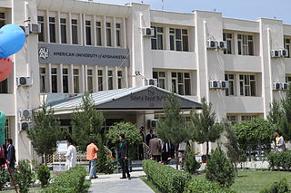
Education in Afghanistan includes K–12 and higher education, which is under the Ministry of Education and Ministry of Higher Education. In 2021, there were nearly 10 million students and 220,000 teachers in Afghanistan. The nation still requires more schools and teachers. Soon after the Taliban take took the country in August 2021, they banned girls from secondary education. Some provinces still allow secondary education for girls despite the ban. In December 2022, the Taliban government also prohibited university education for females in Afghanistan, sparking protests and international condemnation. In December 2023, investigations were being held by the United Nations into the claim that Afghan girls of all ages were allowed to study at religious schools.
Pasaband District is located in Ghor province, Afghanistan. The population is 92,900. Located in the southern part of Ghor province, Pasaband District borders Helmand province to the south, Daykundi province to the east, and Farah province to the southwest. The district center is Shinkot.

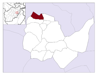
Deh Sabz District, also romanized Dih Sabz District, is situated northeast of Kabul city in Afghanistan. It has a population of 100,136 people. About 70% are Pashtuns and 30% are Tajiks.
Guldara is a village and the center of Guldara District, Kabul Province, Afghanistan. It is located at 34.8172°N 69.0878°E at 1722 m altitude, 45 km North of Kabul. The village was almost fully destroyed and now is continuing the process of rehabilitation. A new clinic has been opened. A local NGO, Afghan Educational and Rehabilitation Organisation (AERO) is running this clinic which will provide family planning, child and general health services to a population of around 38,000 people.

Istalif District is located in the northwestern part of Kabul Province, Afghanistan. It has a population of 8,500, a mixture of Tajiks, Pashtuns and Hazaras.

Mir Bacha Kot District is situated in the central part of Kabul Province, Afghanistan. It has a population of 5,000 and another 37,000 are expected to return in the near future. Tajiks are the majority and some Pashtuns also live there.

Mussahi District is a southern district of Kabul Province, Afghanistan. Mussai district borders Char Asiab District to the west, Bagrami District to the north, Khaki Jabbar District to the east and Logar Province to the south. Its headquarter is in Mussahi village, which is in the central part of the district.

Paghman District is in the western part of Kabul Province, Afghanistan. It has a population of over 120,000 people.

Shakardara District is situated in the central part of Kabul Province, Afghanistan. It has a population of 3,000 people, with another 10,000 expected to return from abroad.
The Tagab District is situated in the eastern part of Kapisa Province, Afghanistan. It borders Parvan Province to the West, Mahmud Raqi and Nijrab districts to the North, Alasay District to the East and Kabul Province to the South-East. The population is 71,700 (2006) with Pashtun being the majority and the Pashai a minority. The district center is the village of "Tamir" (تعمیر) in Dari, located in the western part of the district.

Mwenezi, originally known as Nuanetsi, is a small district situated in southern Zimbabwe. It is bisected by the Mwenezi River and the A4 highway, the main thoroughfare that connects the town of Beitbridge, on the border with South Africa, to Masvingo.
Khokhi District is located in the East part of Logar Province, Afghanistan. 80 km away from Kabul and 18 km from Pul-i-Alam centre of Logar Province. Centre of the district is called Khoshi and the population is made up of Pashtuns , Tajiks and Hazara, accounting for 65%, 34%, 1% of the total population respectively.


