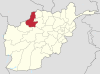
Kunduz is a city in northern Afghanistan, which serves as the capital of Kunduz Province. The city has a population of about 268,893, making it about the 6th-largest city of Afghanistan, and the largest city in the northeastern section of the country. Kunduz is located in the historical Tokharistan region of Bactria, near the confluence of the Kunduz River with the Khanabad River. Kunduz is linked by highways with Kabul to the south, Mazar-i-Sharif to the west, and Badakhshan to the east. Kunduz is also linked with Dushanbe in Tajikistan to the north, via the Afghan dry port of Sherkhan Bandar.

Ghazni historically known as Ghaznin (غزنين) or Ghazna (غزنه), is a city in central Afghanistan with a population of around 270,000 people. The city is strategically located along Highway 1, which has served as the main road between Kabul and Kandahar for thousands of years. Situated on a plateau at 2,219 metres (7,280 ft) above sea level, the city is 150 km south of Kabul and is the capital of Ghazni Province.

Guzargahi Nur or Gozargah-e-Noor is a district in Baghlan Province, Afghanistan. It was created in 2005 from part of Khost wa Firing District.

Gizab, also spelled as Gezab, is a district in the Uruzgan Province of Afghanistan. It has a population of about 75,503 and includes Hazara and Pashtun ethnic groups. Gizab was transferred in 2004 from Uruzgan Province to Daykundi Province, and then re-annexed to Uruzgan in 2006. The main town Gizab is at 1364 m altitude along the Helmand River.
Almar is a district in the southwestern part of Faryab Province, Afghanistan. Its northern border is the national border with Turkmenistan. The population was estimated at 150,000 in 2013. Ethnic diversity includes 35% Turkmen and 65% Uzbek.
Dawlat Abad is a district in Faryab Province, Afghanistan. The population of the district was estimated 95,800 in 2009.
Khwaja Sabz Posh District is the district where the Faryab Province capital Maymana is located. It is a rural district without its own capital. The Khwaja Sabz Posh district is the closest district to the north of Maymana city. Khoja Sabz Posh is the name of a deceased village elder who was famous for always wearing the color green. There is a shrine dedicated to him on a hilltop just north of the Bazaar. It contains 85 villages. Ethnic diversity includes 80% Uzbek, 10% Pashtun and 10% Tajik.
Kohistan district is the southernmost district in Faryab Province. Its population is 53,100 (2010). The district center is Qal'a 35.3811°N 64.7561°E, 1909 m altitude.
Pashtun Kot district is located in the center of Faryab Province, south of the provincial capital Maymana. The district center Pashtun Kot is a suburb of Maymana. The population is 277,000 (2002) with an ethnic composition of 60% Uzbeks, 15% Tajik, 20% Turkmens 10% Pashtuns and minority Arab Aimaq.
Qaisar district is situated in the southwestern part of the Faryab Province of Afghanistan. In 1009, the population was 122,300 with an ethnic composition of 70% Uzbek, 16% Tajik, 10% Pashtun and 4% Turkman. The district center Qeysar, at the edge of the vast desert of Qaisar, has almost the same peculiarities of the Almar bazaar. This bazaar received its name at the end of the nineteenth century.

The Giro District is located within southeastern Ghazni Province in Afghanistan, 50 km South East of Ghazni. The district is a wide plain with scattered low mountains. More than 40 000 residents are estimated, according to 2002 year's data. The district is within the heartland of the Tarakai tribe of Ghilji Pashtuns. The district center is Pana.
As the other districts in this area, it is seriously affected by the continuing drought. Harvests have been decreasing in recent years, and agriculture is the primary source of income.
The roads are in bad condition. The health and education services need much improvement.
On 5 September 2016, 80 Taliban militants were killed and 100 others injured after hundreds of fighters launched a coordinated offensive to capture the district. Five security personnel also had been killed and eight others injured during the operation.

Andar is one of the eastern districts of Ghazni Province in Afghanistan. The population has been estimated at 88,300, all Pashtun. The district center is Miray while the other main town is Andar. The district is named after the Andar Ghilji tribe of the Pashtuns. The district also contains the town of Sardeh Band on its edge near the border with Paktika Province.
Khwaja Umari is a district in Ghazni Province, Afghanistan. It was created in 2005 from the large Jaghatu District. The population in 2005 was estimated at 16,100, of whom 20% were Pashtun, 35% Tajik and 45% Hazara. The district center is the village of Khwaja Umari.
Yangi Qala District is a district in Takhar Province, Afghanistan. Economically the population of this district is primarily involved in agriculture. The main crops are rice and wheat, and the surplus rice is exporting to neighboring districts and provinces. On September 10, 2019, the district was taken the Taliban. 3 days later, the district was of militants cleared in an operation. There are 64 villages in the district.

The War in Afghanistan is a war following the United States invasion of Afghanistan that began when the United States of America and its allies successfully drove the Taliban from power in order to deny Al-Qaeda a safe base of operations in Afghanistan. Since the initial objectives were completed, a coalition of over 40 countries formed a security mission in the country called International Security Assistance Force, of which certain members were involved in military combat allied with Afghanistan's government. The war has afterwards mostly consisted of Taliban insurgents fighting against the Afghan Armed Forces and allied forces; the majority of ISAF/RS soldiers and personnel are American. The war is code named by the U.S. as Operation Enduring Freedom (2001–14) and Operation Freedom's Sentinel (2015–present); it is the longest war in U.S. history.

The Afghanistan conflict is a series of wars that has been fought in Afghanistan since 1978. Starting with the Saur Revolution military coup, an almost continuous series of armed conflicts has dominated and afflicted Afghanistan. The wars include:
In August 2013, Pakistan and eastern Afghanistan experienced heavy rain that led to flash flooding. More than 180 died as a result of the floods.
The following lists events from 2014 in Afghanistan.

The Battle of Kunduz took place from April to October 2015 for control of the city of Kunduz, located in northern Afghanistan, with Taliban fighters attempting to seize the city and displace Afghan security forces. On 28 September 2015, the Taliban forces suddenly overran the city, with government forces retreating outside the city. The capture marked the first time since 2001 that the Taliban had taken control of a major city in Afghanistan. The Afghan government claimed to have largely recaptured Kunduz by 1 October 2015 in a counterattack, although local sources in the city disputed the claim made by government officials.
Events from the year 2019 in Afghanistan.