Kunduz is a city in northern Afghanistan, the capital of Kunduz Province. The city has a population of about 374,746, making it about the 6th-largest city of Afghanistan, and the largest city in the northeastern section of the country. Kunduz is in the historical Tokharistan region of Bactria, near the confluence of the Kunduz River with the Khanabad River. Kunduz is linked by highways with Kabul to the south, Mazar-i-Sharif to the west, and Badakhshan to the east. Kunduz is also linked with Dushanbe in Tajikistan to the north, via the Afghan dry port of Sherkhan Bandar.

Ghazni, historically known as Ghaznin (غزنين) or Ghazna (غزنه) and also transliterated as Ghuznee, is a city in southeastern Afghanistan with a population of around 190,000 people. The city is strategically located along Highway 1, which has served as the main road between Kabul and Kandahar for thousands of years. Situated on a plateau at 2,219 metres (7,280 ft) above sea level, the city is 150 kilometres (93 mi) south of Kabul and is the capital of Ghazni Province.
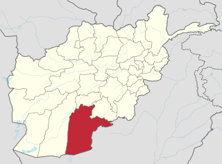
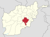
Kandahār is one of the thirty-four provinces of Afghanistan, located in the southern part of the country, sharing a border with Balochistan, Pakistan to the south. It is surrounded by Helmand in the west, Uruzgan in the north and Zabul Province in the east. Its capital is the city of Kandahar, Afghanistan's second largest city, which is located on the Arghandab River. The greater region surrounding the province is called Loy Kandahar.

Uruzgan, also spelled as Urozgan or Oruzgan, is one of the thirty-four provinces of Afghanistan. Uruzgan is located in the center of the country. The population is 443,804, and the province is mostly a tribal society. Tarinkot serves as the capital of the province.

Paktika(Pashto/Dari: پکتیکا) is one of the 34 provinces of Afghanistan, located in the eastern part of the country. Forming part of the larger Loya Paktia region, Paktika has a population of about 789,000, mostly ethnic Pashtuns. The town of Sharana serves as the provincial capital, while the most populous city is Urgun.
Jaghori is one of the main districts of the Ghazni province in Afghanistan. It is located in the highlands in the southern fringes of the Hazaristan region. It occupies 1,855 km2. in the upper Arghandab valley. The population is estimated to be around 560,000 in 2015. The district capital, Sange-e-Masha, is where major business transactions take place. The district is heavily dependent on agriculture, and migrant workers as the main sources of income. Other major marketplaces are in Ghojor, Hotqol and Anguri.

Ab Band is a district in Ghazni Province, Afghanistan. Its population, which is almost entirely Pashtun, was estimated at 41,340 in 2002. The district is within the heartland of the Tarakai tribe of Ghilji Pashtuns. Ab Band is on the main road from Kabul to Kandahar. The district capital is Āb Band.

Malistan is a district in the west of Ghazni Province, Afghanistan. Its population, which is 100% Hazara, was estimated at 350,000 in 2009. The district capital is Mir Adina.
Nawa is a large district in the far south of Ghazni Province, Afghanistan. It is 100 km south from Ghazni in a mountainous region. The salt lake Ab-i Istada is located in the northern part of the district. Nawa's population, which is 100% Pashtun, was estimated at 29,054 in 2002, of whom around 45% were children under 12. The district center is the village of Nawa. Military operations in the district were featured in articles in the Washington Post and the New York Times in October 2009. The district was controlled by the Taliban until 17 July 2017.
Muqur is a district in the southwest of Ghazni Province, Afghanistan. Its population, which is mostly Hazara along with several Pashtun and Tajik, was estimated at 70,900 in 2002, of whom 19,538 were children under 12.
Qarabagh, is a district 56 km to the south-west of Ghazni in eastern Afghanistan. The 1,800 km2 area is one of the most populated at 109,000; some reports count more than 218,000. The ethnic composition of the district includes Hazaras and Pashtuns. The landscape varies in different parts of the district - deserts in the southwest, plains in the southeast and mountains in the north. The district is seriously affected by drought, especially farming and animal husbandry. Health and education need serious improvement.

The Giro District is located within southeastern Ghazni Province in Afghanistan, 50 km South East of Ghazni. The district is a wide plain with scattered low mountains. More than 40 000 residents are estimated, according to 2002 year's data. The district is within the heartland of the Tarakai tribe of Ghilji Pashtuns. The district center is Pana.
As the other districts in this area, it is seriously affected by the continuing drought. Harvests have been decreasing in recent years, and agriculture is the primary source of income.
The roads are in bad condition. The health and education services need much improvement.
On 5 September 2016, 80 Taliban militants were killed and 100 others injured after hundreds of fighters launched a coordinated offensive to capture the district. Five security personnel also had been killed and eight others injured during the operation.
Rashidan District is a new district in Afghanistan; it was created from the larger Jaghatu district.
Andar is one of the eastern districts of Ghazni Province in Afghanistan. The population has been estimated at 88,300, all Pashtun. The district center is Miray while the other main town is Andar. The district is named after the Andar Ghilji tribe of the Pashtuns. The district also contains the town of Sardeh Band on its edge near the border with Paktika Province.
Dado is the district center of Zana Khan district, Afghanistan. It is located 30 km north-east of Ghazni on 33.6681°N 68.6008°E at 2,520 m altitude.
Khwaja Umari is a district in Ghazni Province, Afghanistan. It was created in 2005 from the large Jaghatu District. The population in 2005 was estimated at 16,100, of whom 20% were Pashtun, 35% Tajik and 45% Hazara. The district center is the village of Khwaja Umari.
Khan Abad District is situated in the eastern part of Kunduz Province, Afghanistan. It borders Kunduz District to the west, Archi District to the northeast, Takhar Province to the east and Ali abad District to the south. The population is 140,600 (2006): 40% Pashtun, 20% Hazara, 25% Tajik, 10% Uzbek and 5% Pashai. The district center is the town of Khan Abad, located in the central part of the district.

Zurmat is a district in Paktia Province, Afghanistan. The main town is Zurmat, which is one of the main cities of the region of Loya Paktia.
Jaghatu, is one of the largest and most populated district of Ghazni Province in Afghanistan, west of the city of Ghazni. The ethnic composition of the district includes 73% Hazara and 27% Pashtun.
The Andar are a Ghilji Pashtun sub-tribe. The Andar occupy nearly the whole of the extensive district of Shalgar south of Ghazni The Andar were traditionally known for their skill in the construction and maintenance of large karez. More concentrated in Ghazni Province, they have also a significant presence in Paktia. During the 19th century they joined in the Ghilji revolt and many were summarily sent into internal exile. Somewhat inexplicably, they allied themselves for a time with the Harakat-i Islami, originally a Shia faction, during the anti-Soviet campaign. In fact, there were two Mujaheddin parties named Harakat-i Islami Afghanistan, while one was a Shi'ite faction, the other and far more significant party was originally a 'united front' of mainly Hezb-i Islami and Jamiat-i Islami, that collapsed after only a few months, leaving behind a significant party that was in many ways a precursor to the present day Taliban movement. A majority of the Andar tribe were affiliated with this 'Harakt-i Islami' and it is notable that the leader of this united front and later party, Mawlawi Mohammad Nabi Mohammadi was Andar by tribe. Similarly, the senior Mawlawi Mansoor was Andar too. Mansoor's son Saifurrahman Mansoor was later an important figure and military leader in the Taliban movement.