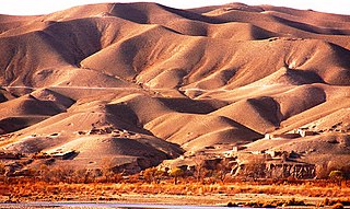
The Helmand River is the longest river in Afghanistan and the primary watershed for the endorheic Sistan Basin. It emerges in the Sanglakh Range of the Hindu Kush mountains in the northeastern part of Maidan Wardak Province, where it is separated from the watershed of the Kabul River by the Unai Pass. The Helmand feeds into the Hamun Lake on the border between Afghanistan and Iran.
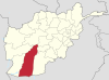
Helmand, also known as Hillmand, in ancient times, as Hermand and Hethumand, is one of the 34 provinces of Afghanistan, in the south of the country. It is the largest province by area, covering 58,584 square kilometres (20,000 sq mi) area. The province contains 13 districts, encompassing over 1,000 villages, and roughly 1,446,230 settled people. Lashkargah serves as the provincial capital. Helmand was part of the Greater Kandahar region until made into a separate province by the Afghan government in the 20th century.

Lashkargāh, historically called Bost or Boost, is a city in southwestern Afghanistan and the capital of Helmand Province. It is located in Lashkargah District, where the Arghandab River merges into the Helmand River. The city has a population of 201,546 as of 2006. Lashkargah is linked by major roads with Kandahar to the east, Zaranj on the border with Iran to the west, and Farah and Herat to the north-west. It is mostly very arid and desolate. However, farming does exist around the Helmand and Arghandab rivers. Bost Airport is located on the east bank of the Helmand River, five miles north of the junction of the Helmand and Arghandab rivers. Because of the trading hubs, it is Afghanistan's second largest city in size, after Kabul and before Kandahar.

Maiwand is a village in Afghanistan within the Maywand District of Kandahar Province. It is located 50 miles northwest of Kandahar, on the main Kandahar–Lashkargah road.
Dishu is a district in the south of Helmand Province, Afghanistan, bordering Pakistan. Its population, which is 80% Pashtun and 20% Baloch, was estimated at 19,900 in 2012. The district centre is the village of Dishu; most of the settlements in the district are along the Helmand River. The other important town is Bahramcha.
Musa Qala is a district in the north of Helmand Province, Afghanistan. Its population was around 57,500 in 2012 and are 97% ethnic Pashtun. The district centre is the village of Musa Qala; there are 19 other large villages and 200 smaller settlements, mostly along the Musa Qala River. The area is irrigated by the Helmand and Arghandab Valley Authority.

Kajaki(Pashto: کجکی) is a district in the Northeast of Helmand Province, Afghanistan. Its population is by a vast majority Pashtun, and stood at 69,300 in 2012. The district centre is the village of Kajaki. Route 611 passes through the district to the district center.

Nad Ali or Nad-e Ali is a district in Helmand Province, Afghanistan. Marja is an unincorporated agricultural district in Nad Ali. The area is irrigated by the Helmand and Arghandab Valley Authority (HAVA). A small town of the same name lies 11 km to the west of the Helmand River, at the coordinates shown at the top of the page. The town of Nad-e Ali was built in 1954 as part of the HAVA irrigation project, and was settled by 3,000 predominantly Pashtun families who were given newly arable land.

Sangin is a district in the east of Helmand Province, Afghanistan. Its population was reported at 58,100 in 2012, all of which belong to Pashtun ethnic group. The district centre is the town of Sangin. The area is irrigated by the Helmand and Arghandab Valley Authority.
Garmsir District is located in the southern part of Helmand Province, Afghanistan. The district is large, but all the villages are along the Helmand River. The rest is a desert. The district capital, Garmsir, is located in the northwestern part of the district on the east bank of Helmand River.

Reg (Khanashin) District is situated in the southeastern part of Helmand Province, Afghanistan along the Helmand River on its western bank. The population is 25,600. The main village is Khanashin.
Khanashin, or Khan Neshin, is a village located in the Reg District of Helmand Province, Afghanistan at 30.5494°N 63.7897°E at 642 altitude. It is close to the Helmand River and 168 km southwest of Lashkargah. It has been identified by the USGS as the site of a deposit, called the Khanneshin carbonatite, of at least 1 million tons of rare earth element ore.
Maiwand District is situated in the western part of the Kandahar Province, Afghanistan. It borders Helmand Province to the west, Ghorak District to the north, Khakrez District to the northeast, Zhari District to the east, and Panjwayi District to the south. The population is 51,900 (2006). The district center is in Hutal, located in the central part of the district. Highway 1 runs through the center of the district and connects two of the major cities in southern Afghanistan, Kandahar and Lashkargah.
The June 2017 Lashkargah bombing occurred on 22 June 2017, when a suicide attack took place in the New Kabul Bank branch in Lashkargah, capital of Helmand province in Afghanistan. During this attack, at least 34 people were killed and 60 were injured.
Babaji, is a rural suburb of Lashkargah, the capital of the southern province of Helmand in Afghanistan. It is in the Lashkargah District. Babaji is dominated by the Barakzai tribe.

Qala-e-Bost, also romanized Qalai Bust, is a fortress in Bost, Helmand Province, Afghanistan, built 3000 years ago. It is located at 31° 30’ 02″ N, 64° 21’ 24″ E near the convergence of the Helmand and Arghandab Rivers, a half-hour's drive south of Lashkargah. Qala-e-Bost is famous for its 11th century decorative arch, which appears on the 100 Afghani note. The arch is part of the remains of a mosque.
The People's Peace Movement or Helmand Peace Convoy is a nonviolent resistance grassroots group in Afghanistan, created in March 2018 after a suicide car bomb attack on 19 March in Lashkargah, Helmand Province. The PPM calls for the military forces of both the government of Afghanistan and the Taliban to implement a ceasefire and advance the Afghan peace process. The group marched across Afghanistan to Kabul, where it met leaders of both parties and conducted sit-ins in front of diplomatic posts, before continuing its march to Balkh and Mazar-i-Sharif, arriving in September 2018.
The Battle of Lashkargah was a battle between the Afghan National Security Forces (ANSF) and the Taliban for control of the city of Lashkargah. The United States supported Afghan forces with airstrikes. The fighting started in late July 2021, and clashes occurred around the governor's residence, NDS headquarters, police headquarters, and prison. The police headquarters was captured by the Taliban on 12 August 2021, and the last government forces evacuated or surrendered in the night from 12 to 13 August 2021. More than 40 civilians were also killed in the two weeks long fighting.
The 215 Azam Corps is one of the eight corps of the Islamic Emirate Army established in October 2021 and headquartered in Helmand. The current Chief of Staff is Maulvi Abdul Aziz "Ansari". The Islamic Republic of Afghanistan-era corps it replaced was known as the 215th 'Maiwand' Corps and was a part of Afghan National Army.