Related Research Articles

The International Security Assistance Force (ISAF) was a multinational military mission in Afghanistan from 2001 to 2014. It was established by United Nations Security Council Resolution 1386 pursuant to the Bonn Agreement, which outlined the establishment of a permanent Afghan government following the U.S. invasion in October 2001. ISAF's primary goal was to train the Afghan National Security Forces (ANSF) and assist Afghanistan in rebuilding key government institutions; it gradually took part in the broader war in Afghanistan against the Taliban insurgency.

Grishk, also spelled Gereshk, is the new name of Zamindawar which is named after the invasion the region by Nader Afshar army and given to Ghilji tribe in 18th century. Grishk a town in Grishk District of Helmand province, geographically located along the Helmand River in Afghanistan, some 120 km (75 mi) northwest of Kandahar, at 817 metres (2,680 ft) altitude. Upstream lies the Kajaki Dam which diverts water to the Boghra Irrigation Canal, an essential infrastructure for the region's crops. Grishk Dam is also nearby. Grishk was originally built around a fort on the east bank of the river but was later rebuilt on the west. The fort was twice captured by the British: first in the First Anglo-Afghan War and again in 1879. In both cases the fort was later abandoned. Grishk has a population of about 48,546 and has a hospital and a school of engineering which was built back in 1957.

The Taliban insurgency was an insurgency that began after the group's fall from power during the 2001 War in Afghanistan. The Taliban forces fought against the Afghan government, led by President Hamid Karzai, and later by President Ashraf Ghani, and against a US-led coalition of forces that has included all members of NATO; the 2021 Taliban offensive resulted in the collapse of the government of Ashraf Ghani.

Operation Mountain Fury was a NATO-led operation begun on September 16, 2006 as a follow-up operation to Operation Medusa, to clear Taliban insurgents from the eastern provinces of Afghanistan. Another focus of the operation was to enable reconstruction projects such as schools, health-care facilities, and courthouses to take place in the targeted provinces.

Musa Qala is a town and the district centre of Musa Qala District in Helmand Province, Afghanistan. It is located at 32.4433°N 64.7444°E and at an altitude of 1,043 m in the valley of Musa Qala River in the central western part of the district. Its population has been reported in the British press to be both 2,000 and 20,000. It is in a desolate area, populated by native Pashtun tribes.

The American invastion of Afgahaistan started in 2001 and ended in 2021. It started because of the 9/11 attacks conducted by Al-Qaeda. The war in Afghanistan was America's longest war.

Operation Lastay Kulang or Pickaxe Handle was a British-led NATO offensive in the southern Helmand province of Afghanistan. Lastay Kulang began on May 30 and ended on June 14, 2007, with 2000 ISAF and Afghan National Army troops taking part. The mission was a direct follow-up of Operation Achilles that ended on the same day.
Events from the year 2007 in Afghanistan.

The Helmand province campaign was a series of military operations conducted by the International Security Assistance Force (ISAF) forces against Taliban insurgents and other local groups in the Helmand Province of Afghanistan. Their objective was to control a province that was known to be a Taliban stronghold, and a center of opium production. None of the ISAF's intended strategic and political objectives were achieved in the long term.
The Battle of Musa Qala was a British-led military action in Helmand Province, southern Afghanistan, launched by the Afghan National Army and the International Security Assistance Force (ISAF) against the Taliban on 7 December 2007. After three days of intense fighting, the Taliban retreated into the mountains on 10 December. Musa Qala was officially reported captured on 12 December, with Afghan Army troops pushing into the town centre.
Hyderabad airstrike refers to the killing of many Afghan civilians including women and children in the village of Hyderabad, Gerishk District, Helmand province, Afghanistan on June 28, 2007 by the United States Army.
The following lists events that happened during 2015 in Afghanistan.
The following lists events that happened during 2016 in Afghanistan.
Events in the year 2017 in Afghanistan.
This article summarizes the history of the War in Afghanistan (2001–2021).
References
- ↑ "Map of Ghershk (Nahri Sarrah) District" (PDF). Archived from the original (PDF) on 6 February 2009. Retrieved 14 November 2008.
- ↑ "'Afghans killed' in air strikes". BBC News. 22 June 2008. Retrieved 14 November 2008.
- ↑ "Nato to investigate Afghan deaths". BBC News. 22 June 2008. Retrieved 14 November 2008.
| Districts | 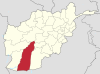 | |
|---|---|---|
| Populated places | ||
| Landmarks | ||
| Other | ||
Coordinates: 31°49′50″N64°35′18″E / 31.83052°N 64.58823°E
| | This Helmand Province, Afghanistan location article is a stub. You can help Wikipedia by expanding it. |