Pasaband پسابند | |
|---|---|
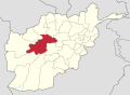
 Pasaband Location within Afghanistan | |
| Coordinates: 33°41′27″N64°51′23″E / 33.6908°N 64.8564°E | |
| Country | |
| Province | Ghor |
| Center | Shinkot |
| Area | |
• Total | 4,537 km2 (1,752 sq mi) |
| Elevation | 2,450 m (8,040 ft) |
| Population (2012) [1] | |
• Total | 92,900 |
Pasaband District is located in Ghor province, Afghanistan. The population is 92,900 [1] (70% Tajik, 20% Hazara). [2] Located in the southern part of Ghor province, Pasaband District borders Helmand province to the south, Daykundi province to the east, and Farah province to the southwest. The district center is Shinkot.
Contents
Pasaband is a mountainous district where winters are long and severe. Roads are not in good condition and some villages are accessible only using animals. Because of the inaccessibility of villages and the few wells, the people's access to clean water is a major problem. Agriculture is the main source of income and it is seriously affected by drought. The health and education need improvement.