Taywara تیوره | |
|---|---|
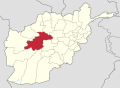
 Taywara Location within Afghanistan | |
| Coordinates: 33°31′08″N64°25′55″E / 33.5188°N 64.4319°E | |
| Country | Afghanistan |
| Province | Ghor |
| Center | Taywara |
| Elevation | 2,150 m (7,050 ft) |
| Population (2012) [1] | |
• Total | 88,900 |
Taywara (Teyvareh) district is located in the southern part of Ghor province in Afghanistan. The population is 88,900 people. [1] The district center is the town of Taywara.
The district has 400 km (250 mi) of gravel roads. [2] The terrain is mountainous and in the winter the roads are often inaccessible.