| Km | Exit | Interchange/junctions | To | Remarks |
|---|
| | Johor Bahru – Senai | see also Skudai Highway |
| | Saleng | | |
| | Hospital Temenggong Seri Maharaja  | | |
| | Indahpura | Southwest
Persiaran Indahpura Utama
Indahpura
Northeast
Lebuh Putra Utama
Bandar Putra Kulai
IOI Mall Kulai | Diamond interchange |
| | Kulai | Majlis Perbandaran Kulai (MPKulai) main headquarters | |
| | Kulai
Jalan Kota Tinggi | East
 FT 94 Kota Tinggi FT 94 Kota Tinggi
 FT 3 FT 3  AH18 Mersing AH18 Mersing
 FT 91 Kota Tinggi waterfall FT 91 Kota Tinggi waterfall
 FT 92 Desaru FT 92 Desaru  | T-junctions |
| | Kulai | | |
| | Kulai
Jalan Sengkang | Northeast
Jalan Sengkang
Sengkang | T-junctions |
| | Kulaijaya-NSE Highway | West
 FT 399 Kulaijaya-NSE Highway FT 399 Kulaijaya-NSE Highway
(Jalan Alor Bukit)
Taman Puteri Kulai
Gunung Pulai
Pekan Nanas
Pontian
  North–South Expressway Southern Route North–South Expressway Southern Route  AH2 North–South Expressway Southern Route AH2 North–South Expressway Southern Route
Kuala Lumpur
Johor Bahru | T-junctions |
| | Kelapa Sawit | | |
| | Kampung Rahmat | | |
| | Sedenak | East
 J103 Jalan Sedenak J103 Jalan Sedenak
Sedenak | T-junctions |
| | Ayer Bemban | | |
| | Kampung Ayer Manis | | |
| | Jalan Parit Panjang | Southwest
J118 Jalan Parit Panjang
FELDA Bukit Batu
Ayer Baloi
Pontian
North–South Expressway Southern Route AH2 North–South Expressway Southern Route
Kuala Lumpur
Johor Bahru | T-junctions |
| | Bukit Batu | | |
| | Jalan Layang-Layang | Northeast
J6 Jalan Layang Layang
Layang-Layang
Renggam
Kluang | T-junctions |
Kulai–Kluang district border
Simpang Renggam sub-district border |
| | Jalan FELDA Layang-Layang | East
 FT 1423 Jalan FELDA Layang-Layang FT 1423 Jalan FELDA Layang-Layang
FELDA Layang-Layang | T-junctions |
| | Johore Safari World
(Closed on 1984) | | Abandoned T-junctions |
| | Jalan Benut | Southwest
 FT 96 Benut FT 96 Benut
 FT 5 Pontian FT 5 Pontian
North–South Expressway Southern Route AH2 North–South Expressway Southern Route
Kuala Lumpur
Johor Bahru | T-junctions |
| | Simpang Renggam
Jalan Simpang Renggam–Layang Layang | Northeast
J26 Jalan Simpang Renggam–Layang Layang
Renggam
Layang-Layang
Kluang | T-junctions |
| | Sungai Machap bridge | | |
| |  Machap Rest and Service Area Machap Rest and Service Area |     | |
| | Machap | | |
| | Machap-NSE | North–South Expressway Southern Route AH2 North–South Expressway Southern Route
North
Kuala Lumpur
Melaka
Ayer Hitam
South
Johor Bahru
Kulai
Simpang Renggam | T-junctions |
| | Tropical Village |  | T-junctions |
Kluang–Batu Pahat district border
Simpang Renggam–Yong Peng sub-district border |
Ayer Hitam, Bandar Persinggahan
(The Rest Town of Johor)
|
| | Ayer Hitam | Southwest
 FT 50 Batu Pahat FT 50 Batu Pahat
FT 50 Parit Raja
Northeast
FT 50 Kluang
FT 3 AH18 Mersing
North–South Expressway Southern Route AH2 North–South Expressway Southern Route
Kuala Lumpur
Johor Bahru | Junctions |
| | Masjid Sultan Ibrahim, Ayer Hitam | | |
Ayer Hitam, Bandar Persinggahan
(The Rest Town of Johor)
|
| | Sungai Semberong Bridge | | |
| | Jalan Olak Batu | Southwest
J206 Jalan Olak Batu
Olak Batu, Parit Raja | T-junctions |
| | Kampung Haji Abdul Ghaffar | | |
| | Yong Peng South-NSE | South Only
North–South Expressway Southern Route AH2 North–South Expressway Southern Route
Johor Bahru
Simpang Renggam
Ayer Hitam | T-junctions |
| | Yong Peng | West
 FT 24 Muar FT 24 Muar
FT 24 Bakri
FT 24 Parit Sulong
J13 Batu Pahat
North–South Expressway Southern Route AH2 North–South Expressway Southern Route
Kuala Lumpur
Johor Bahru | T-junctions |
| | Jalan Paloh | East
J16 Jalan Paloh
Paloh
Kluang | T-junctions |
| | TNB Yong Peng intake | | Largest power intake in Johor state |
Batu Pahat–Segamat district border
Yong Peng–Labis sub-district border |
| | Sungai Simpang Kiri bridge | | |
| | Chaah | | |
| | Sungai Chaah bridge | | |
| | Jalan Bekok | East
J150 Jalan Bekok
Bekok
Jagoh | T-junctions |
| | Sungai Chaah bridge | | |
| | Kampung Sungai Karas | | |
| | Sungai Gatom bridge | | |
| | Sungai Labis bridge | | |
| | Jalan Muar–Labis | North
Jalan Stesen Keretapi Labis
Labis railway station
Southwest
J32 Jalan Muar-Labis
Bukit Kepong
Pagoh
Muar
North–South Expressway Southern Route AH2 North–South Expressway Southern Route
Kuala Lumpur
Johor Bahru | T-junctions |
| | Railway crossing bridge | | |
| | Labis | East
Jalan Bandar Labis
Town Centre
Hospital Labis | T-junctions |
| | Labis | | |
| | Jalan Ayer Panas | North
J151 Jalan Ayer Panas
Pekan Air Panas | T-junctions |
| Labis–Segamat sub-district border |
| | Hutan Rizab Bukit Mambai | | |
| | Tenang | | |
| | Genuang |  FT 1 Kampung Melayu Raya FT 1 Kampung Melayu Raya
FT 1 Genuang | T-junction |
| | Segamat Industrial Area | FT 1 Kampung Melayu Raya
FT 1 Genuang
Segamat Industrial Area
Hospital Segamat
Bandar Putra Segamat | Junctions |
| | Segamat
Kampung Abdullah | South
J14 Jalan Pogoh
Bukit Kepong
Lenga
Muar
North
Segamat Inner Ring Road
 FT 1384 FELDA Medoi FT 1384 FELDA Medoi
J154 Kampung Tengah | Junctions |
| | Sungai Segamat Bridge | | |
| | Segamat | South
 FT 23 Muar FT 23 Muar
FT 23 Tangkak
FT 23 Jementah
North–South Expressway Southern Route AH2 North–South Expressway Southern Route
Kuala Lumpur
Johor Bahru | Junctions |
| | Segamat
Taman Pemuda | North
Segamat Inner Ring Road
FT 1384 FELDA Medoi
J154 Kampung Tengah | Junctions |
| | Tun Razak Highway | North
 FT 12 FT 12  AH142 Tun Razak Highway AH142 Tun Razak Highway
 FT 2 Kuantan FT 2 Kuantan
FT 12 AH142 Gambang
FT 12 AH142 Bandar Muadzam Shah
 East Coast Expressway Kuala Terengganu East Coast Expressway Kuala Terengganu | Junctions |
| | Buloh Kasap | Southwest
J153 Jalan Tasek Alai
FT 23 Muar
FT 23 Tangkak
FT 23 Jementah
North–South Expressway Southern Route AH2 North–South Expressway Southern Route
Kuala Lumpur
Johor Bahru | T-junctions |
| | Sungai Muar Bridge
Jambatan Buloh Kasap | | Historical site |
| | Railway crossing bridge | | |
| | Jalan Batu Enam | South
J43 Jalan Batu Enam
FT 23 Muar
FT 23 Tangkak
FT 23 Jementah
North–South Expressway Southern Route AH2 North–South Expressway Southern Route
Kuala Lumpur
Johor Bahru | T-junctions |
| | Batu Enam | | |
| | Railway crossing bridge | | |
| | Gemas Baharu | | |
Johor Darul Takzim
Segamat district border
Segamat sub-district border |
Sungai Gemas Bridge
Johor-Negeri Sembilan border |
Negeri Sembilan Darul Khusus
Tampin district border |
| | GEMAS | Gemas railway station | |
| | Railway crossing | | |
| | Taman Desa Permai | North
N114 Jalan Bangka Hulu
Kampung Ladang
Bangka Hulu
Pasir Besar | T-junctions |
| | Gemas Army Camp
(Kor Armor Diraja) | | |
| | Jalan Jempol | North
 FT 10 Temerloh FT 10 Temerloh
FT 10 Bahau
FT 10 Rompin | T-junctions |
| | Battle of Gemencheh Bridge historical site
Sungai Gemencheh Bridge | | Historical site |
| | FELDA Sungai Kelamah | | |
| | Kampung Sungai Dua | South
N15 Jalan Nyalas
Ayer Kuning
Nyalas
Jasin | T-junctions |
| | Kampung Baharu Gedok | | |
| | Gemencheh | N13 Jalan Dangi–Kesang Pajak
North
Dangi
Bahau
South
Batang Melaka
Selandar
Jasin | Junctions |
Negeri Sembilan Darul Khusus
Tampin district border |
| Negeri Sembilan–Melaka border |
Melaka
Alor Gajah district border |
| | Kampung Ibus | | |
| | Sempang Kampung Sungga | South
M19 Jalan Machap
Machap Umboo
Durian Tunggal
Melaka | T-junctions |
Melaka
Alor Gajah district border |
| Melaka–Negeri Sembilan border |
Negeri Sembilan Darul Khusus
Tampin district border |
| | Kampung Pondoi | | |
| | Karak - Tampin Highway | North
 FT 9 Karak FT 9 Karak
FT 9 Kuala Pilah
FT 9 Johol | T-junctions |
| | Tampin | Tampin Museum
Tampin District and Land Office
Majlis Daerah Tampin main headquarters
Masjid Tampin | |
| | Tampin | South
 FT 61 Tampin Bypass FT 61 Tampin Bypass
Melaka
Cheng
Peringgit
Alor Gajah
North–South Expressway Southern Route AH2 North–South Expressway Southern Route
Kuala Lumpur
Johor Bahru
West
FT 61 Tampin town centre
Tampin Railway Station | Roundabout
Upgrades to an intersection
Under construction |
| | Tampin Layby | | Layby |
| Tampin-Rembau district border |
| | Kampung Ulu Kendong | South
 FT 19 Simpang Ampat FT 19 Simpang Ampat
FT 19 Melaka
FT 19 Cheng
FT 19 Peringgit
FT 19 Alor Gajah
North–South Expressway Southern Route AH2 North–South Expressway Southern Route
Kuala Lumpur
Johor Bahru
|
| | Railway crossing bridge | | |
| | Kampung Padang Lebar | | |
| | Jalan Semerbok | Southwest
N106 Jalan Semerbok
Semerbok | T-junctions |
| | Kampung Kota Lama | | |
| | Kampung Perah | | |
| | Jalan Gadong | Northeast
N111 Jalan Gadong
Gadong
Chengkau | T-junctions |
| | Jalan Kota | West
N12 Jalan Kota
Kota | T-junctions |
| | Kampung Kota | | |
| | Tanjung Berangan | | |
| | Jalan Penajis | South
N11 Jalan Penajis
Penajis | T-junctions |
| | Jalan Paya Lebar | Southwest
N10 Jalan Paya Lebar
Paya Lebar | T-junctions |
| | Railway crossing bridge | | |
| | Jalan Gadong | Northeast
N111 Jalan Gadong
Gadong
Chengkau | T-junctions |
| | Jalan Inas | East
N14 Jalan Inas
Inas
Johol
Kuala Pilah | T-junctions |
| | Jalan Chembong | North
N105 Jalan Chembong
Chembong
Ulu Sepri | T-junctions |
| | Rembau | | |
| | Railway crossing bridge | | |
| | P&R Rembau railway station | | |
| | Rembau | Rembau District and Land Office | T-junctions |
| | Kampung Tebing Tinggi | | |
| | Jalan Batu Hampar | North
N107 Jalan Batu Hampar
Batu Hampar | T-junctions |
| | Jalan Rantau–Pedas | North
N102 Jalan Rantau–Pedas
Rantau
Pedas | T-junctions |
| | Rembau Industrial Area | | |
| | Wet World Resort Pedas | | |
| | Pedas | South
N9 Jalan Pedas–Linggi
Linggi
Port Dickson
North–South Expressway Southern Route AH2 North–South Expressway Southern Route
Kuala Lumpur
Johor Bahru | T-junctions |
| | Pedas
Jalan Chembong | East
N105 Jalan Chembong
Chembong
Ulu Sepri | T-junctions |
Railway crossing bridge
Rembau–Seremban district border |
| | Sungai Gadut bridge | | |
| | P&R Sungai Gadut Komuter station | Sungai Gadut Komuter station
KTM Komuter | |
| | Jalan Sungai Gadut | South
N5 Jalan Sungai Gadut
Sungai Gadut
Rantau | T-junctions |
| | Senawang |  FT 97 Jalan Senawang–Paroi FT 97 Jalan Senawang–Paroi
North
FT 97 Paroi
 FT 51 Kuala Pilah FT 51 Kuala Pilah
FT 51 Sri Menanti
Ulu Bendol Recreation Area
South
 FT 243 Senawang-NSE Road FT 243 Senawang-NSE Road
Taman Seremban Jaya
North–South Expressway Southern Route AH2 North–South Expressway Southern Route
Kuala Lumpur
Johor Bahru | Diamond interchange |
| | Kampung Baru Rahang | | |
| | Taman Ideal | Taman Ideal | Junctions |
| | Railway crossing bridge | | |
| | Rahang-SIRR | Seremban Inner Ring Road
Southwest
 FT 195 Labu FT 195 Labu
FT 195 Nilai
 FT 53 Port Dickson FT 53 Port Dickson
North–South Expressway Southern Route AH2 North–South Expressway Southern Route
Kuala Lumpur
Johor Bahru
North
FT 51 Kuala Pilah
 FT 86 Kuala Klawang (Jelebu) FT 86 Kuala Klawang (Jelebu)
FT 1 Mantin | Diamond interchange |
| | Sungai Linggi bridge | | |
| | | | Start/end of separated carriageway |
| | Seremban
Jalan Dato' Muda Linggi | North
FT 51 Jalan Dato' Muda Linggi
FT 86 Kuala Klawang (Jelebu)
FT 51 Paroi
FT 51 Kuala Pilah
FT 51 Seri Menanti
Ulu Bendol Recreation Area | T-junctions |
| | Seremban
Jalan Rasah | South
FT 53 Jalan Rasah
Port Dickson
North–South Expressway Southern Route AH2 North–South Expressway Southern Route
Kuala Lumpur
Johor Bahru | Junctions |
| | Seremban
Seremban Station Roundabout | Southwest
Seremban Komuter station
Southeast
FT 1 Jalan Zaaba
Senawang
Seremban Lake Gardens
Seremban State Mosque | Roundabout |
| | Seremban
Jalan Sungai Ujong | Southwest
FT 195 Seremban–Bukit Nenas Highway
Jalan Sungai Ujong
Labu
Nilai
North–South Expressway Southern Route AH2 North–South Expressway Southern Route
Kuala Lumpur
Johor Bahru | Junctions |
| | Seremban
Seremban Old Mosque | Southeast
FT 1 Jalan Yam Tuan
FT 1 Jalan Zaaba
FT 1 Senawang
Seremban Lake Gardens
Seremban State Mosque | |
| | | | Start/end of separated carriageway |
| | Taman Suria | | |
| | Taman Bukit Markisa | | |
| | Jalan Mantin-SIRR | East
Seremban Inner Ring Road
Sikamat
Kuala Klawang (Jelebu)
Kuala Pilah
Senawang | Interchange |
| | Taman Dawn | | |
| | Bukit Mika | | |
| | Taman Kota Emas | | |
| | Setul-LEKAS |  Kajang–Seremban Highway Kajang–Seremban Highway Kajang–Seremban Highway Kajang–Seremban Highway
North
Kuala Lumpur
Kajang
Pajam
South
Kuala Pilah
Paroi
Ampangan | T-junctions |
| | Kawasan Industri Ringan Jalan Tun Dr Ismail | | |
| | Kampung Raya | | |
| | Kampung Belihoi | | |
| | Jalan Lenggeng | East
N34 Jalan Lenggeng
Lenggeng | T-junctions |
| | Mantin-LEKAS | Kajang–Seremban Highway Kajang–Seremban Highway
North
Kuala Lumpur
Kajang
Pajam
South
Seremban
Ampangan
Setul | T-junctions |
| | Mantin | Southwest
N177 Jalan Andalas | T-junctions |
| | Mantin | Northeast
N31 Jalan Sungai Gunung
Lenggeng | T-junctions |
| | Mantin | Southeast
N178 Jalan Kampung Abdullah | T-junctions |
| | Jalan Nilai–Pajam | West
 FT 3265 Jalan Nilai–Pajam FT 3265 Jalan Nilai–Pajam
Pajam
Nilai
Kuala Lumpur International Airport (KLIA) 
Sepang
North–South Expressway Southern Route AH2 North–South Expressway Southern Route
Kuala Lumpur
Johor Bahru | T-junctions |
| | Ulu Beranang | | |
Negeri Sembilan Darul Khusus
Seremban district border |
| Negeri Sembilan–Selangor border |
Selangor Darul Ehsan
Hulu Langat district border |
| | Beranang | West
B24 Jalan Enam Kaki
Bangi
Dengkil | T-junctions |
| | Semenyih | East
B34 Jalan Broga
Broga | T-junctions |
| | Sungai Semenyih Bridge | | |
| | Semenyih | West
 FT 31 Jalan Banting–Semenyih FT 31 Jalan Banting–Semenyih
Bangi
Dengkil
Kajang–Seremban Highway Kajang–Seremban Highway
Kuala Lumpur
Seremban | T-junctions |
| | Kajang South-LEKAS | Kajang–Seremban Highway Kajang–Seremban Highway
North
Kuala Lumpur
Cheras
Saujana Impian
South
Seremban
Pajam | Full cloverleaf interchange |
| | Kajang Prima-SILK | West Only
 Kajang Dispersal Link Expressway Kajang Dispersal Link Expressway Kajang Dispersal Link Expressway Kajang Dispersal Link Expressway
Puchong
Putrajaya
Cyberjaya
Kuala Lumpur International Airport (KLIA)
Kuala Lumpur
Johor Bahru | Half diamond interchange |
| | Taman Zamrud | South
Jalan Taman Zamrud
Taman Zamrud | T-junctions |
| | Jalan Sungai Jelok | Northeast
Jalan Sungai Jelok
Kajang Prison | T-junctions |
| | Kajang
Jelok | | |
| | Kajang | Kajang Hospital | |
| | Kajang
Jalan Bukit | South
Jalan Bukit
Taman Bukit
Taman Kajang Jaya | T-junctions |
| | Kajang | West
B11 Jalan Kajang–Puchong
Sungai Chua
Kajang Dispersal Link Expressway Kajang Dispersal Link Expressway
Puchong
Putrajaya
Cyberjaya
Kuala Lumpur International Airport (KLIA)
Kuala Lumpur
Johor Bahru
South
B18 Jalan Reko
Town Centre
Bandar Baru Bangi
Bangi
Dengkil
Universiti Kebangsaan Malaysia (UKM) 
Kajang railway station | Junctions |
| | Kajang
Masjid Bandar Kajang | Northeast
Jalan Sungai Kantan
Kampung Sungai Kantan | T-junctions |
| | Sungai Jernih bridge | | |
| | Kajang | KPJ Kajang Specialist Hospital | |
| | P&R Sungai Jernih MRT station | P&R Sungai Jernih MRT station
9 | |
| | Kajang-CKE |  Cheras–Kajang Expressway Cheras–Kajang Expressway Cheras–Kajang Expressway Cheras–Kajang Expressway
North
Kuala Lumpur
Cheras
Balakong
East
Kajang Bypass
Seremban
Semenyih
Saujana Impian | Diamond interchange |
| | Kampung Bukit Dukung | |
| | Kajang–Cheras | see also Cheras–Kajang Expressway Cheras–Kajang Expressway | |
| | Cheras–Kuala Lumpur | see also Cheras Highway | |
| | Kuala Lumpur | | |
| | Kuala Lumpur – Rawang | see also Kuala Lumpur–Rawang Highway |
| | Rawang | | |
| Gombak–Hulu Selangor district border |
| | Sungai Choh | West
 FT 3208 Jalan Bukit Beruntung FT 3208 Jalan Bukit Beruntung
Bukit Beruntung
Serendah Industrial Area
 North–South Expressway Northern Route AH2 North–South Expressway Northern Route North–South Expressway Northern Route AH2 North–South Expressway Northern Route
Kuala Lumpur
Ipoh | T-junctions |
| | Rawang Bypass | South
 FT 37 Rawang Bypass FT 37 Rawang Bypass
Bandar Baru Selayang
Batu Caves
Kuala Lumpur | Trumpet interchange |
| | Serendah | Serendah Komuter station | |
| | Serendah Golf Resort | | |
| | Railway crossing bridge | | |
| | Ulu Yam | East
B57 Jalan Ulu Yam
Ulu Yam
Sungai Sendat waterfalls | T-junctions |
| | Batang Kali | West
Batang Kali railway station
East
B113 Jalan Batang Kali–Ulu Yam
B113 Ulu Yam
B66 Genting Highlands
Ulu Yam hotsprings | T-junctions |
| | Rasa | Rasa railway station | |
| | Jalan Ampang Pechah | Northeast
B-- Jalan Ampang Pechah
Ampang Pechah
Kuala Kubu Bharu
 FT 55 Fraser's Hill FT 55 Fraser's Hill
Darul Quran Jakim | T-junctions |
| | Sungai Selangor Bridge | | |
| | Rasa Industrial Area | | |
| | Kuala Kubu Bharu
Kuala Kubu Road | West
Jalan Stesen Keretapi
Kuala Kubu Bharu railway station
East
FT 55 Fraser's Hill
FT 55 Raub
 FT 8 Bentong FT 8 Bentong
FT 8 Kuala Lipis | T-junctions |
| | Kampung Kuala Paya | | |
| | Kampung Kuala Kubu Road | | |
| | Railway crossing bridge | | |
| | Sungai Kerling bridge | | |
| | Kerling | | |
| | Railway crossing bridge | | |
| | Kampung Air Panas | | |
| | Kampung Gumut | | |
| | Taman Tempua Bestari | | |
| | Sungai Keliang bridge | | |
| | Kalumpang | | |
| | Sungai Keliang bridge | | |
| | Kampung Keliang | | |
| | Tanjung Malim-NSE Interchange – Slim River | see also Tanjung Malim–Slim River Highway | |
| | Slim River-NSE | North–South Expressway Northern Route AH2 North–South Expressway Northern Route
North
Alor Setar
Penang
Ipoh
South
Kuala Lumpur
Tanjung Malim | T-junctions |
| | Kampung Batu Ampat | | |
| | Jalan FELDA Besout | West
 FT 1154 Jalan FELDA Besout FT 1154 Jalan FELDA Besout
FELDA Besout | T-junctions |
| | Terolak | | |
| | Kampung Terolak | | |
| | FELDA Terolak | | |
| Muallim–Batang Padang district border |
| | Sungkai Deer Farm | | |
| | Jalan Sungai Klah | East
 FT 1149 Jalan Sungai Klah FT 1149 Jalan Sungai Klah
FELDA Sungai Klah
Sungai Klah Hotsprings | T-junctions |
| | Kampung Gajah | | |
| | Kampung Pekan Lama | | |
| | Jalan Pekan Sungkai | West
A187 Jalan Pekan Sungkai
Sungkai town | T-junctions |
| | Sungkai-NSE | North–South Expressway Northern Route AH2 North–South Expressway Northern Route
North
Alor Setar
Penang
Ipoh
South
Kuala Lumpur
Tanjung Malim | T-junctions |
| | Sungai Sungkai Bridge | | |
| | Kampung Buloh Telor | | |
| | Sungkai | East
A133 Jalan Ulu Sungkai
Kampung Ulu Sungkai | T-junctions |
| | Sungkai | West
A187 Jalan Pekan Sungkai
Sungkai town
Changkat Sulaiman
FELDA Besout | T-junctions |
| | Taman Permai Jaya | Taman Permai Jaya
Sungkai railway station | T-junctions |
| | Kampung Bikam | | |
| | Kampung Baharu Pekan Pasir | | |
| | Bidor Bypass | West
 FT 321 Bidor Bypass FT 321 Bidor Bypass
 FT 58 Teluk Intan FT 58 Teluk Intan
FT 5 Lumut
FT 5 Sitiawan
FT 5 Pangkor Island | Junctions |
| | Sungai Bidor Bridge | | |
| | Bidor | West
FT 58 Teluk Intan
FT 5 Lumut
FT 5 Sitiawan
FT 5 Pangkor Island
East
A132 Jalan Kampung Poh
Kampung Poh
North–South Expressway Northern Route AH2 North–South Expressway Northern Route
Kuala Lumpur
Ipoh | Junctions |
| | Kampung Bukit Pagar | | |
| | Tapah | West
A10 Jalan Tapah
Tapah Road
Chikus
Pasir Salak
Teluk Intan
Pasir Salak Historical Complex | Junctions |
| | Sungai Batang Padang bridge | | |
| | Tapah | East
 FT 59 Cameron Highlands FT 59 Cameron Highlands
FT 59 Kuala Woh waterfall
North–South Expressway Northern Route AH2 North–South Expressway Northern Route
Kuala Lumpur
Ipoh | Junctions |
| | Sungai Cherok bridge | | |
| | Jalan Chenderiang | North
A119 Jalan Chenderiang
Chenderiang | T-junctions |
| | Kampung Baharu Ladang Banir | | |
| | Jalan Sungai Chenderiang | North
A118 Jalan Sungai Chenderiang
Chenderiang | T-junctions |
| | Kampung Pasir | | |
| | Temoh | West
A116 Jalan Temoh
Temoh Road
Tanjung Tualang | T-junctions |
Batang Padang–Kampar district border
Tapah sub-district border |
| | Kampar | | |
| | Kampar | South
 FT 70 Ayer Kuning FT 70 Ayer Kuning
FT 70 Langkap
FT 58 Teluk Intan | T-junctions |
| | Kampar | | |
| | Jalan Chenderiang | South
A119 Jalan Chenderiang
Chenderiang | T-junctions |
| | Kampung Kuala Dipang | West
A114 Jalan Malim Nawar
Malim Nawar
Tanjung Tualang | T-junctions |
| | Jeram | | |
| | Gopeng-NSE | North–South Expressway Northern Route AH2 North–South Expressway Northern Route
North
Alor Setar
Penang
Ipoh
South
Kuala Lumpur
Tanjung Malim | T-junctions |
| | Gopeng | | |
| | Gopeng | West
A110 Jalan Kota Baharu
Kota Baharu | T-junctions |
| | Historical Gopeng Pipeline | | Historical site |
| | Masjid Jamek Baru Gopeng | | |
| | Gopeng Fire Station | | |
| | Gopeng | | |
| Kampar–Kinta district border |
| | Batu Gajah Highway | West
A8 Batu Gajah Highway
A8 Batu Gajah
FT 5 Lumut
FT 5 Sitiawan
FT 5 Pangkor Island
A8 Kellie's Castle | T-junctions |
| | Simpang Pulai-NSE | North–South Expressway Northern Route AH2 North–South Expressway Northern Route
North
Alor Setar
Penang
Ipoh
South
Kuala Lumpur
Tanjung Malim | T-junctions |
| | Simpang Pulai | West
 FT 3150 Jalan Lahat–Simpang Pulai FT 3150 Jalan Lahat–Simpang Pulai
FT 3150 Lahat
FT 3150 Pasir Pinji
East
 FT 185 Second East–West Highway FT 185 Second East–West Highway
Cameron Highlands
Gua Musang
Kuala Lipis
Kota Bharu
Kuala Terengganu | T-junctions |
| | Kek Lok Tong temple | | |
| | Sam Poh Tong temple | | |
| | Pomelo stalls | | |
| | Jalan Lapangan Terbang Sultan Azlan Shah | West
 FT 137 Jalan Lapangan Terbang Sultan Azlan Shah FT 137 Jalan Lapangan Terbang Sultan Azlan Shah
Sultan Azlan Shah Airport | T-junctions |
| | Ipoh
Taman Gopeng | West
Jalan Sultan Azlan Shah Selatan (Jalan President Kennedy)
Taman Cerilex
Pasir Puteh
Northeast
Jalan Sultan Azlan Shah
Tambun
Sungai Siput
Tanjung Rambutan
North–South Expressway Northern Route AH2 North–South Expressway Northern Route
Kuala Lumpur
Alor Setar | Diamond interchange |
| | Istana Kinta | | |
| | The Royal Casuarina Hotel | | |
| | Ipoh
Bulatan Sultan Yussuf | East
A13 Jalan Tambun
Tambun
Sungai Siput
Tanjung Rambutan
North–South Expressway Northern Route AH2 North–South Expressway Northern Route
Kuala Lumpur
Alor Setar | Roundabout |
| | Ipoh
Ipoh railway station | Ipoh railway station
Cenotaph Ipoh
| |
| | Ipoh
Jalan Kelab | South
FT 5 Jalan Kelab
Menglembu
Lumut
Sitiawan | T-junctions |
| | Ipoh
Railway flyover bridge | East
Jalan Raja Musa Aziz
Taman Dr Seenivasagam (Formerly Coronation Park)
Ipoh General Hospital | |
| | Bukit Cheroh | Bukit Cheroh
Bukit Lang | T-junctions |
| | Pottery Centre | | |
| | Meh Prasit Siamese Temple | | |
| | Ipoh North-NSE |  FT 239 FT 239  FT 240 Ipoh North–Ipoh South Local Express Lane FT 240 Ipoh North–Ipoh South Local Express Lane
North–South Expressway Northern Route AH2 North–South Expressway Northern Route
FT 239 North
Alor Setar
Penang
FT 240 South
Kuala Lumpur
Tanjung Malim | Cloverleaf interchange |
| | Jalan Tasek | South
Jalan Tasek
Bercham | T-junctions |
| | Chemor | Southwest
A1 Jalan Jelapang
Jelapang
East
A13 Jalan Tambun
Tambun
Tanjung Rambutan
Hospital Bahagia
Tanjung Rambutan waterfall | Junctions |
| | Kanthan | | |
| Kinta–Kuala Kangsar district border |
| | Sungai Siput (South) | | |
| | Sungai Siput (North) | | |
| | Jalan Lintang Timur | North
A19 Jalan Lintang Timur
Sungai Nyamuk
Lintang | T-junctions |
| | Jalan Lintang Barat | North
A20 Jalan Lintang Barat
Lintang | T-junctions |
| | Railway crossing bridge | | |
| | Kampung Kangsar Road | | |
| | Salak Baharu | | |
| | Karai | North
A156 Jalan Karai
Karai
Historical Victoria Bridge | T-junctions |
| | Jalan Sayong | South
A164 Jalan Manong
Sayong
Manong
Parit
Labu Sayong craft centre | T-junctions |
| | Sungai Perak Bridge
Jambatan Iskandariah | | |
Kuala Kangsar, Bandar Diraja
(The Royal Town of Perak) |
| | Jalan Sungai Temong | Northwest
A11 Jalan Sungai Temong
A11 Sungai Temong
 FT 76 Lenggong FT 76 Lenggong
FT 76 Gerik
 FT 4 Kota Bharu FT 4 Kota Bharu | T-junctions |
| | Kampung Kledang | | |
| | Kampung Kota Lama Kiri | Kampung Kota Lama Kiri
Kampung Bendang Susur | T-junctions |
| | Kampung Masjid | | |
| | Kampung Parit | | |
| | Kampung Banjir | | |
| | Kuala Kangsar
Jambatan Sultan Abdul Jalil Shah | West
Jalan Tun Razak
Kuala Kangsar railway station
East
Jalan Jambatan Sultan Abdul Jalil Shah
Jambatan Sultan Abdul Jalil Shah
Sayong
Manong
Parit
Labu Sayong craft centre | Junctions |
| | Kuala Kangsar | Medan Selera Kuala Kangsar
Tepian Sungai Perak | T-junctions |
| | Kuala Kangsar
Kuala Kangsar clock tower | Southwest
A3 Jalan Kangsar
Jerlun
Manong
Parit
Beruas
Southeast
A136 Jalan Istana
Istana Iskandariah
Istana Kenangan
Galeri Sultan Azlan Shah
Masjid Ubudiah
(Ubudiah Mosque)
Makam Al-Ghufran
(Perak Royal Mausoleum) | Roundabout |
| | Malay College Kuala Kangsar (MCKK) | | |
| | Jalan Tun Razak | North
Jalan Tun Razak
Kuala Kangsar railway station | T-junctions |
Kuala Kangsar, Bandar Diraja
(The Royal Town of Perak)
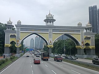
Kuala Kangsar Royal Welcome Arch |
| | Kuala Kangsar (West) | North
FT 76 Lengggong
FT 76 Gerik
FT 4 Kota Bharu
South
North–South Expressway Northern Route AH2 North–South Expressway Northern Route
Kuala Lumpur
Alor Setar | Diamond interchange |
| | Kampung Kuala Dal | | |
| | Kampung Dendang Kering | | |
| | Kampung Binjai | | |
| | Kampung Padang Asam | | |
| | Padang Rengas | North
A107 Jalan Padang Lintar
Padang Lintar
Labu Kubong | T-junctions |
| Kuala Kangsar–Larut, Matang and Selama district border |
| | Sungai Bukit Gantang | | |
| | Bukit Berapit | | |
| | Kampung Pasir Besar | | |
| | Kampung Pauh | | |
| | Kampung Sungai Serai | | |
| | Jalan Bukit Gantang | South
A105 Jalan Bukit Gantang
Bukit Gantang
Bukit Chempedak | T-junctions |
| | Jalan Sungai Bukit Gantang | South
A136 Jalan Sungai Bukit Gantang
Sungai Bukit Gantang | T-junctions |
| | Kampung Paya | | |
| | Changkat Jering | Northeast
A109 Jalan Air Kuning
Taiping
Southwest
 FT 60 Pantai Remis FT 60 Pantai Remis
FT 60 Beruas
FT 60 Lumut
FT 60 Sitiawan
FT 60 Pangkor Island
North–South Expressway Northern Route AH2 North–South Expressway Northern Route
Kuala Lumpur
Alor Setar | Junctions |
| | Taiping
Simpang | West
 FT 74 Kuala Sepetang FT 74 Kuala Sepetang
FT 74 Matang
Kota Ngah Ibrahim
East
FT 74 Taiping
FT 74 Kamunting
FT 74 Bukit Larut | Junctions |
| | Taman Bukit Jaya | | |
| | Sungai Bukit Teguh bridge | | |
| | Sungai Jebong bridge | | |
| | Kampung Air Putih | | |
| | Taiping (North) | West
North–South Expressway Northern Route AH2 North–South Expressway Northern Route
Kuala Lumpur
Alor Setar
East
A2 Jalan Kamunting Lama
Kamunting
Taiping
Bukit Larut | Junctions |
| | Kampung Dew | | |
Sungai Sepetang bridge
Larut,Matang and Selama-Kerian district border |
| | Jalan Gula–Jalan Semanggol | West
A100 Jalan Gula
Kuala Gula
Kuala Kurau
Kuala Gula Bird Sanctuary
East
A197 Jalan Semanggol
Simpang Ampat Semanggol
Bukit Merah
Bukit Merah Laketown Resort
North–South Expressway Northern Route AH2 North–South Expressway Northern Route
Kuala Lumpur
Alor Setar | Junctions |
| | Sungai Gedong | | |
| | Sungai Kurau bridge | | |
| | Kampung Teluk Medan | | |
| | Kampung Masjid Tinggi | | |
| | Kampung Alor Senggut | | |
| | Bagan Serai | West
 FT 75 Kuala Kurau FT 75 Kuala Kurau
East
 FT 147 Jalan Bagan Serai-Lenggong FT 147 Jalan Bagan Serai-Lenggong
FT 147 Kubu Gajah
FT 147 Selama
FT 147 Lenggong | Junctions |
| | Bagan Serai | | |
| | Kampung Sungai Bongak | | |
| | Simpang Lima | A191 Jalan Titi Serong
West
Titi Serong
Kampung Sungai Kota
East
Kampung Tali Air
Southwest
A190 Jalan Kuala Kurau
Kuala Kurau | Junctions |
| | Parit Buntar | Southwest
A104 Jalan Tanjung Piandang
Tanjung Piandang
Northeast
 FT 136 Jalan Parit Buntar FT 136 Jalan Parit Buntar
Town Centre
FT 136 Bandar Baharu
FT 136 Serdang
North–South Expressway Northern Route AH2 North–South Expressway Northern Route
Kuala Lumpur
Alor Setar | Junctions |
| | Parit Buntar | West
A22 Jalan Sungai Bakau
Sungai Bakau
East
A9 Jalan Padang
FT 136 Town Centre
FT 136 Bandar Baharu
FT 136 Serdang
Hospital Parit Buntar
North–South Expressway Northern Route AH2 North–South Expressway Northern Route
Kuala Lumpur
Alor Setar | Junctions |
Perak Darul Ridzuan
Kerian district border |
Parit Sempadan Parit Buntar bridge
Perak–Penang border |
Penang
Seberang Perai Selatan district border |
| | Teluk Ipil | | |
| | Jalan Transkrian | Southeast
 FT 283 Jalan Transkrian FT 283 Jalan Transkrian
Transkrian
Parit Buntar
Universiti Sains Malaysia (USM) Engineering Campus | T-junctions |
| | Sungai Kerian Bridge | | |
| | Nibong Tebal | | |
| | Nibong Tebal Iron Bridge
Railway crossing bridge | | |
| | Jawi-NSE | North–South Expressway Northern Route AH2 North–South Expressway Northern Route
North
Alor Setar
Butterworth
Penang
South
Kuala Lumpur
Ipoh
Bandar Baharu | T-junctions
(Jawi Toll Plaza: Accepts Touch 'n Go, MyRFID SmartTAG ) |
| | Jawi | | |
| | Sungai Bakap | | |
| | Kampung Gurun | | |
| | Val D'or | | |
| Seberang Perai Selatan–Seberang Perai Tengah district border |
| | Railway crossing bridge | | |
| | Kampung Paaboi | North
 FT 150 Jalan Paaboi FT 150 Jalan Paaboi
Bukit Tambun
North–South Expressway Northern Route AH2 North–South Expressway Northern Route (southbound)
Ipoh
Penang
Queensbay
Bayan Lepas Industrial Zone (Phases)
Universiti Sains Malaysia | T-junctions |
| | Taman Simpang Ampat & Bukit Tambun | Northbound
Bukit Tambun
Batu Kawan | T-junctions |
| | Simpang Empat | West
 FT 149 Jalan Bukit Tambun FT 149 Jalan Bukit Tambun
Bukit Tambun
 Sultan Abdul Halim Muadzam Shah Bridge Sultan Abdul Halim Muadzam Shah Bridge (Penang Second Bridge) Sultan Abdul Halim Muadzam Shah Bridge Sultan Abdul Halim Muadzam Shah Bridge (Penang Second Bridge)
Bayan Lepas Industrial Zone (Phases)
Queensbay
Penang
F.I.Z. / USM
North–South Expressway Northern Route AH2 North–South Expressway Northern Route
Gerik
Alor Setar
East
P124 Jalan Tasek
Tasek
Junjong
Kulim | T-junctions |
| | Permatang Tinggi | Alma
Machang Bubok
Kulim
Bukit Mertajam (northbound) | T-junctions |
| | Bukit Minyak Industrial Area | Bukit Tambun
Batu Kawan (southbound) | T-junctions |
| | Juru–Butterworth | see also
Butterworth–Juru Highway | |
| | Perai | Taman Perai Jaya | |
| | Butterworth Outer Ring Road | South
 FT 3112 Jalan Perusahaan Perai FT 3112 Jalan Perusahaan Perai
Perai Industrial Area
West
 Butterworth Outer Ring Road Butterworth Outer Ring Road Butterworth Outer Ring Road Butterworth Outer Ring Road
Butterworth
Ferry Terminal | |
| | Sungai Perai bridge | | |
| | Jalan Bagan 1 | Telaga Air Jalan Mak Mandin | |
| | Butterworth | East
P191 Jalan Sungai Nyior
Raja Uda
West
P191 Ferry Terminal | Interchange |
| | Jalan Heng Choon Tian | East
 Butterworth–Kulim Expressway FT 4 Butterworth–Kulim Expressway FT 4  AH140 Butterworth–Kulim Expressway AH140 Butterworth–Kulim Expressway
Kulim
Seberang Jaya
West
North Butterworth Container Terminal
Butterworth Outer Ring Road Butterworth Outer Ring Road
NBCT
Alor Setar | |
| | Bagan Ajam | Bagan Lalang Sungai Puyu | |
| | Bagan Tambang | | |
| | Titi Mukim | North
P1 Jalan Permatang Bendahari
Kota Kuala Muda
Kuala Muda
Pantai Merdeka | T-junctions |
| | Simpang Empat Permatang Sintok | P3 Jalan Bertam
Northwest
Kota Kuala Muda
Kuala Muda
Pantai Merdeka
South
Bertam
Padang Menora
Bukit Mertajam | Junctions |
| | Kepala Batas
| East
P123 Jalan Kubang Menerung
Bertam
Kubang Menerung
Tasek Gelugor
North–South Expressway Northern Route AH2 North–South Expressway Northern Route
Kuala Lumpur
Alor Setar | T-junctions |
| | Lahar Ikan Mati | | |
| | Permatang Tiga Ringgit | | |
| | Kampung Bumbung | | |
Penang
Seberang Perai Utara district border |
Sungai Muda Bridge
Jambatan Merdeka
Penang–Kedah border |
Kedah Darul Aman
Kuala Muda district border |
| | Tikam Batu | West
K14 Jalan Kuala Muda
Kota Kuala Muda
Kuala Muda
Pantai Merdeka | T-junctions |
| | Jalan Lencongan Timur | East
 FT 225 Jalan Lencongan Timur FT 225 Jalan Lencongan Timur
Bandar Aman Jaya
Kuala Ketil | T-junctions |
| | Sungai Petani South-NSE | West
 FT 257 Jalan Lencongan Barat FT 257 Jalan Lencongan Barat
Sungai Layar
East
North–South Expressway Northern Route AH2 North–South Expressway Northern Route
Alor Setar
Kuala Lumpur
Butterworth
Kulim | T-junctions |
| | Sungai Petani bridge | | |
| | Sungai Petani | East
 FT 67 Baling FT 67 Baling
FT 67 Gerik
FT 67 Kuala Ketil
FT 67 Kulim | T-junctions |
| | Railway crossing bridge | | |
| | Taman Lagenda Indah | | |
| | Jalan Lencongan Timur | East
FT 225 Jalan Lencongan Timur
Bandar Aman Jaya
Kuala Ketil | T-junctions |
| | Sungai Petani North-NSE | West
FT 257 Jalan Lencongan Barat
Sungai Layar
East
North–South Expressway Northern Route AH2 North–South Expressway Northern Route
Alor Setar
Kuala Lumpur
Butterworth
Kulim | T-junctions
(Sungai Petani (North) Toll Plaza: Accepts Touch 'n Go, MyRFID SmartTAG ) |
| | Sungai Lalang | | |
| | Bedong | West
K1 Jalan Pantai Barat Kedah
Merbok
Yan
Bujang Valley Archaeological Museum | T-junctions |
| | Railway crossing bridge | | |
| | Gurun | | |
| | Gurun | East
 FT 175 Jeniang FT 175 Jeniang
FT 175 Sik
FT 175 Gurun Industrial Area
North–South Expressway Northern Route AH2 North–South Expressway Northern Route
Alor Setar
Kuala Lumpur | T-junctions |
| | Gurun | | |
| Kuala Muda–Yan district border |
| | Jalan Gunung Jerai | Southwest
 FT 252 Jalan Gunung Jerai FT 252 Jalan Gunung Jerai
Kampung Titi Teras
Gunung Jerai | T-junctions |
| | Guar Chempedak | | |
| | Guar Chempedak | K146 Jalan Guar Chempedak
West
Yan
East
Banggul Sanai
Sungai Rotan | Junctions |
| | Guar Chempedak | | |
| | Sungai Padang Terap bridge | | |
| | Madrasah Taufiqiah Khairiah Al-Halimiah (Pondok Pak Ya) | | |
| | Padang Lumat | | |
| Yan–Kota Setar district border |
| | Kota Sarang Semut | West
K366 Jalan Sala
Sala
East
K133 Jalan Pendang–Kota Sarang Semut
Pendang
North–South Expressway Northern Route AH2 North–South Expressway Northern Route
Alor Setar
Kuala Lumpur | Junctions |
| | Simpang Empat | K130 Jalan Simpang Empat, Kedah
West
Kampung Kuala Kangkong
Permatang Ibus
East
Tokai
Tanah Merah | Junctions |
| | Alor Setar Selatan | Northwest
 FT 255 Sultanah Bahiyah Highway FT 255 Sultanah Bahiyah Highway
 FT 7 Kangar FT 7 Kangar
 FT 78 Kuala Kedah FT 78 Kuala Kedah
East
North–South Expressway Northern Route AH2 North–South Expressway Northern Route
Bukit Kayu Hitam
Kuala Lumpur | Junctions |
| | Alor Setar Selatan–Alor Setar | see also Sultan Abdul Halim Highway | |
| | Alor Setar | | |
| | Alor Setar–Jitra | see also Darul Aman Highway | |
| | Jitra | Northwest
K3 Jalan Arau
Arau
Kangar
Padang Besar | T-junctions |
| | Jitra–Bukit Kayu Hitam | see also North–South Expressway Northern Route AH2 North–South Expressway Northern Route | |