Kajang

Last updated

Kajang
Town
Other transcription(s)
   Jawi کاجڠ
   Chinese 加影
   Tamil காஜாங்
Kājāṅ(Transliteration)
Bandar Kajang, Hulu Langat District 20230618 120509.jpg
The Seal of Kajang Municipal Council.png
Motto(s): 
Kajang Bandar Pilihan untuk Didiami
(Kajang Choice City for Living)
Kajang
Location in Malaysia
Malaysia location map.svg
Red pog.svg
Kajang
Coordinates: 2°59′35″N101°47′20″E / 2.99306°N 101.78889°E / 2.99306; 101.78889
Country Malaysia
State Selangor
Establishment1709
Granted
municipal status
1 January 1997
Granted
city status
TBA
Government
  Yang Di-Pertua
(President)
Nazli Md Taib
Area
  Town93.4 km2 (36.1 sq mi)
  Urban
790.43 km2 (305.19 sq mi)
Population
 (2020 [1] )
  Town236,240
  Density1,326/km2 (3,393/sq mi)
   Metro
1,047,356 [2]
Time zone UTC+8 (MST)
  Summer (DST)Not observed
Postal codes in Malaysia
43000
43200
43500
43650
Calling code +60-3-87
+60-3-89
+60-3-90
Website www.mpkj.gov.my

Kajang is a town in Hulu Langat District, Selangor, Malaysia, located southeast of Kuala Lumpur.

Contents

Kajang, along with much of Hulu Langat District, is governed by the Kajang Municipal Council. Kajang town is located on the eastern banks of the Langat River. It is surrounded by Cheras, Semenyih, Bangi, Putrajaya and Serdang.

According to the 2020 census, the local authority area (which includes Kajang, Cheras, Balakong, Bangi, Semenyih and Pekan Hulu Langat) has a population of 1.05 million people. [3]

Etymology

The name Kajang is believed to have originated from the language of Temuan tribes (Orang Asli) who populated the Langat valley in the 17th-18th centuries. In their language kajang referred to their art of weaving screwpine or pandanus leaves, which were prevalent in much of the country. A similar theory stated that settlers from the neighboring domain of Sungai Ujong (Negeri Sembilan) once constructed huts (pondok) in the area with thatched roof made from folded (lipat kajang) screwpine leaves. [4]

It is also believed that the name kajang may have originated from the Buginese word berkajang, meaning camp or accommodation. [5]

Geography and development

Kajang is about 22 km (14 miles), about a half hour's drive, from Kuala Lumpur's central business district, primarily through Jalan Cheras and the Grand Saga Expressway; both routes are part of the Malaysia Federal Route 1 system. By railway, it is about 40 minutes' ride from KL Sentral on the MRT Kajang line.

The first planned township built and developed just outside Kajang is Bandar Baru Bangi which was first developed in 1974 by the Selangor state government. As a satellite town to Kajang proper, some government offices including the district land office begin operating out of the township. The Kajang bus and taxi terminal called Hentian Kajang is also located at the eastern end of the township. [6]

More townships were developed closer to Kajang town in recent years, such as Taman Prima Saujana, Sungai Chua and Taman Kajang Perdana (Kajang Highlands). High-end developments in Kajang include Twin Palms, Sri Banyan, Country Heights, Jade Hills, Saujana Impian, TTDI Grove, Tropicana Heights and Prima Paramount. Areas surrounding these townships are accessible via the SILK Expressway, Kajang-Seremban Expressway, Grand Saga Expressway and the North–South Expressway Southern Route.

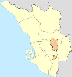
Geographical definition

Some adjacent areas in the neighbouring Sepang region including Kampung Sungai Merab, Desa Pinggiran Putra and Kampung Dato Abu Bakar Baginda, though rarely regarded as part of Kajang, are included in Kajang's postal code of 43000 due to their proximity to Kajang than to Sepang town itself. [7] [8] [9] [10]

The townships in Bandar Seri Putra and Bukit Mahkota, while closer to Bangi Lama (Bangi old town) also use the postal code of Kajang. Bangi Lama, Bandar Seri Putra and Bukit Mahkota are located in Mukim Kajang. [11]

History

Orang Asli tribes had already established settlements in what is now Kajang as early as the 16th century, however the first recorded settlement was found in 1709 by additional Orang Asli settlers who relocated from the Klang valley. [12] Kajang town in its present form was founded in the 1870s, in the aftermath of the Klang War. In its early days, it was settled by Mandailings and Minangkabau people from Sumatra in the then-Dutch East Indies, followed by Chinese tin miners. [13]

As with other towns in Selangor, Kajang as a modern town owes its rise in particular to tin mines and plantations which were opened around the 1890s. A famous coffee estates was Inch Kenneth Estate managed by the Kindersley brothers, who were among the first to plant rubber in the country on a commercial basis. [14]

Kajang town in Selangor at night, with Metro Plaza Kajang in the background Kajang town at night.jpg
Kajang town in Selangor at night, with Metro Plaza Kajang in the background

During the Japanese invasion, Kajang was bombed on 12 January 1942, a day after the fall of Kuala Lumpur. The bombs, meant for the railway station, missed its target, and hit a nearby church instead. [15]

In 1948, a Communist insurgency against British forces and their allies across Malaya began, which led to the Malayan Emergency with fighting soon spreading to Kajang. Guerrilla leader Lau Yew died in combat just outside Kajang in July 1948; British forces photographed his corpse and printed the image onto leaflets to distribute around Kajang. [16]

Kajang was granted municipal status on 1 January 1997. Previously it was under the jurisdiction of the Hulu Langat District Council (Majlis Daerah Hulu Langat, MDHL). Kajang was the administrative centre of the Hulu Langat region until it was relocated to Bandar Baru Bangi in 1992. [17]

Demographics

In the 2020 census, the Kajang Municipal Council is home to 1.05 million people, making it Malaysia's second most populous local authority after Kuala Lumpur. Over 350,000 people reside in Kajang town itself and its immediate suburbs. [18] [19]

Kajang's main population centres are Sg. Sekamat, Taman Saujana Impian, Sg. Kantan, Sg. Jelok, Sg. Ramal, Sungai Chua, Jalan Reko, Jalan Bukit, Taman Jenaris, Taman Prima Saujana, Taman Kantan Permai, Taman Kajang Perdana, Taman Sri Ramal, Taman Bukit Mewah, Kajang Prima, Bandar Teknologi Kajang, Hillpark and Bandar Baru Bangi.

Malay
43.66%
Other Bumiputeras
2.46%
Chinese
35.34%
Indians
9.74%
Others
0.6%
Non-Malaysians
8.2%

Landmarks

Kajang Jamek Mosque Masjid Kajang.jpg
Kajang Jamek Mosque

The city centre of Kajang is the colonial quarter near the Stadium Kajang MRT station, including the streets of Jalan Mendaling, Jalan Stadium, Jalan Sulaiman and Jalan Raja Haroun. The buildings in the area were constructed around the 1900s to 1930s. [20] The architecture of these shophouses are a combination of traditional Chinese and European designs. The ground floor was used mostly for commercial activities and the upper floor as the family living quarters.

Famous mosque in Jalan Reko next to Kajang MRT station Masjid India Kajang.jpg
Famous mosque in Jalan Reko next to Kajang MRT station

One of Kajang's landmarks is Kajang Stadium which is situated in the heart of the town. The stadium can accommodate up to 5,000 people and is used throughout the year for the community soccer competitions.

Another landmark is the Kajang Jamek Mosque, which is recognisable by its bright yellow facade.

Transportation

Car

Kajang is served by a network of tolled expressways and federal highways.

Federal Route 1, the premier north–south federal route of Peninsular Malaysia, runs through downtown Kajang as Jalan Cheras from Cheras until Sungai Jernih and Stadium Kajang and then southwards as Jalan Semenyih from Stadium Kajang until Semenyih, Beranang and neighbouring Seremban, Negeri Sembilan with the rest of the route terminating in Johor Bahru, Johor - the route's southern terminus. On Federal Route 1, Kajang is 22 km from Kuala Lumpur, 8 km from Semenyih and 43 km from Seremban.

A stretch of Federal Route 1 is concurrent with the Cheras-Kajang toll road (aka the Grand Saga Expressway) between Taman Connaught and Bukit Dukung. The SILK Expressway starts in Serdang, which then runs through Balakong and then forms a beltway around downtown Kajang before ending near Bandar Baru Bangi. It is the main ring road for Kajang.

PLUS Expressway exit 210 (Kajang Interchange) serves the vicinity of Kajang and Bangi. It also links the expressway to SILK Expressway and SKVE Expressway as well as B11 which runs concurrently with SILK and SKVE from SKVE's Serdang Interchange at Seri Kembangan until SILK's Sungai Chua Interchange at Kajang, before being detoured out of SILK after the interchange. B11 continues on its own separate route until its terminus at Stadium Kajang just before the intersection with Jalan Cheras, Jalan Semenyih and Jalan Reko

From Ampang Jaya, one can reach Kajang with state routes B62 and B52.

Public transport

 KB06  KG35  Kajang railway station is the principal rail station of Kajang. It is an interchange station between the 9 MRT Kajang Line, 1 KTM Seremban Line and   ETS   KTM ETS. The station is the southern terminal of the MRT line.

Kajang station, though so named, does not directly serve downtown Kajang; Stadium Kajang MRT is located in the actual downtown area, along with Sungai Jernih MRT.

Food and tourism

Dato' Nazir Building (Medan Sate) where Sate Kajang Haji Samuri is situated Haji Samuri.jpg
Dato' Nazir Building (Medan Sate) where Sate Kajang Haji Samuri is situated

Kajang is famous for its satay , a form of skewered barbecued meat. Informally, Kajang is known as the Satay Town. [21]

Government and infrastructure

The Malaysia Prison Complex (Kompleks Penjara Kajang), Prison Department of Malaysia is headquartered in Kajang. [22] [23]

Shopping

Lotus's Kajang, in Saujana Impian, Kajang Lotus's Kajang (220713).jpg
Lotus's Kajang, in Saujana Impian, Kajang

Kajang has multiple shopping complexes, amongst them is the Billion Shopping Center formerly in Kajang town, which now has relocated to Bandar Teknologi Kajang. Other shopping centres located in Kajang are Plaza Metro Kajang, Metro Point and Kompleks Kota Kajang. Metro Avenue is a new shopping district located opposite SMJK Yu Hua Kajang and Kajang High School.

Facilities and amenities

Kajang Hospital is the primary public hospital in the city.

Private medical centres function 24 hours and include facilities such as Poliklinik MUC @Metro Point, Klinik Mediviron Prima Saujana, Kajang Plaza Medical Centre (KPMC) and KPJ Kajang Specialist Hospital.

The Hulu Langat District Police Headquarters are located in the town centre, across the Highway 1 junction from the Post Office. Federal government agencies with their branch in Kajang include the National Registration Department, Immigration Department, Transportation Department, and Hulu Langat Education Office.

Education

SK Sungai Kantan SK Sungai Kantan.jpg
SK Sungai Kantan

Primary

Secondary

Tertiary

New Era University College New Era College.jpg
New Era University College

Kajang is home to institutions of higher learning, which includes:

Politics

The Kajang town Post Office Kajang Post Office 2021.jpg
The Kajang town Post Office

Kajang is a state seat in the Selangor State Legislative Assembly and one of three state seats within the Bangi parliamentary seat in the Dewan Rakyat of the Parliament besides Balakong and Sungai Ramal. Bangi has been represented by Member of Parliament (MP) Syahredzan Johan of Pakatan Harapan (PH) since 2022 and Kajang has been represented by Member of the Legislative Assembly (MLA) David Cheong Kian Young of PH since 2023.

Before that, Kajang was one of the state seats within the Hulu Langat parliamentary seat in the Dewan Rakyat of the Parliament besides Semenyih and Dusun Tua.

Notable people

Kajang Plaza Courts Mammoth Kajang.jpg
Kajang Plaza

Related Research Articles

<span class="mw-page-title-main">Sepang District</span> District of Malaysia in Selangor

The Sepang District is a district located in the southern part of the state of Selangor in Malaysia. Sepang District covers an area of around 600 square kilometres, and had a population of 190,889 in the 2010 Census.

<span class="mw-page-title-main">Hulu Langat District</span> District of Malaysia in Selangor

Hulu Langat District is a district of Malaysia located in the southeastern corner of Selangor, between Kuala Lumpur and Negeri Sembilan. It is bordered by the state of Pahang to the east and north, Gombak district to the north-west, Federal Territory of Kuala Lumpur and Petaling district to the west, Sepang district to the south-west, and state of Negeri Sembilan to the south.

<span class="mw-page-title-main">Semenyih</span> Town in Selangor, Malaysia

Semenyih is a town and a mukim in Hulu Langat District in southeastern Selangor, Malaysia along the Kajang–Seremban road. It is 28 km (17 mi) southeast of downtown Kuala Lumpur and 8 km (5.0 mi) southeast of Kajang.

The Cheras–Kajang Expressway is an 11.5-kilometre (7.1-mile) controlled-access highway in the Klang Valley region of Peninsular Malaysia. It runs between the suburb of Cheras at the Kuala Lumpur–Selangor border and the township of Kajang in Selangor.

<span class="mw-page-title-main">Cheras, Kuala Lumpur</span> Suburb and Mukim in Selangor and Federal Territory of Kuala Lumpur, Malaysia

Cheras is a suburban and a district, straddling both the Federal Territory of Kuala Lumpur and Hulu Langat District in the state of Selangor, Malaysia.

<span class="mw-page-title-main">Sungai Buloh</span> Place in Selangor, Malaysia

Sungai Buloh, or Sungei Buloh, is a town, a mukim (commune) and a parliamentary constituency in the northern part of Petaling District, Selangor, Malaysia. The name itself means bamboo river in the Malay language. It is located 16 km NW of downtown Kuala Lumpur and 8 km north of the Subang Airport, along the Kuala Selangor highway.

Bandar Tun Razak is a township and parliamentary constituency in Kuala Lumpur, Malaysia. It is named after the second Prime Minister of Malaysia, Tun Abdul Razak.

<span class="mw-page-title-main">Puchong</span> Town in Selangor, Malaysia

Puchong is a major town and a parliamentary constituency in Petaling District, Selangor, Malaysia.

<span class="mw-page-title-main">Bandar Sungai Long</span>

Bandar Sungai Long is a main township in Cheras, Selangor, Malaysia. Bandar Sungai Long was designed for a population of 10,000 residents. The majority population in this township are Chinese with a minority of Indians and Malays living in this township.

<span class="mw-page-title-main">Segambut</span> Place in Federal Territory of Kuala Lumpur, Malaysia

Segambut is a sub-district in Kuala Lumpur, Malaysia. The federal constituency represented in the Dewan Rakyat is Segambut.

<span class="mw-page-title-main">Ampang Jaya</span> Town in Selangor, Malaysia

Ampang Jaya, more commonly known as just Ampang, is a town, a mukim and a parliamentary constituency straddling parts of the Hulu Langat District and Gombak District, in eastern Selangor, Malaysia. It is located just outside the eastern border of Kuala Lumpur Federal Territory.

<span class="mw-page-title-main">University of Kuala Lumpur</span> Private university in Malaysia

The University of Kuala Lumpur is a multi-campus technical university with its main campus based in Kuala Lumpur, Malaysia. Rated as a Tier-5 "Excellent University" by the Ministry of Higher Education Malaysia in 2009, 2011, 2013 and awarded Putra Brand Award in 2016. UniKL has 14 institutes spread across 12 campuses throughout Malaysia in Kuala Lumpur, Gombak, Cheras, Bangi, Kajang, Sepang, Taboh Naning, Pasir Gudang, Ipoh, Lumut and Kulim.

Bandar Tun Hussein Onn is a township in 11th-Mile Cheras in Bangi constituency, Selangor, Malaysia. It is primarily a residential area, established in the early 1990s. It is situated about 13 km southeast of central Kuala Lumpur and 7.5 km north of Kajang.

Bandar Seri Putra is a township in Bangi in Hulu Langat District, Selangor, Malaysia. This township is about 30 km from Kuala Lumpur and 18 km from Kuala Lumpur International Airport. The township is some 2.5 km from the Selangor–Negeri Sembilan border.

Saujana Impian is a township in Hulu Langat District, Selangor, Malaysia. This township is located about two kilometers away from Kajang town. The Impian Golf & Country Club is located within this township.

Taman CUEPACS is a major township in Cheras, Selangor, Malaysia. Taman CUEPACS is located near Pasukan Gerakan Am (PGA) police base. The township gets its name from the abbreviation of CUEPACS which means Congress of Unions of Employees in the Public and Civil Services.

<span class="mw-page-title-main">Greater Kuala Lumpur</span> Metropolitan area in Malaysia

Greater Kuala Lumpur is the geographical term that determines the boundaries of metropolitan Kuala Lumpur in Malaysia. Though similar to the term "Klang Valley", there remains a variation between the two. The metropolitan area covers 5,194.72 square km of land.

Sungai Jernih MRT station is an elevated rapid transit station on the MRT Kajang Line, located in the northern precincts of downtown Kajang, Selangor, Malaysia. It was opened on 17 July 2017, along with 19 adjoining stations as part of Phase 2 of the system.

<span class="mw-page-title-main">Taman Putra Perdana</span> Place in Selangor, Malaysia

Taman Putra Perdana is a township in Dengkil sub-district, Sepang District, Selangor, Malaysia. Although the township's postcode is 47100 / 47120 / 47130, which gives it Puchong postal address, it is actually in the Sepang constituency of Selangor, administered by the Sepang Municipal Council (MPSepang). The township was developed by Kenshine Corporation in 1997.

The following is an alphabetical list of articles related to Selangor.

References

  1. "LATAR BELAKANG PEJABAT DAERAH / TANAH HULU LANGAT" . Retrieved 27 April 2022.
  2. "MyCenDash" . Retrieved 1 June 2022.
  3. "MyCenDash" . Retrieved 1 June 2022.
  4. "Kajang kaya warisan sejarah". Berita Harian. Retrieved 27 August 2021.
  5. "Asal usul nama Kajang". Sinar Harian. Archived from the original on 20 November 2017. Retrieved 27 August 2021.
  6. "Portal Rasmi PDT Hulu Langat Sejarah". www.selangor.gov.my.
  7. Shaharir, Syahrul Sazli (30 March 2023). "Kampung Sungai Merab (1896)". Cebisan Sejarah Bangi (in Malay).
  8. "Sungai Merab, Kajang - Postcode - 43000 - Malaysia Postcode".
  9. "Kampung Dato Abu Bakar Baginda, Kajang - Postcode - 43000 - Malaysia Postcode". postcode.my.
  10. "Desa Pinggiran Putra, Kajang - Postcode - 43000 - Malaysia Postcode". postcode.my.
  11. "Ulu Langat (District, Malaysia) - Population Statistics, Charts, Map and Location". www.citypopulation.de.
  12. "Info Kajang". Kajang Municipal Council. 4 November 2015. Retrieved 27 August 2021.
  13. "Kajang bukan sekadar ada sate sedap, tapi punyai sejarah menarik untuk dijelajah". MStar. 21 December 2019. Retrieved 27 August 2021.
  14. "It's History: Men who sowed the seeds of country's rubber industry". www.angelfire.com. Retrieved 30 August 2023.
  15. "History of Kajang". 15 July 2020. Retrieved 4 April 2021.
  16. Hack, Karl (2022). The Malayan Emergency: Revolution and Counterinsurgency at the End of Empire. Cambridge: Cambridge University Press. p. 320.
  17. "SEJARAH PEJABAT DAERAH / TANAH HULU LANGAT" . Retrieved 27 August 2021.
  18. "Population Distribution by Local Authority Areas and Mukims, 2010". Department of Statistics, Malaysia. Archived from the original on 14 November 2014.
  19. "Mukim - Quick Glance" . Retrieved 4 May 2024.
  20. Pradhan, Biswajeet (8 May 2017). Spatial Modeling and Assessment of Urban Form: Analysis of Urban Growth: From Sprawl to Compact Using Geospatial Data. Springer. ISBN   978-3-319-54217-1.
  21. "Progression of a satay town - Focus - The Star Online". thestar.com.my. Retrieved 20 November 2016.
  22. "Home." Prison Department of Malaysia. Retrieved on 7 August 2014. "Malaysia Prison Complex, Kajang Selangor." Map.
  23. "IBU PEJABAT PENJARA MALAYSIA." Prison Department of Malaysia. Retrieved on 7 August 2014. "Bukit Wira, Beg Berkunci No. 212, 43000 Kajang, SELANGOR DARUL EHSAN"
  24. Thayaparan, S. (1 January 2021). "Ramli Ibrahim dances through arts, religion and politics". Malaysiakini. Retrieved 5 January 2023.
  25. "Ramli - dancer, arts and culture icon. Born in Kajang". MyHometown. Retrieved 5 January 2023.
  26. Mok, Opalyn (17 May 2015). "10 things about: Ramli Ibrahim, champion of Indian classical dance". Malay Mail. Retrieved 5 January 2023.
  27. "International Mathematical Olympiad". www.imo-official.org. Retrieved 7 January 2023.
  28. "Ex-Olympians". IMO Malaysia. 8 July 2020. Retrieved 7 January 2023.
  29. "Persatuan Sains Matematik Malaysia (PERSAMA) - Keputusan Terdahulu". persama.org.my. Retrieved 7 January 2023.
  30. "There's no place like home" . Retrieved 13 January 2023 via PressReader.
  31. "ABOUT US". Anonymous Christian. Retrieved 13 February 2023.