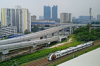
Kajang is a town in Hulu Langat District, Selangor, Malaysia, located southeast of Kuala Lumpur. Kajang, along with much of Hulu Langat District, is governed by the Kajang Municipal Council. Kajang town is located on the eastern banks of the Langat River. It is surrounded by Cheras, Semenyih, Bangi, Putrajaya and Serdang.

Jugra is a mukim, historical town and a former royal town in Kuala Langat District, Selangor, Malaysia. It is separated from Pulau Carey by the Langat River. The town is administered by the Zone 16 of the Kuala Langat Municipal Council.

Hulu Langat District is a district of Malaysia located in the southeastern corner of Selangor, between Kuala Lumpur and Negeri Sembilan. It is bordered by the state of Pahang to the east and north, Gombak district to the north-west, Federal Territory of Kuala Lumpur and Petaling district to the west, Sepang district to the south-west, and state of Negeri Sembilan to the south.

Banting is a town and the seat of Kuala Langat District, Selangor, Malaysia. Banting has a population of 93,497. The postal code for Banting is 42700 and is administered by the Zone of 15 and 19 of the Kuala Langat Municipal Council. It is situated on the banks of Langat River. It is a Rest Town or Bandar Persinggahan of Federal Route 5. The historical Jugra, a former royal town of Selangor is situated near Banting. Banting is located near the beaches of Morib, as well as hills, forest and farms. Banting is an agricultural hub. Its main agricultural resources include oil palm plantations, poultry farms, betel leaves and it has a number of industrial areas. It is also the home town of the Malaysian badminton player Rashid Sidek.

Bangi, alternately Bangi Lama, is a small town situated south of Hulu Langat District, Selangor, Malaysia.

Cheras is a suburban and a district, straddling both the Federal Territory of Kuala Lumpur and Hulu Langat District in the state of Selangor, Malaysia.

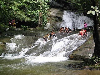
The Gabai River, a minor river in the Langat River basin, flows from the 1,462-metre-high (4,797 ft) Mount Besar Hantu in the state of Negeri Sembilan into the dipterocarp forest reserve of the Hulu Langat district in the adjacent state of Selangor.

Bandar Sungai Long is a main township in Cheras and Kajang, Selangor, Malaysia. Bandar Sungai Long was designed for a population of 10,000 residents. The majority population in this township are Chinese with a minority of Indians and Malays living in this township.

Sungai Besi is a town and suburb within the Federal Territory of Kuala Lumpur. The federal constituency of Sungai Besi existed from 1974 to 1995. Sungai Besi was a historical mining town with many heavy industries such as steelworks, waste steel plants and other steel industries. Sungei Besi Tin Mine site was the largest and deepest open cast alluvial tin mine in the world and in Malaysia. The town has since developed from a large area of village settlements.

Dengkil is a town and mukim in Sepang District, southern Selangor, Malaysia.

Salak Tinggi is a town in Sepang District, Selangor, Malaysia. Located about 9 km north of the Kuala Lumpur International Airport, it is the seat of the Sepang district's administration.

Balakong; Chinese: 無拉港) or Cheras South; Chinese: 蕉賴南區) is a township in Hulu Langat District, Selangor, Malaysia. Located to the southeast of Greater Kuala Lumpur, the township consists mainly of residential condominiums, office complexes and factories. Notable landmarks in Balakong include AEON Mall Cheras Selatan and Sin Ann Meow Temple (星安庙).

Jenjarom is a town located in the Kuala Langat District of Selangor state in Malaysia. Around 95% of the 30,000 residents are Hokkien Chinese and the Hokkien dialect is the main language used locally. The town also administered by the Zones 9, 10 (Chinese) and 6 (Malay) of the Kuala Langat Municipal Council.
Bandar Mahkota Cheras, often referred to by its initials BMC, is a township in Cheras, Hulu Langat, Selangor, Malaysia. A smaller part of the township is also a part of Kajang. It was developed by Narajaya Sdn Bhd, a subsidiary of Lion Group. Construction commenced in late 1999 or early 2000 on a freehold plot of about 365 hectares. Mostly consisting of two-storey terraced houses, the population is estimated to be in excess of 50,000 in more than 10,000 households. There are also a few smaller developments by other developers in the same township, e.g., Cheras Vista and Pinggiran Mahkota Cheras. It is located in the mukim (sub-district) of Cheras, daerah (district) of Hulu Langat and state of Selangor. It borders Bandar Sungai Long to the north and west.

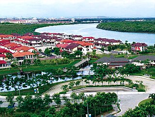
Glenmarie Cove is a 200-acre (0.81 km2) exclusive resort style water-front freehold gated & guarded residential enclave located in the south of the royal town of Klang in the state of Selangor, Malaysia. It is adjacent to other new and modern townships such as Bandar Botanic and Bukit Tinggi.

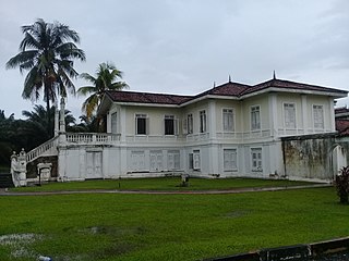
The Istana Bandar is a historical palace in Jugra, Kuala Langat District, Selangor, Malaysia.

The Klang District is a district in Selangor, Malaysia. It is located in the western part of Selangor. It borders the Kuala Selangor District to the north, Petaling to the east, Kuala Langat district to the south and Malacca Straits to the west. The district was further divided into two mukims which is Klang and Kapar that covers 626.78 square km of land with 53.75 km of coastline.
The Bandar Malaysia railway station is a planned railway station and a high-speed rail terminus as part of the Bandar Malaysia project in the Salak Selatan district in southern Kuala Lumpur, Malaysia.
The following is an alphabetical list of articles related to Selangor.
Sungai Way is a suburb of Petaling Jaya, Petaling District, Selangor, Malaysia. It was established in 1949 during Briggs Plan, as a Chinese new village. After independence, Sungai Way become a populated place and its surroundings.had established new industrial zone prior to the opening of Federal Highway, and also Subang-Sungai Way and Bandar Sunway. Sungai Way has an official name as "Seri Setia". Naming of Sungai Way was adopted from nearby river as "sungai" and "way" in.English.


