Bandar Gamuda Cove | |
|---|---|
Township | |
| Gamuda Cove | |
 Gamuda Cove Toll Plaza | |
 Bandar Gamuda Cove  Bandar Gamuda Cove  Bandar Gamuda Cove | |
| Coordinates: 2°53′07″N101°36′55″E / 2.8853385°N 101.6153145°E | |
| Country | |
| State | |
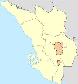
| District | Kuala Langat |
| Established | September 2018 |
| Founded by | Gamuda Land |
| Area | |
• Total | 6.1 km2 (2.4 sq mi) |
| Time zone | UTC+8 (MYT) |
| Postal code | 42700 |
Bandar Gamuda Cove is a 1,530 acre township located next to Paya Indah Wetlands and Kuala Langat North Forest Reserve. [1] It was launched in 2018 with the Discovery Park. [2] It's projected that Mori Pines and Palma Sands will reach 7,600 people in the end of 2024. [3]
