North Klang Straits Bypass, Federal Route 20, AH 141, is the main highway bypass to Port Klang in Klang, Selangor, Malaysia. Federal Route 20 became the backbone of the road system linking Sungai Rasau to Port Klang before being surpassed by the New North Klang Straits Bypass 30. Many cargo trucks travel along the highway daily.
Federal Route 3 is a main federal road running along the east coast of Peninsula Malaysia. The 739 kilometres (459 mi) federal highway connects Rantau Panjang in Kelantan until Johor Bahru in Johor. The entire FT3 highway is gazetted as a part of the Asian Highway Network route 18.
Federal Route 4 is a federal road in the north of Peninsula Malaysia. The 307 kilometres (191 mi) road connects Butterworth, Penang to Pasir Puteh in Kelantan. The highway also goes close to the border with Thailand and meets Jalan Kompleks CIQ Bukit Bunga at Bukit Bunga.
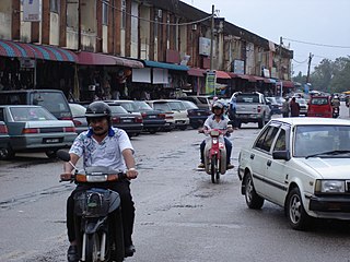
Rantau Panjang (Thai: รันเตาปันจัง) is a daerah (subdistrict/commune) and also a parliamentary constituency in Pasir Mas District, Kelantan, Malaysia.
Federal Route 57 comprising Jalan Long Yunus and Jalan Pengkalan Chepa is a federal road in Kelantan, Malaysia. It is a main route to Sultan Ismail Petra Airport at Pengkalan Chepa.
Rantau Panjang–Sungai Golok Bridge, popularly called the "Harmony Bridge", is a road bridge crossing Kolok River of the Malaysia–Thailand border, connecting Rantau Panjang town in Kelantan, Malaysia, with Su-ngai Kolok town in Narathiwat, Narathiwat Province, Thailand. It spans to the south of the cross-border railway bridge nearby. The bridge is a part of Asian highway network AH18, including Thailand Route 4056 and Federal Route 3. It was built by the governments of both countries, and was officially opened on 21 May 1973 by both Malaysian Prime Minister Tun Abdul Razak bin Haji Dato' Hussein Al-Haj and Thai Prime Minister Field Marshal Thanom Kittikachorn.
Federal Route 211, or Jalan Kubang Kerian-Bachok, is a federal road in Kelantan, Malaysia.
Federal Route 198, or Jalan Jedok-Air Canal-Legeh, is a federal road in Kelantan, Malaysia. The route connects Jedok in the northeast and Kampung Legeh in the southwest.
Federal Route 209, or Jalan Pasir Hor, is a federal road in Kelantan, Malaysia. The road connects Wakaf Che Yeh in the west to Kubang Kerian in the east.
Federal Route 201, or Jalan Nibong-Jakar-Bukit Nangka, is a federal road in Kelantan, Malaysia. The route connects town of Bukit Bunga in the west and Kampung Nibong in the east.
Federal Route 197, or Jalan Tok Deh-Gual Periok, is a federal road in Kelantan, Malaysia.
Federal Route 199, or Jalan Batu Gajah, is a federal road in Kelantan, Malaysia. The route connects Kampung Batu Gajah in the north and Kampung Lawang in the south.

The Rantau Panjang railway station was a Malaysian railway station located near Jalan Besar and named after the town of Rantau Panjang, Kelantan. Opened in 1921, it is located on the Rantau Panjang branch line, branching off from the main KTM East Coast Line at Pasir Mas. Rantau Panjang is one of the two rail border crossings on the border with Thailand, though currently there is no cross-border train crossing the Malaysia–Thailand border at Rantau Panjang. The Thai entrance to the Harmony rail bridge is currently sealed off by the Royal Thai Army.
Jalan Pantai Cahaya Bulan, or Jalan Pantai Cinta Berahi, Federal Route 223 is a federal road in Kelantan, Malaysia. The Kilometre Zero of the Federal Route 223 starts at Pantai Cahaya Bulan.
Federal Route 261, or Jalan Lubok Jong-Tanah Merah, is a federal road in Kelantan, Malaysia. The road connects Lubok Jong in the north to Tanah Merah in the south.
Federal Route 260, or Jalan Pasir Mas-Pohon Tanjung, is a federal road in Kelantan, Malaysia. The road connects Pasir Mas in the east to Pohon Tanjung in the west.
Jalan Sultan Ismail Petra, Federal Route 259, is a federal road in Kelantan, Malaysia. The roads connected Batang Merbau in the west to Tanah Merah in the east. It was named after ninth Sultan of Kelantan, Sultan Ismail Petra, who reigned from 1979 until 2010.

Rantau Panjang is a federal constituency in Pasir Mas District, Kelantan, Malaysia, that has been represented in the Dewan Rakyat since 1974.

Segamat is a town located in the Segamat District, Johor, Malaysia. It is 95 km travel distance via North–South Expressway from Johor Bahru to Yong Peng, and another 77 km from Federal Route 1.

Pasir Mas District is a district (jajahan) in Kelantan, Malaysia. The district covers an area of 614.15 square kilometers and is bordered by the districts of Tumpat District to the north, Tanah Merah District to the south, Kota Bharu District to the east, and the Thai district of Su-ngai Kolok to the west.

