
Mersing is a town, mukim and the capital of Mersing District, Johor, Malaysia.

Johor Bahru Inner Ring Road, (JBIRR) or Jalan Lingkaran Dalam, Federal Route 188, is a multi-lane federal ring road highway that circles the Johor Bahru Central District in Johor, Malaysia. The 4.6-kilometre (2.9 mi) highway was the most expensive road infrastructure project per kilometre of its time in the country.

Pasir Gudang Highway, also known as Federal Route 17, is a highway in Johor Bahru District, Johor, Malaysia that connects Tampoi North in the west to Pasir Gudang and Tanjung Langsat in the east. Pasir Gudang Highway is a four-laned highway, unlike the wider Skudai Highway which has six lanes. Many cargo trucks travel along the highway daily. Pasir Gudang Highway became the backbone of the road system linking Johor Bahru to Pasir Gudang before being surpassed by the Senai–Desaru Expressway, SDE 22, and the Johor Bahru East Coast Parkway 35.
Johor Bahru–Kota Tinggi Highway (Malay: Lebuhraya Johor Bahru–Kota Tinggi), Federal Route 3, also known as Tebrau Highway (Jalan Tebrau) and Jalan Kota Tinggi is a highway that encompasses Federal Route 3 in Johor Bahru, Malaysia. Part of Asian Highway Route AH18, the highway stretches from its southern end at Jalan Wong Ah Fook and Jalan Tun Abdul Razak in the metropolitan area of Johor Bahru to the northern end at the underpass flyover with North–South Expressway Southern Route and Johor Bahru Eastern Dispersal Link Expressway around Pandan. The stretch of Tebrau Highway after this continues as Jalan Pandan and Jalan Kota Tinggi respectively, beyond Pandan. The highway became the backbone of the Johor Bahru road system linking Pandan to the city centre, and to the Johor–Singapore Causeway, before being surpassed by the Johor Bahru Eastern Dispersal Link Expressway in 2012.
Federal Route 3 is a main federal road running along the east coast of Peninsula Malaysia. The 739 kilometres (459 mi) federal highway connects Rantau Panjang in Kelantan until Johor Bahru in Johor. The entire FT3 highway is gazetted as a part of the Asian Highway Network route 18.
Federal Route 5 is one of the three north–south oriented backbone federal road running along the west coast of Peninsular Malaysia, Malaysia. The 655.85 kilometres (408 mi) federal highway runs from Jelapang, Perak in the north to Skudai, Johor in the south.
Senai Airport Highway or Jalan Lapangan Terbang Senai, Federal Route 16 is a major highway in Kulai District, Johor, Malaysia that connects Senai International Airport to Senai, which from there connected to Johor Bahru via Federal Route 1 Skudai Highway.
Federal Route 92, also known as Pengerang Highway, is a federal highway that runs from Kota Tinggi to Sungai Rengit in Johor, Malaysia. The 66.8 km (41.5 mi) highway is also a main route to Desaru beach. Federal Route 92 became the backbone of the road system linking the southeastern Johor before being surpassed by the Senai–Desaru Expressway E22.
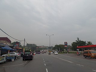
Federal Route 50, or Jalan Batu Pahat–Kluang–Mersing, is a main federal road in Johor, Malaysia. The road connects Batu Pahat in the west to Jemaluang in the east. It is also a main route to North-South Expressway Southern Route via Ayer Hitam Interchange.
Ayer Hitam, nicknamed Bandar Seramik, is a town in Batu Pahat District, Johor, Malaysia. Located just at the junction of Federal Route 1 and Federal Route 50, it is known for its many outlets selling pottery and other crafts. It also is one of the interchange for North–South Expressway.
Federal Route 96, or Jalan Simpang Renggam–Benut, is a main federal road in Johor, Malaysia. The road connects the town of Simpang Renggam to Benut in Johor. The road is also a main route to North–South Expressway Southern Route via Simpang Renggam Interchange.
Federal Route 91, or Jalan Kluang-Kota Tinggi, is the main federal road in Johor, Malaysia. It connects Kluang to Kota Tinggi.
Jalan Bekok is a major road in Johor, Malaysia. It connects Chaah in Segamat District to Paloh in Kluang District.
Jalan Tanjung Sedili, Federal Route, is a federal road in Johor, Malaysia. It is also a main route to Teluk Mahkota. The Kilometre Zero of the Federal Route 212 starts at Tanjung Sedili.
Jalan Kluang–Renggam or Jalan Mengkibol is a major road in Johor, Malaysia.
Jalan Besar, Kluang, or Kluang Middle Ring Road, Federal Route 173, is a federal road in Kluang town, Johor, Malaysia.
Jalan Padang Tembak, Kluang, Federal Route 184, is a federal road in Johor, Malaysia. The road was a part of Johor State Route 16 before being recommissioned as a federal road. The Kilometre Zero of the Federal Route 184 starts at Kampung Serong junctions.
Jalan Sedili Kechil, Federal Route, is a federal road in Johor, Malaysia. It is also a main route to Teluk Mahkota and Tanjung Balau. The Kilometre Zero of the Federal Route 213 starts at Tanjung Sedili.
The Iskandar Coastal Highway (ICH) (formerly Johor Bahru West Coast Parkway) (Malay: Lebuhraya Pesisir Pantai Iskandar (LPPI)) or the stretch of road that includes Lebuhraya Sultan Iskandar, Persiaran Sultan Abu Bakar (formerly Jalan Skudai, Jalan Abu Bakar) and Persiaran Sultan Ismail (formerly Jalan Ibrahim and Persiaran Tun Sri Lanang) (Federal Route 52 (Iskandar Puteri–Danga Bay) and Johor State Route 1 (Danga Bay–City Centre)) is a highway in Johor Bahru District, Johor, Malaysia. The 23 km (14 mi) highway connects Iskandar Puteri in the west to Johor Bahru in the east. It is a toll free highway and part of the Iskandar Malaysia project. The Iskandar Coastal Highway is the fifth east–west-oriented expressway in the Iskandar Malaysia area after the Pasir Gudang Highway, the Pontian–Johor Bahru Link of the Second Link Expressway, the Senai–Desaru Expressway and the Johor Bahru East Coast Highway.
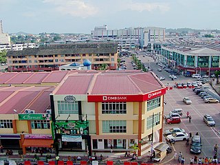
Kluang, formerly Keluang, is a town in Kluang District, Johor, Malaysia. Kluang was founded in 1915 as the administrative capital of central Johor by the British. It is located in the centre of the state and is within 90 minutes of all major urban areas of Johor. Kluang, combined with Batu Pahat, encompasses central Johor with a market catchment of over 700,000. Over the 20th century, Kluang's economy transitioned from rubber to palm oil and now has some of Malaysia's largest organic farms. The industrial sector has also grown significantly with multinational investment and a critical mass of tile manufacturers enabling the district to be called the 'tile capital of Malaysia'. The organic farming sector has also boosted Kluang as an ecotourism destination with key farms such as Zenxin, UK Agro and Kahang Organic Rice Farm.

