
Ipoh is the capital city of the Malaysian state of Perak. Located by the Kinta River, it is nearly 180 km (110 mi) north of Kuala Lumpur and 123 km (76 mi) southeast of George Town in neighbouring Penang. As of 2010, Ipoh had a population of 657,892, making it the fourth largest city in Malaysia by population.

James Wheeler Woodford Birch, commonly known as J. W. W. Birch was a British colonial official who was assassinated in the Malay state of Perak in 1875, an event that led to the outbreak of the Perak War and ultimately to the extension of British political influence over the Malay Peninsula.
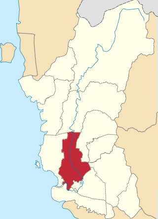
Teluk Intan is a town in Hilir Perak District, Perak, Malaysia. It is the district capital and largest town in Hilir Perak district and fourth largest town in the state of Perak with an estimated population of around 172,505, more than half of Hilir Perak district's total population (232,900).
Perak Tengah District is a district in Perak, Malaysia. It is administered by the Perak Tengah District Council, which is based at the town of Seri Iskandar; Parit is however the largest settlement in the area.
The Federal Route 1 is the first federal road in Malaysia, the oldest federal road in Malaysia, and among the nation's earliest public roadways ever constructed. The Federal Route 1 was the backbone of the road system in the western states of Peninsular Malaysia before being supplanted by the North–South Expressway.
Federal Route 3 is a main federal road running along the east coast of Peninsula Malaysia. The 739 kilometres (459 mi) federal highway connects Rantau Panjang in Kelantan until Johor Bahru in Johor. The entire FT3 highway is gazetted as a part of the Asian Highway Network route 18.
Federal Route 4 is a federal road in the north of Peninsula Malaysia. The 307 kilometres (191 mi) road connects Butterworth, Penang to Pasir Puteh in Kelantan. The highway also goes close to the border with Thailand and meets Jalan Kompleks CIQ Bukit Bunga at Bukit Bunga.

Federal Route 54, or Jalan Kuala Selangor–Kepong or Jalan Kepong in Kuala Lumpur side, is a main federal road in Selangor, Malaysia. The road connects Asam Jawa near Kuala Selangor to Kepong near Kuala Lumpur. It is a main route to Kuala Lumpur from Federal Route 5. Federal Route 54 became the backbone of the road system linking Kuala Selangor to Kuala Lumpur before being surpassed by the Kuala Lumpur–Kuala Selangor Expressway E25 in 2011.
Second East–West Highway, also known as Simpang Pulai–Kuala Berang Highway, Federal Route 185 and Federal Route 36, is a highway in Peninsular Malaysia which connects Simpang Pulai in Perak to Kuala Jeneris in Terengganu. It overlaps with Federal Route 8 Federal Route 8 between Gua Musang and Sungai Relau. It is notorious for its many sharp corners which increase the risk of road accidents.

The Perak River is the second longest river in Peninsular Malaysia after Pahang River in Pahang, Malaysia. A number of towns are on the banks of the river including the royal town of Kuala Kangsar. Most of the settlements in what is today Perak were situated near the river until the 19th century, when tin deposits were discovered elsewhere, most notably Ipoh. The source of Perak River is in the Perak–Kelantan–Thailand border tripoint near the Royal Belum State Park, in the Titiwangsa Mountains. To be exact, the confluence of Machang River and Merah River, deep in the remoted area of Royal Belum State Park. The Machang River originated from Titiwangsa Range along the Perak – Kelantan border and Merah River from the upper stream of Bang Lang National Park, Thailand. The confluence of these rivers joined together and made up the headwater of Perak River. Some of the branches of the river are the Bidor River and the Kinta River. The Temenggor Dam has created a large man-made lake at Banding near Grik.

The Bandar Baharu District is a town, district and state assembly constituency at the southernmost end of Kedah, Malaysia. Bandar Baharu is located along the Kedah-Penang–Perak border tripoint, 37 km (23 mi) southeast of George Town, Penang's capital city.
Ipoh–Lumut Highway, Federal Route 5, is a 70.7-km federal highway in Perak, Malaysia, connecting the Perakian capital city of Ipoh in the east to Lumut near Sitiawan in the west. The Ipoh–Lumut Highway consists of a 22.7-km super two highway from Jelapang to Seputeh and a 48-km divided highway from Seputeh to Lumut. This highway is a part of the Federal Route 5 and serves as the final section of the FT5 route.
Federal Route 136 is a federal road in Kedah and Perak state, Malaysia. The roads connects Kuala Ketil, Kedah in the north until Parit Buntar, Perak in the south. This road used to be 121.331 km long, but now it is only 84 km. The Malaysian Public Works Department (JKR) Kedah cut some corners because it is very dangerous, The corners is located near the Sungai Ular bridge. Kilometre Zero of the Federal Route 136 starts at Kuala Ketil, Kedah.
Jalan Bota Kiri is a major road in Perak, Malaysia. It is also a main route to Pasir Salak Historical Complex in Pasir Salak.

The Malaysian Expressway System is a network of national controlled-access expressways in Malaysia that forms the primary backbone network of Malaysian national highways. The network begins with the Tanjung Malim–Slim River tolled road which was opened to traffic on 16 March 1966, later North–South Expressway (NSE), and is being substantially developed. Malaysian expressways are built by private companies under the supervision of the government highway authority, Malaysian Highway Authority.
The Iskandar Coastal Highway (ICH) (formerly Johor Bahru West Coast Parkway) (Malay: Lebuhraya Pesisir Pantai Iskandar (LPPI)) or the stretch of road that includes Lebuhraya Sultan Iskandar, Persiaran Sultan Abu Bakar (formerly Jalan Skudai, Jalan Abu Bakar) and Persiaran Sultan Ismail (formerly Jalan Ibrahim and Persiaran Tun Sri Lanang) (Federal Route 52 (Iskandar Puteri–Danga Bay) and Johor State Route 1 (Danga Bay–City Centre)) is a highway in Johor Bahru District, Johor, Malaysia. The 23 km (14 mi) highway connects Iskandar Puteri in the west to Johor Bahru in the east. It is a toll free highway and part of the Iskandar Malaysia project. The Iskandar Coastal Highway is the fifth east–west-oriented expressway in the Iskandar Malaysia area after the Pasir Gudang Highway, the Pontian–Johor Bahru Link of the Second Link Expressway, the Senai–Desaru Expressway and the Johor Bahru East Coast Highway.
Jalan Bukit Changgang, or Jalan Perak Kanan, Federal Route 248, is a federal road in Selangor, Malaysia. The Kilometre Zero is at Kampung Bukit Changgang.
Bidor Bypass, Federal Route 321 is a federal road bypass in Bidor, Perak, Malaysia linking Pekan Pasir at Federal Route 1 to Jeram Mengkuang at Federal Route 58. The road also act as an bypass for Bidor town.

Pasir Mas District is a district (jajahan) in Kelantan, Malaysia. The district covers an area of 614.15 square kilometers and is bordered by the districts of Tumpat District to the north, Tanah Merah District to the south, Kota Bharu District to the east, and the Thai district of Su-ngai Kolok to the west.

