The North–South Expressway is a network of tolled controlled-access highways running through the west coast of Peninsular Malaysia. The expressway network consists of the northern route and southern route, having a total length of 772 kilometres. Running through seven states and connecting the Thailand and Singapore borders, the North–South Expressway is an important thoroughfare for local, interstate and international traffic. The expressway is part of route AH2, a designation of the Asian Highway Network.

Johor Bahru Inner Ring Road, (JBIRR) or Jalan Lingkaran Dalam, Federal Route 188, is a multi-lane federal ring road highway that circles the Johor Bahru Central District in Johor, Malaysia. The 4.6-kilometre (2.9 mi) highway was the most expensive road infrastructure project per kilometre of its time in the country.
North Klang Straits Bypass, Federal Route 20, AH 141, is the main highway bypass to Port Klang in Klang, Selangor, Malaysia. Federal Route 20 became the backbone of the road system linking Sungai Rasau to Port Klang before being surpassed by the New North Klang Straits Bypass 30. Many cargo trucks travel along the highway daily.
The Federal Route 1 is the first federal road in Malaysia, the oldest federal road in Malaysia, and among the nation's earliest public roadways ever constructed. The Federal Route 1 was the backbone of the road system in the western states of Peninsular Malaysia before being supplanted by the North–South Expressway.
The Federal Route 2 is a major east–west oriented federal highway in Malaysia. The 276.9 kilometres (172 mi) road connects Port Klang in Selangor to Kuantan Port in Pahang. The Federal Route 2 became the backbone of the road system linking the east and west coasts of Peninsula Malaysia before being surpassed by the East Coast Expressway E8.
Federal Route 5 is one of the three north–south oriented backbone federal road running along the west coast of Peninsular Malaysia, Malaysia. The 655.85 kilometres (408 mi) federal highway runs from Jelapang, Perak in the north to Skudai, Johor in the south.

Federal Route 23, or Jalan Muar–Tangkak–Segamat, is a federal road in Johor, Malaysia, connecting Segamat in the north and Parit Bunga in the south. It is also a main route to North–South Expressway Southern Route via Tangkak Interchange.
Federal Route 24, or Jalan Muar–Yong Peng, is a federal road in Johor, Malaysia. The roads connects Muar in the west to Yong Peng in the east. It is also a main route to North-South Expressway via Yong Peng Interchange.

The Sultan Ismail Bridge is a bridge in Muar town across the Muar River in Johor, Malaysia. It was the first bridge built across a river that connects Bandar Maharani, Muar to Tanjung Agas which is now named as part of Tangkak district. The bridge replaced old ferry services in the 1960s. The bridge was originally a toll bridge making the second toll bridge in Malaysia after Sultan Yahya Petra Bridge in Kelantan.

Muar Second Bridge is a famous landmark in Muar, Johor, Malaysia. It crosses the Muar River.

Pan Borneo Highway, also known as Trans-Borneo Highway or Trans-Kalimantan Highway, is a road network on Borneo Island connecting two Malaysian states, Sabah and Sarawak, with Brunei and Kalimantan region in Indonesia. The highway is numbered AH150 in the Asian Highway Network and as Federal Route 1 in Sarawak. In Sabah, the route numbers given are 1, 13 and 22. The highway is a joint project between both governments which started as soon as the formation of Malaysia in 1963 which comprised Malaya, Sabah, Sarawak and Singapore. The lack of a road network system in Sarawak was the main factor of the construction.
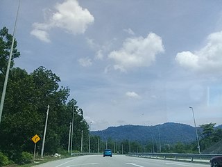
The West Coast Expressway (E32) is an interstate controlled-access highway running along the west coast of Peninsular Malaysia. The 233-kilometre (145-mile) expressway is currently under construction, with several sections open for public use. Once completed, the expressway will run between Changkat Jering, Perak and Banting, Selangor, following federal routes 5 and 60 for most of its route. The expressway will operate in three sections, with sections of federal route 5 completing the missing connections; these sections will be upgraded to limited-access roads. The expressway is expected to be fully completed by the end of 2024, except for a 10 km stretch from Section 7B which is expected to be completed by June 2026.
Jalan Tampoi, Federal Route 3374, is a dual carriageway industrial federal roads in Johor Bahru, Johor, Malaysia. Before Pasir Gudang Highway was built, Jalan Tampoi became the main road to Pasir Gudang together with Jalan Masai Lama.

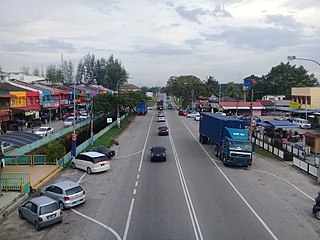
Jalan Muar–Labis is a major road in Johor, Malaysia. It is the longest state road in Johor with the total distance of 87 km (54 mi). It connects the town of Bukit Trehin Muar to Labis via the Muar Bypass. It is also a main route to North–South Expressway Southern Route via Pagoh Interchange.

Sungai Buloh Highway or Jalan Sungai Buloh, Federal Route 54, is a major highway in Klang Valley region, Selangor state, Malaysia. The highway has now been upgraded into six-lane carriageway on 22 June 2007.
Lebuhraya Alor Gajah–Melaka Tengah–Jasin , or popularly known as Lebuh AMJ(Alor Gajah–Central Malacca –Jasin), Federal Routes 19 and 5 is a divided highway across Malacca state, Malaysia.

Muar or Bandar Maharani, is a historical town and the capital of Muar District, Johor, Malaysia. It is one of the most popular tourist attractions in Malaysia to be visited and explored for its food, coffee and historical prewar buildings. It was recently declared as the royal town of Johor by Sultan Ibrahim Sultan Iskandar and is the fourth largest urban area in Johor. It is the main and biggest town of the bigger entity region or area of the same name, Muar which is sub-divided into the Muar district and the new Tangkak district, which was upgraded into a full-fledged district from the Tangkak sub-district earlier. Muar district as the only district covering the whole area formerly borders Malacca in the northern part. Upon the upgrading of Tangkak district, the Muar district now covers only the area south of Sungai Muar, whilst the northern area beyond the river is in within Tangkak district. However, both divided administrative districts are still collectively and fondly called and referred to as the region or area of Muar as a whole by their residents and outsiders. Currently, the new township of Muar is located in the Bakri area.

The Malaysian Expressway System is a network of national controlled-access expressways in Malaysia that forms the primary backbone network of Malaysian national highways. The network begins with the Tanjung Malim–Slim River tolled road which was opened to traffic on 16 March 1966, later North–South Expressway (NSE), and is being substantially developed. Malaysian expressways are built by private companies under the supervision of the government highway authority, Malaysian Highway Authority.
The Iskandar Coastal Highway (ICH) (formerly Johor Bahru West Coast Parkway) (Malay: Lebuhraya Pesisir Pantai Iskandar (LPPI)) or the stretch of road that includes Lebuhraya Sultan Iskandar, Persiaran Sultan Abu Bakar (formerly Jalan Skudai, Jalan Abu Bakar) and Persiaran Sultan Ismail (formerly Jalan Ibrahim and Persiaran Tun Sri Lanang) (Federal Route 52 (Iskandar Puteri–Danga Bay) and Johor State Route 1 (Danga Bay–City Centre)) is a highway in Johor Bahru District, Johor, Malaysia. The 23 km (14 mi) highway connects Iskandar Puteri in the west to Johor Bahru in the east. It is a toll free highway and part of the Iskandar Malaysia project. The Iskandar Coastal Highway is the fifth east–west-oriented expressway in the Iskandar Malaysia area after the Pasir Gudang Highway, the Pontian–Johor Bahru Link of the Second Link Expressway, the Senai–Desaru Expressway and the Johor Bahru East Coast Highway.
Rawang Bypass, Federal Route 37 also known as Rawang–Serendah Highway, is a federally-funded divided highway bypass in Rawang, Selangor, Malaysia. The 10-km highway was opened to traffic on 28 November 2017 at 9.00 pm. Construction of the RM628mil Rawang Bypass began on 16 July 2005 and was completed on 21 November 2017. It features a 2.7-km elevated viaduct with its highest pillar of 58.2 meters.


