Kuala Lumpur International Airport (KLIA) is the main international airport serving Kuala Lumpur, the capital of Malaysia. It is located in the Sepang District of Selangor, approximately 45 km (28 mi) south of downtown Kuala Lumpur and serves the city's greater conurbation.

The Sepang District is a district located in the southern part of the state of Selangor in Malaysia. Sepang District covers an area of around 600 square kilometers, and had an estimated population of 338,600 in 2023.

Malaysian Federal Roads System, is the main national road network in Malaysia. All Federal Roads in Malaysia are under the purview of the Ministry of Works (MOW). According to the Ministerial Functions Act 1969, the MOW is responsible to plan, build and maintain all Federal Roads gazetted under the Federal Roads Act 1959. However, most of the Federal roads' projects were built and maintained by the Malaysian Public Works Department (JKR), which is also one of the implementing agencies under the MOW.

KLIA Expressway, E6 and Federal Route 26, is an expressway in Sepang, Selangor, Malaysia. It serves as the main access road to Kuala Lumpur International Airport (KLIA), as well as the nearby Sepang International Circuit and Bandar Enstek.

Putrajaya–Cyberjaya Expressway, Federal Route 29, is a major expressway in Klang Valley, Malaysia. The 21.2 km (13.2 mi) expressway connects Serdang interchange on Damansara–Puchong Expressway to Kuala Lumpur International Airport (KLIA) in Sepang. It was named after the two sides of the MSC cities, Putrajaya and Cyberjaya.
The Federal Route 2 is a major east–west oriented federal highway in Malaysia. The 276.9 kilometres (172 mi) road connects Port Klang in Selangor to Kuantan Port in Pahang. The Federal Route 2 became the backbone of the road system linking the east and west coasts of Peninsula Malaysia before being surpassed by the East Coast Expressway E8.

KLIA Outer Ring Road(KLIAORR), or Jalan Pekeliling, Federal Route 27, is the second highway and ring road along Kuala Lumpur International Airport (KLIA) after KLIA Expressway (Federal Route 26) in Malaysia. During Formula One Petronas Malaysian Grand Prix championship every year it becomes the main route to Sepang F1 Circuit. From 1 March 2006 until 9 May 2014 it became a main road to Low Cost Carrier Terminal (LCCT).

Salak Tinggi is a town in Sepang District, Selangor, Malaysia. Located about 9 km north of the Kuala Lumpur International Airport, it is the seat of the Sepang district's administration.
The Seremban–Bandar Baru Enstek Highway, also known as KLIA Linkage and Jalan Sungai Ujong, designated as Federal Route 195, is a major highway in Negeri Sembilan, Malaysia which connects Seremban to Bandar Enstek. It is also a main route to the North–South Expressway Southern Route via Seremban Interchange, as well as providing a direct connection between the city with the Kuala Lumpur International Airport.
Transport in Greater Kuala Lumpur includes a road network, a railway network, airports, and other modes of public transport. Greater Kuala Lumpur is conterminous with the Klang Valley, an urban conglomeration consisting of the city of Kuala Lumpur, as well as surrounding towns and cities in the state of Selangor. The Klang Valley has the country's largest airport, the Kuala Lumpur International Airport (KLIA), as well as the country's largest intermodal transport hub and railway station, Kuala Lumpur Sentral.

The University of Kuala Lumpur is a multi-campus technical university with its main campus based in Kuala Lumpur, Malaysia. Rated as a Tier-5 "Excellent University" by the Ministry of Higher Education Malaysia in 2009, 2011, 2013 and awarded Putra Brand Award in 2016. UniKL has 14 institutes spread across 12 campuses throughout Malaysia in Kuala Lumpur, Gombak, Cheras, Bangi, Kajang, Sepang, Taboh Naning, Pasir Gudang, Ipoh, Lumut and Kulim.

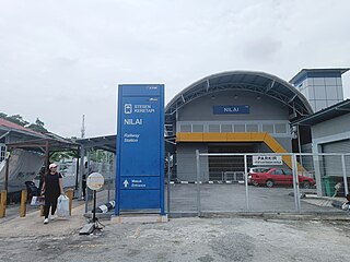
Nilai Komuter station is a KTM Komuter train station, situated close to and named after the old town of Nilai, Negeri Sembilan. The station strictly serves as a two-platform train halt for the Seremban Line KTM Komuter train service. This used to be a stop for the KTM ETS service when the line was extended to Gemas in 2015.
The city of Seremban, Negeri Sembilan, Malaysia is linked by rail from KTMB's Seremban station to Kuala Lumpur, Singapore and the coastal town of Port Dickson, and has a commuter rail network. It lacks its own airport and is served by the nearby Kuala Lumpur International Airport. Local and longer-distance bus services use a bus station at Terminal 1 Bus Terminal and Shopping Centre, Negeri Sembilan's primary transportation hub. Major roads include Federal Route 1, Federal Route 51, Federal Route 86, Federal Route 366, North–South Expressway Southern Route (E2), Kajang-Seremban Highway (E21), Seremban-Port Dickson Highway (E29), and the Seremban Inner Ring Road (SIRR). The major streets in the city have been renamed since colonial days.

Jalan KLIA 1, Federal Route 182, is the third highway in Kuala Lumpur International Airport (KLIA), Malaysia. It is a main route to KLIA Charter Field Town or KLIA Town Centre. The Kilometre Zero is located at Nilai-KLIA Highway junctions.
Jalan Pekeliling 4, Federal Route 343, is a federal road in the Kuala Lumpur International Airport (KLIA), Malaysia.

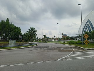
Jalan Masjid KLIA, Federal Route 341, is an institutional facilities federal road in Kuala Lumpur International Airport (KLIA) in Malaysia.

The Malaysian Expressway System is a network of national controlled-access expressways in Malaysia that forms the primary backbone network of Malaysian national highways. The network begins with the Tanjung Malim–Slim River tolled road which was opened to traffic on 16 March 1966, later North–South Expressway (NSE), and is being substantially developed. Malaysian toll road-expressways are built by private companies under the supervision of the government highway authority, Malaysian Highway Authority. While toll-free expressways are built by Malaysian Public Works Department or Jabatan Kerja Raya Malaysia (JKR) in Malay.
Jalan Pekeliling 3, Federal Route 342, is a federal road in the Kuala Lumpur International Airport (KLIA), Malaysia.
Labohan Dagang–Nilai Route, also known as Nilai–KLIA Highway, Federal Route 32, is a major highway in the Multimedia Super Corridor area in Selangor and Negeri Sembilan states, Malaysia. The 26.0 km (16.2 mi) federal highway connects Tanjung Dua Belas, Selangor in the west to Nilai, Negeri Sembilan in the east.
The following is an alphabetical list of articles related to Selangor.


