
Kudat is the capital of the Kudat District in the Kudat Division of Sabah, Malaysia. Its population was estimated to be around 29,025 in 2010. It is located on the Kudat Peninsula, about 190 kilometres (120 mi) north of Kota Kinabalu, the state capital, and is near the northernmost point of Borneo. It is the largest town in the heartland of the Rungus people which is a sub-ethnic group of the majority Kadazan-Dusun race and is therefore a major centre of Rungus culture. It is also notable for being one of the first parts of Sabah to be settled by Chinese Malaysians, particularly from the Hakka dialect group. It is the Northernmost Malaysian city.

Malaysian Federal Roads System, is the main national road network in Malaysia. All Federal Roads in Malaysia are under the purview of the Ministry of Works (MOW). According to the Ministerial Functions Act 1969, the MOW is responsible to plan, build and maintain all Federal Roads gazetted under the Federal Roads Act 1959. However, most of the Federal roads' projects were built and maintained by the Malaysian Public Works Department (JKR), which is also one of the implementing agencies under the MOW.
The Federal Route 1 is the first federal road in Malaysia, and also the oldest federal road in Malaysia, as well as among the nation's earliest public roadways ever constructed. The Federal Route 1 was the backbone of the road system in the western states of Peninsular Malaysia before being supplanted by the North–South Expressway.
The Federal Route 2 is a major east–west oriented federal highway in Malaysia. The 276.9 kilometres (172 mi) road connects Port Klang in Selangor to Kuantan Port in Pahang. The Federal Route 2 became the backbone of the road system linking the east and west coasts of Peninsula Malaysia before being surpassed by the East Coast Expressway E8.
Johor Bahru–Kota Tinggi Highway, Federal Route 3, also known as Tebrau Highway and Jalan Kota Tinggi is a highway that encompasses Federal Route 3 in Johor Bahru, Malaysia. Part of Asian Highway Route AH18, the highway stretches from its southern end at Jalan Wong Ah Fook and Jalan Tun Abdul Razak in the metropolitan area of Johor Bahru to the northern end at the underpass flyover with North–South Expressway Southern Route and Johor Bahru Eastern Dispersal Link Expressway around Pandan. The stretch of Tebrau Highway after this continues as Jalan Pandan and Jalan Kota Tinggi respectively, beyond Pandan. The highway became the backbone of the Johor Bahru road system linking Pandan to city centre, and to the Johor–Singapore Causeway, before being surpassed by the Johor Bahru Eastern Dispersal Link Expressway in 2012.
Federal Route 3 is a main federal road running along the east coast of Peninsula Malaysia. The 739 kilometres (459 mi) federal highway connects Rantau Panjang in Kelantan until Johor Bahru in Johor. The entire FT3 highway is gazetted as a part of the Asian Highway Network route 18.
Federal Route 5 is one of the three north–south oriented backbone federal road running along the west coast of Peninsular Malaysia, Malaysia. The 655.85 kilometres (408 mi) federal highway runs from Jelapang, Perak in the north to Skudai, Johor in the south.
Federal Route 92, also known as Pengerang Highway, is a federal highway that runs from Kota Tinggi to Sungai Rengit in Johor, Malaysia. The 66.8 km (41.5 mi) highway is also a main route to Desaru beach. Federal Route 92 became the backbone of the road system linking the southeastern Johor before being surpassed by the Senai–Desaru Expressway E22.
Federal Route 94, or Jalan Kulai-Kota Tinggi, is the main federal road in Johor, Malaysia. It connects Kulai to Kota Tinggi.
Federal Route 74, or Jalan Taiping–Kuala Sepetang, is a federal road in Perak, Malaysia. The 17.1 km (10.6 mi) roads connects Taiping to Kuala Sepetang. The road was built at the site of the first railway line in Malaysia from Taiping to Port Weld in 1885.

Pan Borneo Highway, also known as Trans-Borneo Highway or Trans-Kalimantan Highway, is a road network on Borneo Island connecting two Malaysian states, Sabah and Sarawak, with Brunei and Kalimantan region in Indonesia. The highway is numbered AH150 in the Asian Highway Network and as Federal Route 1 in Sarawak. In Sabah, the route numbers given are 1, 13 and 22. The highway is a joint project between both governments which started as soon as the formation of Malaysia in 1963 which comprised Malaya, Sabah, Sarawak and Singapore. The lack of a road network system in Sarawak was the main factor of the construction.
The Federal Route 8, also known as the Kuala Lumpur–Kota Bharu Highway, is a 402.7-km federal highway in Malaysia. It connects Bentong in the south to Kota Bharu in the north. The highway had two parts - Kota Bharu–Kuala Krai Road and Bentong–Kuala Lipis Road until the completion of the missing link from Kuala Krai to Kuala Lipis, causing the entire FT8 highway to take 99 years to be completed.

Menggatal or Manggatal is a Malaysian town and suburb of Kota Kinabalu District on the west coast of Sabah. It is an outskirt of the state capital, Kota Kinabalu, and is under the jurisdiction of Kota Kinabalu City Hall. It is located along Jalan Tuaran, which is the main road leading north from Kota Kinabalu city centre.
Federal Route 190, consisting of Jalan Kota Raja, Jalan Sungai Kandis and Jalan Bukit Kemuning, is a federal road in Klang Valley region, Selangor, Malaysia. It is also a main route to Klang from Puchong, Kota Kemuning and Bukit Rimau.
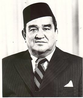
Muhammad Fuad Stephens, was a Malaysian politician who served as the 1st and 5th Chief Minister of Sabah from September 1963 to December 1964 and again briefly from April 1976 to his death in June 1976, 3rd Yang di-Pertua Negara of Sabah from September 1973 to July 1975, 6th High Commissioner of Malaysia to Australia from 1968 to 1973. In addition, he also served as the 1st Huguan Siou or Paramount Leader of the Kadazandusun community. He played a role in bringing Sabah into the Federation of Malaysia in 1963. While he was initially against the idea of Sabah joining in the Federation, given British concerns about the stability of the region and their move to relinquish all their colonies in the post WWII era, he was gradually convinced to work towards it. He held the chief minister's post from 16 September 1963 until 31 December 1964 when he was forced to resign; and again in 1976 for 54 days from 15 April.
Federal Route 91, or Jalan Kluang-Kota Tinggi, is the main federal road in Johor, Malaysia. It connects Kluang to Kota Tinggi.

Federal Route 22, Asian Highway Route AH150, is a 310-kilometre (193 mi) federal highway in Sabah, Malaysia, which is also a component of the larger Pan Borneo Highway network. It starts from Tamparuli and ends at Sandakan. The section running from Tamparuli to Ranau, which is known as Tamparuli-Ranau Highway, crosses the Crocker Range just to the south of Mount Kinabalu.
The Iskandar Coastal Highway (ICH) or the stretch of road that includes Lebuhraya Sultan Iskandar, Persiaran Sultan Abu Bakar and Persiaran Sultan Ismail is a highway in Johor Bahru District, Johor, Malaysia. The 23 km (14 mi) highway connects Iskandar Puteri in the west to Johor Bahru in the east. It is a toll free highway and part of the Iskandar Malaysia project. The Iskandar Coastal Highway is the fifth east–west-oriented expressway in the Iskandar Malaysia area after the Pasir Gudang Highway, the Pontian–Johor Bahru Link of the Second Link Expressway, the Senai–Desaru Expressway and the Johor Bahru East Coast Highway.
The Sabah section of the Federal Route 1, Asian Highway Route AH150, is a 428-km federal highway in Sabah, Malaysia, which is also a component of the larger Pan Borneo Highway network. The route was formed in 1996 during the merging of two former routes A1 and A2. The merging of the former routes formed an alternate route of Route 1 within the city of Kota Kinabalu. However, most maps still use the older route numbering scheme by referring to the northern section as A1 and the southern section as A2.
Federal Route 500 is a 163-kilometre (101 mi) federal highway in Sabah, Malaysia, connecting Kota Kinabalu to Tenom. It serves as the main highway from Kota Kinabalu to towns and villages in the Interior Division of Sabah. Federal Route 500 is one of the five highways in Sabah crossing the Crocker Range; the Tamparuli-Ranau Highway, Kimanis-Keningau Highway and Jalan Tenom-Sipitang are the other three and the new highway, Interior North–South Highway.

