
Kajang is a town in Hulu Langat District, Selangor, Malaysia, located southeast of Kuala Lumpur. Kajang, along with much of Hulu Langat District, is governed by the Kajang Municipal Council. Kajang town is located on the eastern banks of the Langat River. It is surrounded by Cheras, Semenyih, Bangi, Putrajaya and Serdang.
Ulu Tiram is a suburb in Johor Bahru, Johor, Malaysia. The town lies along the Tebrau Highway, a section of Malaysia Federal Route 3, a major trunk road on Peninsular Malaysia's east coast that connects Ulu Tiram with major towns and cities such as Mersing, Kuantan and Kota Bharu.

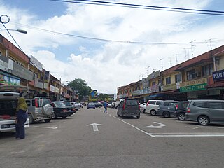
Bahau is the principal town of Jempol District, Negeri Sembilan, Malaysia.

The North–South Expressway Northern Route is an interstate controlled-access highway running parallel to the northwestern coast of Peninsular Malaysia. The 460-kilometre (290-mile) expressway forms the north section of the North–South Expressway, passing through the northwestern states of Kedah, Penang, Perak and Selangor. The expressway begins at the Bukit Kayu Hitam checkpoint in Kedah, where the Malaysia–Thailand border lies, and ends at Bukit Lanjan in Selangor state where the expressway interchanges with the New Klang Valley Expressway. The expressway is operated by PLUS Expressways.
North Klang Straits Bypass, Federal Route 20, AH 141, is the main highway bypass to Port Klang in Klang, Selangor, Malaysia. Federal Route 20 became the backbone of the road system linking Sungai Rasau to Port Klang before being surpassed by the New North Klang Straits Bypass 30. Many cargo trucks travel along the highway daily.

Federal Route 54, or Jalan Kuala Selangor–Kepong or Jalan Kepong in Kuala Lumpur side, is a main federal road in Selangor, Malaysia. The road connects Asam Jawa near Kuala Selangor to Kepong near Kuala Lumpur. It is a main route to Kuala Lumpur from Federal Route 5. Federal Route 54 became the backbone of the road system linking Kuala Selangor to Kuala Lumpur before being surpassed by the Kuala Lumpur–Kuala Selangor Expressway E25 in 2011.

Sungai Buloh, or Sungei Buloh, is a town, a mukim (commune) and a parliamentary constituency in the northern part of Petaling District, Selangor, Malaysia. The name itself means bamboo river in the Malay language. It is located 16 km NW of downtown Kuala Lumpur and 8 km north of the Subang Airport, along the Kuala Selangor highway.
Federal Route 68, also known as Jalan Gombak or Jalan Karak Lama, is a federal road in Malaysia that links the city of Kuala Lumpur to Bentong, Pahang. Before Kuala Lumpur–Karak Expressway E8/FT2 was built, the road was used to be a part of Kuala Lumpur–Kuantan Road FT2; however, due to its sharp corners, narrow roadway and lack of safety features, a replacement highway known as the Kuala Lumpur–Karak Highway FT2 was built, causing the former Kuala Lumpur–Bentong section to be re-gazetted as the Federal Route 68.

Segambut is a sub-district in Kuala Lumpur, Malaysia. The federal constituency represented in the Dewan Rakyat is Segambut.
Federal Route 66 is a federal road in Kelantan, Malaysia, linking the town of Jeli to the village of Kampung Bukit Tebok to Manek Urai.

Paya Jaras is a town in Selangor, Malaysia. The first village head to open the village of Paya Jaras was Baie bin Duawan, of Malay descent from Padang, Indonesia who came to Malaysia around the early 20s. Remembering his sacrifice and service, one road bears his name, Haji Baie Road, located in Kampung Paya Jaras Hulu which consists of four villages: Kampung Paya Jaras Dalam, Kampung Paya Jaras Tengah, Kampung Paya Jaras Hulu and Kampung Paya Jaras Hilir.
Federal Route 63 is a federal road in Pahang, Malaysia, linking the town of Bukit Ibam and Bandar Muadzam Shah to the town of Bandar Baru Rompin. The road was built at the site of a defunct light railway track from Bukit Ibam to Kuala Rompin.

Pandamaran is a town and a state constituency in Klang District, Selangor, Malaysia. It is adjacent to Port Klang and close to Tengku Ampuan Rahimah Hospital as well as Bandar Bukit Tinggi. Pandamaran is essentially a Chinese New Village area, it is served by excellent road connections and is one of the major industrial zones in the royal town of Klang.
Federal Route 147, or Jalan Bagan Serai–Alor Pongsu–Selama, is a federal road in Perak, Malaysia. The Kilometre Zero of the Federal Route 147 starts at Bagan Serai.

Sungai Lalang is a small town in Kuala Muda District, Kedah, Malaysia. It is located 5 kilometer north from Sungai Petani. Sg. Lalang River situated in this town flows into the Merbok River.
Federal Route 201, or Jalan Nibong-Jakar-Bukit Nangka, is a federal road in Kelantan, Malaysia. The route connects town of Bukit Bunga in the west and Kampung Nibong in the east.

Batu Tiga–Sungai Buloh Highway, Selangor State Route B9, is the main highway in Klang Valley, Malaysia connects from Batu Tiga Interchange in Batu Tiga to Hospital Sungai Buloh in Sungai Buloh. The highway overlaps with a few roads with the same name but different code: Route 15 and Route 3214. At the Politeknik Junction, it extends towards the eastern side of Shah Alam which is the Persiaran Sukan. The Persiaran Sukan is basically a ring road that covers the eastern side of Shah Alam with some one-way road. The highway was upgraded in 2008.

Lingkaran Tengah Utama Expressway, previously known as Central Spine Road (CSR) or Kuala Krai–Kuala Pilah Highway, Federal Route 34, is a new toll-free highway under construction in the center of Peninsular Malaysia. The 325 km (201 miles) highway is built to eventually replace the former two-lane Malaysia Federal Route 8 (Gua Musang Highway) and Malaysia Federal Route 9 (Karak–Tampin highway). Construction of CSR starts at Package 3 which is from Merapoh to Kampung Relong. It commences at Package 3 as the Gua Musang Highway passes through Chegar Perah which is prone to roadkill. The highway has a long eco-viaduct built in this section. Package 5 which is from north Raub to Karak will be built next, which will connect it to E8 Kuala Lumpur–Karak Expressway bypassing Bentong and Mempaga. This will help detour traffic from the steep mountainous grade between Raub and Bentong. It was formerly known as Central Spine Expressway.
Jalan Bukit Changgang, or Jalan Perak Kanan, Federal Route 248, is a federal road in Selangor, Malaysia. The Kilometre Zero is at Kampung Bukit Changgang.
Semambu is a state constituency in Pahang, Malaysia, that has been represented in the Pahang State Legislative Assembly since 2004.

