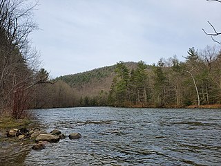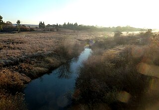
The Godavari is India's second longest river after the Ganga River and drains the third largest basin in India, covering about 10% of India's total geographical area. Its source is in Trimbakeshwar, Nashik, Maharashtra. It flows east for 1,465 kilometres (910 mi), draining the states of Maharashtra (48.6%), Telangana (18.8%), Andhra Pradesh (4.5%), Chhattisgarh (10.9%) and Odisha (5.7%). The river ultimately empties into the Bay of Bengal through an extensive network of distributaries. Its 312,812 km2 (120,777 sq mi) drainage basin is one of the largest in the Indian subcontinent, with only the Ganga and Indus rivers having a larger drainage basin. In terms of length, catchment area and discharge, the Godavari is the largest in peninsular India, and had been dubbed as the Dakshina Ganga.

Cleveland is a land of hills and dales from the River Tees to Vale of Pickering, England. The name means "cliff-land".

The River Tweed, or Tweed Water, Scots: Watter o Tweid, Welsh: Tuedd), is a river 97 miles (156 km) long that flows east across the Border region in Scotland and northern England. Tweed cloth derives its name from its association with the River Tweed. The Tweed is one of the great salmon rivers of Britain and the only river in England where an Environment Agency rod licence is not required for angling. The river generates a large income for the local borders region, attracting anglers from all around the world.

Lostwithiel is a civil parish and small town in Cornwall, England, United Kingdom at the head of the estuary of the River Fowey. According to the 2001 census it had a population of 2,739, increasing to 2,899 at the 2011 census. The Lostwithiel electoral ward had a population of 4,639 at the 2011 census. The name Lostwithiel comes from the Cornish "lostwydhyel" which means "tail of a wooded area".

The Housatonic River is a river, approximately 149 miles (240 km) long, in western Massachusetts and western Connecticut in the United States. It flows south to southeast, and drains about 1,950 square miles (5,100 km2) of southwestern Connecticut into Long Island Sound.

The Walloomsac River from the Native American name, Wal-loom-sac is a 16.8-mile-long (27.0 km) tributary of the Hoosic River in the northeastern United States. It rises in southwestern Vermont, in the Green Mountains east of the town of Bennington in Woodford Hollow at the confluence of Bolles Brook and City Stream where it is labeled Walloomsac Brook on maps but is locally known as "The Roaring Branch". The river then flows west toward Bennington and passes the downtown area to the north. For many years this section was intermittent due to the water having been diverted to power mills in town. This divergence gave the name Walloomsac to a portion of the river flowing through town on the present course of South Stream. The combined Walloomsac / South Stream joins the Roaring Branch northwest of town. From here the river flows westward as the Walloomsac River and joins the Hoosic River below Hoosick Falls, New York.

Iritty is a municipality and taluk of Kannur district in Kerala state, India. The town is the main market place for the farmer communities in the surrounding regions. Iritty is at a distance of 20 km (12 mi) from Kannur International Airport and one among five taluks in Kannur district. Iritty is one of the major towns lies between Coorg and Kannur international airport near Mattanur.

Uharte-Arakil is a town and municipality located in the province and autonomous community of Navarre, northern Spain.

Port Alfred is a small town with a population of just under 26,000 in the Eastern Cape province of South Africa. It is situated on the eastern seaboard of the country at the mouth of the Kowie River, almost exactly halfway between the larger cities of Gqeberha and East London and 30 kilometres (19 mi) east of Cannon Rocks.

Yellow Breeches Creek, also known as Callapatscink Creek, Callapatschink Creek or Shawnee Creek is a 56.1-mile-long (90.3 km) tributary of the Susquehanna River in central Pennsylvania, USA. There is no agreed upon explanation for the name Yellow Breeches Creek, which is found in land warrants as early as 1736.

Helderberg refers to a planning district of the City of Cape Town metropolitan municipality, the mountain after which it is named, a wine-producing area in the Western Cape province of South Africa, or a small census area in Somerset West.

The Ammonoosuc River is a 55-mile-long (89 km) river in northwestern New Hampshire in the United States. It is a tributary of the Connecticut River, which flows to Long Island Sound. Ammonoosuc is Abnaki for "small, narrow fishing place".

São Gonçalo do Pará is a municipality in the center-west of the state of Minas Gerais, Brazil. The estimated population in 2020 was 12,597 inhabitants. The total area of the municipality is 265 km2 (102 sq mi) and the elevation is 750 m (2,461 ft). It is located at 129 km (80 mi) from state capital Belo Horizonte. São Gonçalo do Pará is the seat of the regional administration of the Upper São Francisco River.

Temoh Station is a small town in Tapah, Batang Padang District, Perak, Malaysia. Formerly there was a major railway station located here, which Temoh Station got its name. The railway station was closed in 1980. One can go here via the Jalan Temoh from Temoh, 3 km from here.

The Old Connecticut Path was the Native American trail that led westward from the area of Massachusetts Bay to the Connecticut River Valley, the first of the North American trails that led west from the settlements close to the Atlantic seacoast, towards the interior. The earliest colonists of Massachusetts Bay Colony used it, and rendered it wider by driving cattle along it. The old route is still followed, for part of its length, by Massachusetts Route 9 and Massachusetts Route 126.
Jalan Temoh is a major road in Perak, Malaysia.

The Wilge River (iKuthu) is a river in Mpumalanga and Gauteng provinces, South Africa. It is a tributary of the Olifants River.

The Roeliff Jansen Kill is a major tributary to the Hudson River. Roeliff Jansen Kill was the traditional boundary between the Native American Mahican and Wappinger tribes.
Hermaion or Hermaeum (Latin) was a location in ancient Mysia, which formed part of the border between the city-states of Lampsacus and Parium. It was probably the same place as Hermoton, mentioned by Arrian, and may have been the site of a village or town. It was located near Çınardere, Turkey.


