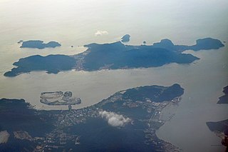
Pangkor Island is an island in Manjung District, Perak, Malaysia. It has a population of approximately 10,000. Nearby islands include Pangkor Laut Island, Giam Island, Mentagor Island, Simpan Island, and Tukun Terindak Island. The major industries of the island are tourism and fishing.

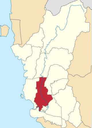
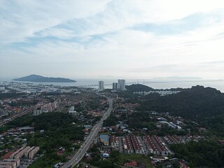
The Manjung District, formerly known as Dindings, is a district in the south-western part of the state of Perak, Malaysia. It is the 26th-most populated district in Malaysia. It is administered by the Manjung Municipal Council, formerly known as Manjung District Council from 1 January 1980 until 31 July 2001. The district is well known for Pangkor Island, an attraction in Perak and the home of the Royal Malaysian Navy (TLDM), Lumut Naval Base and dockyard. Dinding was once part of the British Straits Settlements colony. Seri Manjung is the district's principal urban centre while smaller towns include Lumut town, Sitiawan town, Ayer Tawar, Pantai Remis, Changkat Keruning and Beruas.

Perak Tengah District is a district in Perak, Malaysia. It is administered by the Perak Tengah District Council, which is based at the town of Seri Iskandar. Parit is however the largest settlement in the area. The district is well known for its historical sites in the Pasir Salak. Smaller towns in the district include Bota, Lambor and Kampung Gajah.

Perai is a suburb of Seberang Perai in the Malaysian state of Penang. It lies at the southern bank of the Perai River and borders Butterworth to the north.

Batu Maung is a residential neighbourhood in the Malaysian state of Penang. It is located 15.7 km (9.8 mi) south of the city centre, adjacent to Bayan Lepas and the Penang International Airport. Batu Maung is home to the island terminus of the Second Penang Bridge and the southern end of the Tun Dr Lim Chong Eu Expressway. It is also surrounded by fishing villages such as Permatang Damar Laut and Teluk Tempoyak.

Minyak Beku is a mukim in Batu Pahat District, Johor, Malaysia.

Temenggor Lake is a lake in Hulu Perak District, Perak, Malaysia. It is the second largest lake in Peninsular Malaysia after Kenyir Lake in Hulu Terengganu District, Terengganu. This man-made lake is located south of the 1,533 m high Ulu Titi Basah peak. The lake was created by the construction of Temenggor Dam to generate electric power. The lake is located about 45 km from the Hulu Perak district capital, Gerik. There is a man-made island, Banding Island and Lake Temenggor Bridge on the East-West Highway which crosses the lake.

The Penang National Park spans 1,213ha of land and sea and is used by scientists, researchers, and nature lovers to explore its natural treasures.

Kukup Island is an island in Pontian District, Johor, Malaysia.
Perak Island is a small rocky island which constitutes the westernmost extremity of Malaysian territory. Its diameter is around 200 meters. The island is a sandstone rock that rises from the Strait of Malacca. It has a steep cliff with a height of more than 100m.

Pangkor Laut Island is a small island southwest of Pangkor Island, Perak, Malaysia.
Banding Island is an artificial island within the man-made Lake Temenggor, created by the construction of Temenggor Dam in Perak, Malaysia.
Baik Island is an island located in the Celebes Sea near Lahad Datu area in Sabah, Malaysia.
Bakubang Island is an island located near Lahad Datu in Sabah, Malaysia.
Balak Island is an island located near Banggi Island in the Kudat Division on Sabah, Malaysia.

Asam pedas is a Maritime Southeast Asian sour and spicy fish stew dish. Asam pedas is believed to come from Minangkabau cuisine of West Sumatra, Indonesia and has spread throughout to the islands of Sumatra, Borneo and the Malay Peninsula.

The Bagan Datuk District is the most southwest district in Perak, Malaysia. It covers an area of 951 square kilometres, and had a population about of 70,300. The district is bordered by Perak River which separates Manjung and Central Perak in the north, Bernam River which separates Sabak Bernam in the state of Selangor in the south, Muallim and Hilir Perak in the northeast. The capital of this district is Bagan Datuk town. Other localities that are situated in the district include Hutan Melintang, Rungkup and a planned township known as the “Bagan Datuk Water City (BDWC)”. Bagan Datuk is well known for the largest source of coconuts in Perak.
Konet Island is an islet located 100 metres off the shores of Telok Gong in Kuala Sungai Baru, Malacca, Malaysia. It is rich with corals and colourful ornamental fishes, connected to the mainland by a tombolo and is accessible by foot at low tide. Similar to Besar Island and according to local legends, the island is also believed to be the home of the elves known as Orang bunian. Another islet with similar feature, Keramat Island, is located 50 metres west of this islet.
Jarak Island is an island in the straits of Malacca. It is administered as part of Perak, Malaysia. The island is granitic, heavily forested, and has a rocky shoreline. Jarak has been described as being 8 hectares in size.


