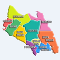
List of districts in Malaysia

Last updated

Districts (Malay : Daerah; Jajahan in Kelantan) are a type of subdivision below the state level in Malaysia. An administrative district is administered by a lands and district office (Malay : pejabat daerah dan tanah) which is headed by district officer (Malay : pegawai daerah).

Contents

Classification

In Peninsular Malaysia, a district is a subdivision of a state. A mukim (commune, sub-district or parish) is a subdivision of a district. The National Land Code assigns land matters, including the delineation of districts, to the purview of state governments. [1] These states operate a Torrens system, with districts administered by the respective state’s land and district office, and coordinated by the land and mines office. [2]

The state of Perlis is not divided into districts due to its size, but straight to the mukim level. The three Federal Territories are also not divided into districts; however Kuala Lumpur is divided into several mukim for land administration purposes. Putrajaya is divided into precincts.

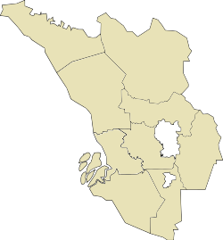
In East Malaysia, a district is a subdivision of a division (bahagian) of a state. [3] For example, Tuaran is a district within the West Coast Division of Sabah. A district is usually named after the main town or its administrative capital; for example, the town of Sandakan is the capital of the Sandakan District, as well as the capital of Sandakan Division.

Some larger districts are further divided into autonomous sub-districts (daerah kecil; literally "small district") before the mukim level. This is prevalent in Sarawak and Sabah, but also seen in Peninsular Malaysia in recent years, e.g. Lojing autonomous sub-district in Kelantan. Sub-districts in Sabah, however, are not divided into mukim.

Relationship with parliament and local government

In contrast to local governments that manage municipal administration and infrastructure development, [4] districts are solely utilised for land revenue. [5] While districts are usually congruent with local government areas, in more urbanised states, municipalities and districts either overlap or subsume one another. [4] In Selangor, the district of Petaling contains three cities Petaling Jaya, Subang Jaya and the state's capital Shah Alam. [6] Similarly in Johor, Johor Bahru District consists of three cities Iskandar Puteri, Johor Bahru and Pasir Gudang. [7] Conversely, a local government can administer multiple districts, such as in Penang, where George Town encompasses the Northeast and Southwest districts, [8] and Seberang Perai comprises the Northern, Central and Southern districts. [9]

Administrative district boundaries also provide the basis of boundaries for the parliamentary constituencies in the Malaysian Parliament. [10] However this is not always the case; in heavily populated areas e.g. the Klang Valley and Kinta Valley there is serious overlap between district, local government and parliamentary boundaries.

By states

West Malaysia

  City-status District
  Municipal-status District
Federal Territory/StateDistrict NameCapital/Largest settlementLocal GovernmentPopulation (2020 [11] )Area (km2)Density
Flag of the Federal Territories of Malaysia.svg  Federal Territory (Malaysia)
Flag of Kuala Lumpur Malaysia.svg  Kuala Lumpur Kuala Lumpur H 19821122438,156.8
Flag of Putrajaya.svg  Putrajaya Putrajaya P 109202492,228.6
Flag of Johor.svg  Johor
Flag of Batu Pahat, Johor.svg Batu Pahat District Batu Pahat Batu Pahat M
Yong Peng D
4953381966252.0
Flag of Johor Bahru, Johor.svg Johor Bahru District Johor Bahru Johor Bahru C
Iskandar Puteri C
Pasir Gudang C
171119110661,605.2
Flag of Kluang, Johor.svg Kluang District Kluang Kluang M
Simpang Renggam D
3237622865113.0
Flag of Kota Tinggi, Johor.svg Kota Tinggi District Kota Tinggi Kota Tinggi D
Pengerang M
222382348963.7
Flag of Kulai, Johor.svg Kulai District Kulai Kulai M 329497756435.8
Flag of Mersing, Johor.svg Mersing District Mersing Mersing D 78195285727.4
Flag of Muar, Johor.svg Muar District Muar Muar M 3147761393226.0
Flag of Pontian, Johor.svg Pontian District Pontian Kechil Pontian M 173318933185.8
Flag of Segamat, Johor.svg Segamat District Segamat Segamat M
Labis D
197762286769.0
Flag of Tangkak, Johor.svg Tangkak District Tangkak Tangkak D 163449977167.3
Flag of Kedah.svg  Kedah
Baling District Baling Baling D 142643152993.3
Bandar Baharu District Serdang Bandar Baharu D 44412271163.9
Kota Setar District Alor Setar Alor Setar C 374051420890.6
Kuala Muda District Sungai Petani Sungai Petani M 544984913596.9
Kubang Pasu District Jitra Kubang Pasu M 237759946251.3
Kulim District Kulim Kulim M
Kulim Hi-Tech
Industrial Park LA
337699774436.3
Langkawi District Kuah Langkawi M 94138526179.0
Padang Terap District Kuala Nerang Padang Terap D 65698135948.3
Pendang District Pendang Pendang D 98922629157.3
Pokok Sena District Pokok Sena Alor Setar C 49812244204.1
Sik District Sik Sik D 67925163541.5
Yan District Yan Besar Yan D 73384246298.3
Flag of Kelantan.svg  Kelantan
Flag of Bachok, Kelantan.svg Bachok District Bachok Bachok D 157288279563.8
Flag of Gua Musang, Kelantan.svg Gua Musang District [note 1] Gua Musang Gua Musang D Lojing D 112495817913.8
Flag of Jeli, Kelantan.svg Jeli District Jeli Jeli D 54656132641.2
Flag of Kota Bharu, Kelantan.svg Kota Bharu District Kota Bharu Kota Bharu M
Ketereh D
5557574031,379.0
Flag of Kuala Krai, Kelantan.svg Kuala Krai District Kuala Krai Kuala Krai D
Dabong D
105007227546.2
Flag of Machang, Kelantan.svg Machang District Machang Machang D 110008526209.1
Flag of Pasir Mas, Kelantan.svg Pasir Mas District Pasir Mas Pasir Mas D 230424570404.3
Flag of Pasir Puteh, Kelantan.svg Pasir Puteh District Pasir Puteh Pasir Puteh D 136157423321.9
Flag of Tanah Merah, Kelantan.svg Tanah Merah District Tanah Merah Tanah Merah D 150766880171.3
Flag of Tumpat, Kelantan.svg Tumpat District Tumpat Tumpat D 179943180999.7
Flag of Malacca.svg  Malacca
Alor Gajah District Alor Gajah Alor Gajah M
Hang Tuah Jaya M
249356674370.0
Jasin District Jasin Jasin M
Hang Tuah Jaya M
151937679223.8
Melaka Tengah District Malacca City Malacca C
Hang Tuah Jaya M
5971353591,663.3
Flag of Negeri Sembilan.svg  Negeri Sembilan
Jelebu District Kuala Klawang Jelebu D 46026135434.0
Jempol District Bandar Seri Jempol Jempol M 127181148585.6
Kuala Pilah District Kuala Pilah Kuala Pilah D 70324102768.5
Port Dickson District Port Dickson Port Dickson M 128657583220.7
Rembau District Rembau Rembau D 47278406116.4
Seremban District Seremban Seremban C 692407954725.8
Tampin District Tampin Tampin D 88101851103.5
Flag of Pahang.svg  Pahang
Bentong District Bentong Bentong M 116799183163.8
Bera District Bandar Bera Bera D 98137221444.3
Cameron Highlands District Tanah Rata Cameron Highlands D 3900471254.8
Jerantut District Jerantut Jerantut D 96006756112.7
Kuantan District Kuantan Kuantan C 5480142960185.1
Lipis District Kuala Lipis Lipis D 96620519818.6
Maran District Maran Maran D 112330191758.6
Pekan District Pekan Pekan M 121158380531.8
Raub District Raub Raub D 96139226942.4
Rompin District Kuala Rompin Rompin D
Tioman DA
98065524718.7
Temerloh District Temerloh Temerloh M 169023225175.1
Flag of Penang (Malaysia).svg  Penang
Central Seberang Perai District Bukit Mertajam Seberang Perai C 4229852381,777.2
North Seberang Perai District Kepala Batas Seberang Perai C 3391322681,265.4
Northeast Penang Island District George Town Penang Island C 5565571264,417.1
South Seberang Perai District Sungai Jawi Seberang Perai C 183996242760.3
Southwest Penang Island District Balik Pulau Penang Island C 2377351751,358.5
Flag of Perak.svg  Perak
Bagan Datuk District Bagan Datuk Teluk Intan M 8278597485.0
Batang Padang District Tapah Tapah D 124049179469.1
Hilir Perak District Teluk Intan Teluk Intan M 141959821172.9
Hulu Perak District Gerik Gerik D
Lenggong D
Pengkalan Hulu D
95076661314.4
Kampar District Kampar Kampar D 98732667148.0
Kerian District Parit Buntar Kerian D 166352938177.3
Kinta District Batu Gajah Ipoh C
Batu Gajah D
8887671305681.0
Kuala Kangsar District Kuala Kangsar Kuala Kangsar M 176060256268.7
Larut, Matang and Selama District [note 2] Taiping Taiping M
Selama D
3040232115143.7
Manjung District Seri Manjung Manjung M 2469771126219.3
Muallim District Tanjung Malim Tanjong Malim D 7668894980.8
Perak Tengah District Seri Iskandar Perak Tengah D 94573128273.8
Flag of Perlis.svg  Perlis Kangar Kangar M 284885819347.8
Flag of Selangor.svg  Selangor
Gombak District Bandar Baru Selayang Selayang M
Ampang Jaya M
9423366531,443.1
Hulu Langat District Bandar Baru Bangi Kajang M
Ampang Jaya M
14004618331,681.2
Hulu Selangor District Kuala Kubu Bharu Hulu Selangor M 2430291749139.0
Klang District Klang Klang C
Shah Alam C
10889426321,723.0
Kuala Langat District Teluk Datok Kuala Langat M 307787855360.0
Kuala Selangor District Kuala Selangor Kuala Selangor M 2817531187237.4
Petaling District Subang Petaling Jaya C
Shah Alam C
Subang Jaya C
22981234874,718.9
Sabak Bernam District Sabak Sabak Bernam D 1070571004106.6
Sepang District Salak Tinggi Sepang M 324935552588.7
Flag of Terengganu.svg  Terengganu
Flag of Besut, Terengganu.svg Besut District Kampung Raja Besut D 1541681234124.9
Flag of Dungun, Terengganu.svg Dungun District Kuala Dungun Dungun M 158130273557.8
Flag of Hulu Terengganu, Terengganu.svg Hulu Terengganu District Kuala Berang Hulu Terengganu D 69881387518.0
Flag of Kemaman, Terengganu.svg Kemaman District Chukai Kemaman M 215582253685.0
Flag of Kuala Nerus, Terengganu.svg Kuala Nerus District Kuala Nerus Kuala Terengganu C 145643398365.9
Flag of Kuala Terengganu, Terengganu.svg Kuala Terengganu District Kuala Terengganu Kuala Terengganu C 2297802101,094.2
Flag of Marang, Terengganu.svg Marang District Marang Marang D 116605667174.8
Flag of Setiu, Terengganu.svg Setiu District Bandar Permaisuri Setiu D 59651130445.7

East Malaysia

Federal Territory/StateDivisionNameCapitalCouncilPopulation (2020 [11] )Area (km2)Density
Flag of the Federal Territories of Malaysia.svg  Federal Territory (Malaysia) Flag of Labuan.svg  Labuan Victoria Labuan C 95120921,033.9
Flag of Sabah.svg  Sabah
Interior Beaufort District Beaufort Beaufort D 75716173543.6
Keningau District Keningau Keningau D 150927353342.7
Kuala Penyu District Kuala Penyu Kuala Penyu D 2371045352.3
Membakut District [note 3] Membakut Beaufort D
Nabawan District Nabawan Nabawan D 2834960894.7
Sipitang District Sipitang Sipitang D 37828273213.8
Sook District Sook Keningau D
Tambunan District Tambunan Tambunan D 31573134723.4
Tenom District Tenom Tenom D 51328240921.3
Kudat Kota Marudu District Kota Marudu Kota Marudu D 69528191736.3
Kudat District Kudat Kudat D 86410128767.1
Pitas District Pitas Pitas D 36660141925.8
Sandakan Beluran District Beluran Beluran D 77125549814.0
Kinabatangan District Kinabatangan Kinabatangan D 143112660521.7
Paitan District Paitan Beluran D
Sandakan District Sandakan Sandakan M 4390502266193.8
Telupid District Telupid Telupid D 29241221013.2
Tongod District Tongod Kinabatangan D 42742100544.3
Tawau
Kalabakan District Kalabakan Kalabakan D 48195388512.4
Kunak District Kunak Kunak D 68891113460.8
Lahad Datu District Lahad Datu Lahad Datu D 229138744430.8
Semporna District Semporna Semporna D 1665871145145.5
Tawau District Tawau Tawau M 3726152240166.3
West Coast Kota Belud District Kota Belud Kota Belud D 107243138677.4
Kota Kinabalu District Kota Kinabalu Kota Kinabalu C 5004213511,425.7
Papar District Papar Papar D 1506671243121.2
Penampang District Penampang Penampang D 162174425381.6
Putatan District Putatan Putatan D 68811401,720.3
Ranau District Ranau Ranau D 85077360823.6
Tuaran District Tuaran Tuaran D 1356651166116.4
Flag of Sarawak.svg  Sarawak
Betong Betong District Betong Betong D 36303154723.5
Kabong District Kabong Saratok D 1840479923.0
Pusa District Pusa Betong D 1955794720.7
Saratok District Saratok Saratok D 2310588826.0
Bintulu
Bintulu District Bintulu Bintulu DA 178646199189.7
Sebauh District Sebauh Bintulu DA 2960652295.7
Tatau District Tatau Bintulu DA 3192049466.5
Kapit Belaga District Belaga Kapit D [13] 22502190501.2
Kapit District Kapit Kapit D 3603039739.1
Song District Song Kapit D 996139352.5
Bukit Mabong District [14] Bukit Mabong Kapit D 10155119760.8
Kuching Bau District Bau Bau D 5264388459.6
Kuching District Kuching Kuching North C
Kuching South C
Padawan M
6092051498406.7
Lundu District Lundu Lundu D 33479181218.5
Limbang Lawas District Lawas Lawas D 3660438129.6
Limbang District Limbang Limbang D 45061397811.3
Miri Beluru District Bakong Marudi D 2869549055.9 [15]
Marudi District Marudi Marudi D 1883830796.1
Miri District Miri Subis D
Miri C
248877514348.4
Subis District Subis Subis D 57289382115.0 [16]
Telang Usan District Long Lama Marudi D 1740698291.8 [17]
Mukah Dalat District Dalat Dalat and Mukah D 2114790523.4
Daro District Daro Matu and Daro D 19477122615.9
Matu District Matu Matu and Daro D 16316160010.2
Mukah District Mukah Dalat and Mukah D 42275253616.7
Tanjung Manis District Belawai Matu and Daro D 794673110.9
Samarahan Sebuyau District [note 4] Sebuyau Simunjan D
Gedong District [note 4] Gedong Simunjan D
Asajaya District Asajaya Kota Samarahan M 33606303110.9
Samarahan District Samarahan Kota Samarahan M [19] [20] 128284407315.2
Simunjan District Simunjan Simunjan D 36211221816.3
Sarikei Julau District Julau Meradong and Julau D 1533317039.0
Meradong District Bintangor Meradong and Julau D 2029971928.2
Pakan District Pakan Meradong and Julau D 1546292516.7
Sarikei District Sarikei Sarikei D 4403998544.7
Serian [21] Serian District Serian Serian D 85345174948.8
Tebedu District Tebedu Serian D 2523265638.5
Siburan District [note 4] Siburan Serian D
Sibu Kanowit District Kanowit Kanowit D 24700225411.0
Sibu District Sibu Sibu D
Sibu Rural D (Sibu Jaya)
2480642230111.2
Selangau District Selangau Sibu Rural D 1984437955.2
Sri Aman Lubok Antu District Lubok Antu Lubok Antu D 33479314310.7
Sri Aman District Simanggang Sri Aman D 61238232426.4
Pantu District [note 4] Pantu Sri Aman D 1115083313.4
Lingga District [note 4] Lingga Sri Aman D

Townships (Mukim)

In the 11 states of the Peninsular Malaysia including the Federal Territories, there are townships (precinct for Putrajaya) that been administered by the district office and also the state government. For a list, see Category:Mukims of Malaysia. However, two states and one federal territory in Malaysia is not divided into any townships.

Labelled maps

Maps

See also

Notes

  1. figures include Lojing Sub-district
  2. figures include Selama Sub-district
  3. gazetted as full district on March 30, 2022 [12]
  4. 1 2 3 4 5 new district declared December 2021 [18]

Related Research Articles

<span class="mw-page-title-main">Butterworth, Seberang Perai</span> City centre of Seberang Perai in Penang, Malaysia

Butterworth is the city centre of Seberang Perai in the Malaysian state of Penang. It lies about 3 km (1.9 mi) east of George Town, the capital city of Penang, across the Penang Strait. As of 2020, Butterworth had a total population of 80,378 residents.

<span class="mw-page-title-main">Johor Bahru District</span> District in Johor, Malaysia

The Johor Bahru District is a district located in the southern part of Johor, Malaysia. It covers an area of 1,063.97km2 and has a population of 1.8 million, making it the second largest district in Malaysia by population. The district capital is Johor Bahru City and the administrative capital is Iskandar Puteri City. The district borders Pontian District on the west, Kota Tinggi District on the east, Kulai District on the north and Straits of Johor to the south. The urban centres are divided into the cities of Johor Bahru, Iskandar Puteri and Pasir Gudang.

<span class="mw-page-title-main">Mersing</span> Town and district capital in Johor, Malaysia

Mersing is a town, mukim and the capital of Mersing District, Johor, Malaysia. The town is located at the southern end of the east coast of Peninsular Malaysia. As of 2010, the town has an estimated population of 70,894.

<span class="mw-page-title-main">Pontian District</span> District in Johor, Malaysia

Pontian District is a district located in southwest part of the Malaysian state of Johor. It borders Batu Pahat and Kluang Districts to the north and Kulai and Johor Bahru Districts to the east.

Divisions are the primary subdivisions of Sabah and Sarawak, the states in East Malaysia. Each division is subdivided into districts — this is different in Peninsular Malaysia whereby districts are generally the primary subdivisions of a state. Each division is headed by a resident.

Bukit, the Indonesian or Malay word for hill, may refer to:

<span class="mw-page-title-main">South-West District (Penang)</span> District in George Town, Penang, Malaysia

The Southwest District is a district in George Town within the Malaysian state of Penang. The district covers the southwestern half of Penang Island and borders the Northeast District. Both districts fall under the jurisdiction of the Penang Island City Council.

<span class="mw-page-title-main">Kulai District</span> District in Johor, Malaysia

The Kulai District is a district in the state of Johor, Malaysia. Its district capital is Kulai Town. It covers Kulai Town, Ayer Bemban, Bandar Putra Kulai, Bukit Batu, Indahpura, Bandar Baru Kangkar Pulai, Kelapa Sawit, Saleng, Sedenak, Seelong, Senai, and Sengkang. Kulai is also within Iskandar Malaysia economic zone.

<span class="mw-page-title-main">Malaysian Prison Department</span> Law enforcement agency

The Malaysian Prison Department, is a department under Malaysia's Ministry of Home Affairs responsible for prisons where offenders sentenced by the courts are held. These prisons also serve as detention and recovery institutions.

<span class="mw-page-title-main">2010 in Malaysia</span>

This article lists important figures and events in Malaysian public affairs during the year 2010, together with the deaths of notable Malaysians. Malaysia Day, 16 September was celebrated as a national holiday for the first time.

<span class="mw-page-title-main">Kota Tinggi District</span> District in Johor, Malaysia

Kota Tinggi District is a district in the Malaysian state of Johor. It is the largest district in the state with an area of 3,488.7 square kilometres (1,347.0 sq mi). The population was 222,382 in 2020. The principal town is Kota Tinggi.

<span class="mw-page-title-main">Malaysian Expressway System</span>

The Malaysian Expressway System is a network of national controlled-access expressways in Malaysia that forms the primary backbone network of Malaysian national highways. The network begins with the Tanjung Malim–Slim River tolled road which was opened to traffic on 16 March 1966, later North–South Expressway (NSE), and is being substantially developed. Malaysian toll road-expressways are built by private companies under the supervision of the government highway authority, Malaysian Highway Authority. While toll-free expressways are built by Malaysian Public Works Department or Jabatan Kerja Raya Malaysia (JKR) in Malay.

<span class="mw-page-title-main">Greater Penang Conurbation</span> Metropolitan area in northwestern Malaysia

The Greater Penang Conurbation, also known as the George Town Conurbation, is the urban area within and surrounding the Malaysian state of Penang, including parts of neighbouring Kedah and Perak. It is the second largest conurbation in Malaysia, with a population of over 2.84 million as of 2020. The conurbation is also the second largest metropolitan economy in the country after the Klang Valley, with an estimated gross domestic product (GDP) of over US$30 billion in 2020.

References

  1. "National Land Code" (PDF). Malaysian federal government : 54. 2020 via Food and Agriculture Organization.
  2. Zulkifli, Nur Amalina; Abdul Rahman, Alias; van Oosterom, Peter; Tan, Liat Choon; Jamil, Hasan; Teng, Chee Hua; Looi, Kam Seng; Chan, Keat Lim (December 2015). "The importance of Malaysian Land Administration Domain Model country profile in land policy". Land Use Policy. 49: 649–659. Bibcode:2015LUPol..49..649Z. doi:10.1016/j.landusepol.2015.07.015.
  3. "Malaysia Districts". Statoids.com. Retrieved 3 November 2010.
  4. 1 2 Lo Vullo et al. 2022, p. 6.
  5. Adnan, M Z; Suratman, R; Samsudin, S (March 2021). "Key geographical features on malaysia's land tax system: a comparison study in negeri sembilan, malaysia". IOP Conference Series: Earth and Environmental Science. 683 (1): 012095. Bibcode:2021E&ES..683a2095A. doi:10.1088/1755-1315/683/1/012095.
  6. Yasin, Muhammad Yazrin; Zain, Muhammad Azmi Bin Mohd; Hassan, Muhammad Haniff Bin (15 December 2022). "Urbanization and growth of Greater Kuala Lumpur: Issues and recommendations for urban growth management". Southeast Asia: A Multidisciplinary Journal. 22 (2): 4–19. doi:10.1108/seamj-02-2022-b1002.
  7. Ariffin, Azman; Mukhelas, Haziq Kamal; Hamid Mar Iman, Abd.; Desa, Ghazali; Mohammad, Izran Sarrazin (2014). "Spatial-Based Sustainability Assessment of Urban Neighbourhoods: A Case Study of Johor Bahru City Council, Malaysia". Geoinformation for Informed Decisions. Lecture Notes in Geoinformation and Cartography. pp. 85–101. doi:10.1007/978-3-319-03644-1_6. ISBN   978-3-319-03643-4.
  8. McIntyre, Ian (26 January 2024). "Nearly half of Penang island's non-built land under forest cover, says council". The Vibes. Retrieved 22 December 2024.
  9. Goh, Ban Lee (7 October 2019). "Seberang Perai comes of age". The Sun . Retrieved 22 December 2024.
  10. "Persempadanan". Suruhanjaya Pilihan Raya (Election Commission of Malaysia). Retrieved 20 September 2020.
  11. 1 2 "Key Findings of Population and Housing Census of Malaysia 2020" (pdf) (in Malay and English). Department of Statistics, Malaysia. ISBN   978-967-2000-85-3.
  12. Dzulkifli, Hayati (15 October 2023). "Membakut now a full district". Daily Express Malaysia.
  13. Lian Cheng; Peter Sibon (23 January 2016). "Call for Belaga to have own district council". The Borneo Post. Retrieved 19 June 2018.
  14. "Launch of Bukit Mabong, Tunoh, Kapit by the Chief Minister of Sarawak". Sarawak Regional Corridor Development Authority. 3 November 2015. Retrieved 28 December 2016.
  15. "Rakan Sarawak October 2001". www.sarawak.com.my. Archived from the original on 6 June 2009.
  16. "Laman Web Rasmi Majlis Daerah Subis".
  17. Abdullah, Mohamad (6 October 2015). "Telang Usan District Office a game changer". Borneo Post Online.
  18. "INFOGRAPHICS: NEW DISTRICTS IN SARAWAK". BERNAMA. 13 December 2021.
  19. Lian Cheng (11 November 2016). "It's Kota Samarahan Municipal Council effective today". The Borneo Post. Retrieved 19 June 2018.
  20. "Laman Web Rasmi Majlis Perbandaran Kota Samarahan". mpks.sarawak.gov.my.
  21. Samuel Aubrey (12 April 2015). "Serian now a division". The Borneo Post. Retrieved 15 May 2015.

Sources