Kanowit Pekan Kanowit | |
---|---|
Other transcription(s) | |
• Chinese | 加拿逸 |
Coordinates: 2°06′0″N112°09′0″E / 2.10000°N 112.15000°E Coordinates: 2°06′0″N112°09′0″E / 2.10000°N 112.15000°E | |
Country | Malaysia |
State | Sarawak |
Division | Sibu |
District | Kanowit |
Population (2010) | |
• Total | 28,985 |
Website | http://www.kanowitdc.sarawak.gov.my/ |
Kanowit (Malay: Pekan Kanowit) is a town and the capital of a district of the same name, located within the Sibu Division, Sarawak, Malaysia, comprising 2,253.5 square kilometres. As of 2010, Kanowit's population is 28,985. It is built on the mouth of Kanowit River at the bank of Rajang River, approximately 174 kilometers from the coast of South China Sea. It takes 45 minutes to reach the town by land transport and an hour by boat from Sibu. The main ethnic groups are Iban, Chinese, Malay, and Melanau.
The town takes its name from the Kanowit, a Melanau ethnic group called Rajang by the Ibans (ISO 639-3: kxn). The language is still spoken by the Kanowit people living in the area.
The village where the Kanowit people live is known as Kampung Bedil, a short trip by boat up the Rajang River from Kanowit town.
The name "Kanowit" is derived from the name of the earliest ethnic group settling along the Kanowit River. The ethnic group adopted similar culture as the Melanau ethnic group. Therefore, they are often called as the "Melanau of Kanowit". Their languages is classified as the languages related to the people from Oya, Mukah, and Matu District. They had their own social rankings: aristocrats, middle class, and slaves. Their houses were 40 foot tall, although such houses no longer exists today. They were well known of their basketry which were sold in the Kanowit Bazaar (market). [1] [note 1]
In 1846, Phlegethon ship commanded by Captain Rodney Mundy and James Brooke sail up the Rajang River to combat Dayak piracy that frequently threatened the borders of Sarawak (Kuching area). On 29 June, Rodney and James arrived at Kanowit and their first contact with the "Kanowit" people there was peaceful. In 1851, Fort Emma was built by the Brookes although Kanowit was still under the control of Bruneian empire. The fort was named after the sister of James Brooke, Emma Brooke. Emma Brooke was also the mother of the second Rajah of Sarawak, Charles Anthony Brooke. [1] [note 2] In 1853, James Brooke was able to take over Rajang River and its surrounding settlements from the Brunei Sultanate. [2] Fort Emma offered protection against Dayak piracy along the Rajang River. Therefore, Hokkien Chinese from Singapore and Fujian province of China came to settle in Kanowit during the 1870s, while Sibu was still a small Malay village at that time. Chinese traders from Singapore brought clothes, jars, salt, and other daily necessities in exchange for rattan, hides of wild cattle, camphor, rhinoceros horns, and monkeys gall stones. The Cantonese people later arrived in the 1880s. They were involved in timber exports. [1] [note 3] The Fuzhounese arrived here from Sibu in 1910. [1] [note 4] Besides, Malay villages also established just immediate south to the fort. [1] [note 5] In 1883, Father Edmund Dunn of St Joseph College, Mill Hill, England, established the first Roman Catholic Mission headquarters at Kanowit. The missionary at that time worked almost exclusively amongst the Iban people [1] [note 6] In 1885, St Francis Xavier Church was built. The church was demolished in 1967 to pave the way for new modern building construction. [1] [note 7] Later a mission hospital and a primary school was built. A boat to bring emergency cases to Sibu was provided. [1] [note 8]
In June 1859, Syarif Masahor, [1] [note 9] together with a "Kanowit" leader named "Sawing", [3] and a number of Malay chiefs killed two Brooke government officials, Charles Fox and Henry Steele. [1] [note 10] In 1906, a peacemaking ceremony was performed between Kana and Iban tribes here. [4]
During the last years of the Japanese occupation, the Kanowit bazaar was looted and burnt to the ground by some natives. In 1951, as the Korean war broke out, the Kanowit bazaar was overflowing with rubber sheets due to rise in rubber prices. However, on 8 November 1951, the bazaar was burnt to the ground in a large fire. [1] [note 11] Construction of the shophouses was restarted from 1952 to 1953. However, several owners were unable to pay the mortgages owed to Chartered Bank in Sibu due to low collapsing rubber prices. [1] [note 12]
In the 1970s, there were 48 shophouses in Kanowit, lying parallel to the Kanowit River. There was also a market, churches, a hospital, [1] [note 13] a moving picture theatre (named Capital Theatre), [1] [note 14] a jetty, government offices, government resident quarters, a government clinic, and a community hall. [1] [note 15] The Chinese were settled near the banks of the Rajang River. There were no roads that enter the town. Therefore, the Rajang River is the only mode of transport for people to travel to other towns. [1] [note 16]
The town of Kanowit is the capital of the Kanowit District. [1] [note 17] The Kanowit district is administered by a District officer, an assistant officer, administrative officers, treasurer, clerks, and other office employees. [1] [note 18] Kanowit District Council was first known as Kanowit Sea Dayak Local Authority when it was established in 1949. In 1957, the council name was changed to its present name. [5] Julau was previously a sub-district under the jurisdiction of the Kanowit District. In 1973, Julau was upgraded into a district and put under the administration of Sarikei Division. [6] In the 1960s, there were 24 democratically elected representatives in the Kanowit District Council. The Kanowit District was in turn put under the jurisdiction of the Third Division of Sarawak (also known as Sibu Division today). [1] [note 19] In the 1970s, the Kanowit government secondary school was the only secondary school apart from Sibu in the Rajang basin. [1] [note 20]
Kanowit is located at 105 miles (169 km) miles from the sea, near the Rajang River. Although the Rajang flows from east to west in its general course of direction, the river is flowing from south to north in Kanowit, with the Kanowit river entering Rajang south to north. The part of Rajang River near Kanowit is 0.5 miles (0.80 km) wide. The town of Kanowit is located in the north-south direction. [1] [note 21]
The area around Kanowit contains mostly tertiary stage of Paleozoic rocks such as sandstones, greywicks, siltstone, shales, and slate. During the Peneplanation and Jerudong cycles, the erosions of the hills in the central Rajang basin has reduced their elevations to 200 to 300 feet, when compared to 3,000 to 5,000 feet mountains located near the Sarawak-Kalimantan border. The riverbanks at Kanowit are below sea level; therefore, Kanowit is subject to frequent flooding during periods of monsoon seasons. [1] [note 22] There are three types of soils in the Kanowit area: acid yellow soils found in the mountainous areas, podsols derived from sandy material at the moderately high terrains, and alluvial deposits at the flood plain areas. [1] [note 23]
Kanowit has a tropical rainforest climate (Af) with heavy to very heavy rainfall year-round.
Climate data for Kanowit | |||||||||||||
---|---|---|---|---|---|---|---|---|---|---|---|---|---|
Month | Jan | Feb | Mar | Apr | May | Jun | Jul | Aug | Sep | Oct | Nov | Dec | Year |
Average high °C (°F) | 30.1 (86.2) | 30.3 (86.5) | 31.3 (88.3) | 31.9 (89.4) | 32.3 (90.1) | 32.1 (89.8) | 32.0 (89.6) | 31.7 (89.1) | 31.6 (88.9) | 31.5 (88.7) | 31.3 (88.3) | 30.7 (87.3) | 31.4 (88.5) |
Daily mean °C (°F) | 26.1 (79.0) | 26.2 (79.2) | 27.0 (80.6) | 27.2 (81.0) | 27.6 (81.7) | 27.3 (81.1) | 27.1 (80.8) | 26.9 (80.4) | 26.9 (80.4) | 27.0 (80.6) | 26.8 (80.2) | 26.4 (79.5) | 26.9 (80.4) |
Average low °C (°F) | 22.2 (72.0) | 22.2 (72.0) | 22.7 (72.9) | 22.6 (72.7) | 22.9 (73.2) | 22.5 (72.5) | 22.2 (72.0) | 22.1 (71.8) | 22.3 (72.1) | 22.5 (72.5) | 22.4 (72.3) | 22.2 (72.0) | 22.4 (72.3) |
Average rainfall mm (inches) | 351 (13.8) | 293 (11.5) | 315 (12.4) | 248 (9.8) | 279 (11.0) | 227 (8.9) | 177 (7.0) | 244 (9.6) | 315 (12.4) | 288 (11.3) | 288 (11.3) | 362 (14.3) | 3,387 (133.3) |
Source: Climate-Data.org [7] |
The total population in the Kanowit Bazaar (market) in 1960 was 1,555. [1] [note 24] It increased by 13% to 1,720 in August 1970, where 72.7% of them were Chinese and 18.1% were the Malays. Among the Chinese, Hokkien accounted for 48.8% of the population, followed by Cantonese (21.4%), and Fuzhounese (20.1%). [1] [note 25] The Iban people made up 6.5% of the population in the Kanowit bazaar. Outside the Kanowit bazaar, the Iban people were the majority. Some Malay families may raise or adopt children from other races. Therefore, names such as "Abdul Chen" and "Aminah Lim" may appear. [1] [note 26] All the ethnic groups in the Kanowit Bazaar only started arriving in the last 200 years. The "Kanowit" ethnic group, where the town is named after them, is known to be the earliest inhabitants along the Kanowit River. Few of the "Kanowit" people still staying in Kampung Bedil today. [1] [note 27] The Kampung Bedil has about 40 houses with a population of 200 in the year 2015. [3]
In the 1970s, there were seven widely spoken languages in Kanowit: English, Malay, Iban, Mandarin, Hokkien, Fuzhounese, and Cantonese. About 30% of the population at that time speak English. 90% of the population in Kanowit can speak Iban, including 70 to 80% of the Chinese. Meanwhile, 18% of the Kanowit people spoke Malay. [1] [note 28] Hokkien was the most widely spoken Chinese dialect in Kanowit during the 1970s. At that time, 48.8% of the Chinese spoke Hokkien, 40 to 50% of the Chinese spoke Fuzhounese, and 90% of the Chinese spoke Mandarin. Most of the Kanowit population was able to converse in more than one languages. [1] [note 29]
In the 1970s, 21% of the Kanowit bazaar population was Christians while 19% of the population was Muslims. Meanwhile, 60% of the population was devoted to other religions. [1] [note 30]
Kanowit acts as a middleman of trade between the town of Sibu and people from the interior of the Rajang River. Kanowit exports rural agricultural products to the outside world. At the same time, manufactured goods from the outside world are imported for daily use by the Kanowit residents. [1] [note 31] Among the items available for trade in the Kanowit bazaar are: hill rice, vegetables, chicken, pigs, fish, and fresh-water shrimp. Rubber and pepper are also cultivated in Kanowit. [1] [note 32] Kanowit also produces rubber and black pepper. [1] [note 33] Before 1970s, Kanowit acted as a transshipment centre for timbers coming from the Rajang upriver. After the freeze of new timber licenses in the 1970s, the effect of timber on the local economy has been reducing. [1] [note 34] Majority of the businesses in Kanowit were retail grocery businesses. Other business were: tailors, [1] [note 35] coffeshops, [1] [note 36] hairdressers, and food stalls. [1] [note 37]
Fee of local bus is only RM1, but bus service is not frequently.
Route No. | Operating Route | Operator | Remark |
---|---|---|---|
20 | Sibu-Kanowit | Lanang Bus | |
Operating Route | Operator | Remark |
---|---|---|
Sibu-Kapit | Kapit Bus Express, BusAsia, Lanang Bus | |
Express boats from Kanowit can reach Sibu in one and a half hours. [1] [note 38]
The town has two primary schools:
and three secondary schools:
The town center consists of three streets of 1930s vintage Chinese shophouses, near the waterfront. A few new shophouses have been built. Kanowit have a dry and wet market, offering local vegetables, meats and handicrafts. The market opens everyday from 7am till 12 noon. The biggest supermarket is Hock Tong Seng. During periods of celebration, the local karaoke can often be heard from far away with the pounding basslines of 80s hits in English, Malay and Chinese.
The best sight seeing can be had by walking along the riverside from town or up the Telecom Hill or Bukit Memaluh Hill.
Sibu is a landlocked city in the central region of Sarawak. It is the capital of Sibu District in Sibu Division, Sarawak, Malaysia. The city is located on the island of Borneo and covers an area of 129.5 square kilometres (50.0 sq mi). It is located at the confluence of the Rajang and Igan Rivers, some 60 kilometres from the South China Sea and approximately 191.5 kilometres (119 mi) north-east of the state capital Kuching. Sibu is mainly populated by people of Chinese descent, mainly from Fuzhou. Other ethnic groups such as Iban, Malay and Melanau are also present, but unlike other regions of Sarawak, they are not as significant. The cities population as of 2010 is 162,676.
Sarikei is a town, and the capital of Sarikei District in Sarikei Division, Sarawak, Malaysia. It is located on the Rajang River, near where the river empties into the South China Sea. The district population was 56,798.
The Rajang River is a river in Sarawak, northwest Borneo, Malaysia. The river originates in the Iran Mountains, flows through Kapit, and then towards the South China Sea. At approximately 565 km long (351 mi), the river is the seventh-longest in Borneo and the longest in Malaysia.
Kapit is a town and the capital of Kapit District in Kapit Division, Sarawak, Malaysia on the south bank of the Rajang River. The district comprises 15,595.6 square kilometres and as of 2020, it has a population of 65,800.
Song is a town, and the capital of the Song District in Kapit Division, Sarawak, Malaysia. The district population was 20,046 according to the 2010 census. Song is situated by the banks of the Katibas River, a tributary of the Rajang River. It is an important stopover for river traffic going up the Rajang River.
Sibu Division is one of the twelve administrative divisions of Sarawak, Malaysia. It has a total area of 8,278.3 square kilometres, and is the third largest division after Kapit Division and Miri Division.
Sarikei Division is one of the twelve administrative divisions in Sarawak, Malaysia. Formerly part of the Third Division, which included Sibu and Kapit, Sarikei Division has a total area of 4,332.4 square kilometres (1,672.7 sq mi), and is the second smallest of the administrative divisions of Sarawak.
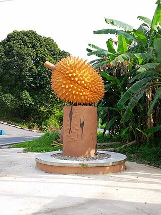
Julau is a town, and the capital of the Julau District in Sarikei Division, Sarawak, Malaysia. The district population is 15, 333. The population is dominated by Iban as well as Chinese especially the Fuzhou.
Mukah Division is one of the twelve administrative divisions in Sarawak, Malaysia. It was established on 1 March 2002 and it has a total area of 6,997.61 square kilometres.
Kuching Division is one of the twelve administrative divisions in Sarawak, Malaysia. Formerly part of what was called the "First Division", it is the center and the starting point of modern Sarawak. Kuching Division has a total area of 4,559.5 square kilometres.
Dalat is the administrative town of the Dalat district in Mukah Division, Sarawak, Malaysia. It is situated by the Oya river.
Melanau or A-Likou is an ethnic group indigenous to Sarawak, Malaysia. They are among the earliest settlers of Sarawak. They speak in the Melanau language, which is a part of the North Bornean branch of Malayo-Polynesian languages.
Bintangor is a town, and the capital of the Meradong District in Sarikei Division, of Sarawak, Malaysia. Situated along the Rejang River, Bintangor was an express boat services hub connecting between, Sarikei town and Sibu city in the 1970s up to the early 1990s. As road connections between these towns became a more prominent mode of transport, the waterway of the town died down.
Pakan is a small town in Pakan District, Sarikei Division, Sarawak, Malaysia. The district population estimates was 17,600.
Tatau District is one of the two districts of Bintulu Division in Sarawak, Malaysia. It has a total area of 4,945.80 square kilometres. The largest town in the district is Tatau.
Selangau, Sarawak, is a small town located by the Pan Borneo Highway. It is also located by Batang Mukah, a river which flows to the South China Sea. It is located approximately 74 km (46 mi) from Sibu city, 84 km (52 mi) from Mukah town and 134 km (83 mi) from Bintulu town. Selangau town is the administrative centre for the Selangau District.
Sarawak's population is very diverse, comprising many races and ethnic groups. Sarawak has more than 40 sub-ethnic groups, each with its own distinct language, culture and lifestyle. This makes Sarawak demography very distinct and unique compared to its Peninsular counterpart.
The Crown Colony of Sarawak was a British Crown colony on the island of Borneo, established in 1946, shortly after the dissolution of the British Military Administration. It was succeeded as the state of Sarawak through the formation of the Federation of Malaysia on 16 September 1963.
Sibu District is an administrative district in Sibu Division, Sarawak, Malaysia covering a total area of 2229.8 km2. It can be divided into Sibu Town area (129.5 km2) and the rural areas (2,100.3 km2). The satellite township of Sibu Jaya is included in the rural areas. Sibu District is under the purview of Sibu District Office located at Sibu Islamic Complex, Sibu City. There are currently two local authorities namely Sibu Municipal Council (SMC) and Sibu Rural District Council (SRDC) that administers Sibu City and Sibu rural areas respectively.
Tebedu District is a district in the state of Sarawak, Malaysia. It is a part of Serian Division that consists of Serian, Siburan, and Tebedu districts. Before this, Tebedu District was a sub-district under Serian District which was then fully upgraded to a district in its own right. The majority of the population of this district is from the Bidayuh ethnic group.
Brooke had been able to take over Rajang river in 1853, and managed to secure Mukah and surrounding rivers in 1861.