Limbang District | |
|---|---|
 District of Sarawak | |
 | |
| Country | |
| State | |
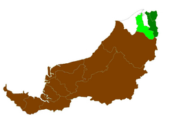
| Division | Limbang Division |
| District Office location | Limbang |
| Local area government(s) | Majlis Daerah Limbang |
| Area | |
• Total | 3,978.10 km2 (1,535.95 sq mi) |
| Population (2020) | |
• Total | 90,990 |
| • Density | 22.87/km2 (59.24/sq mi) |
| District Officer | Anyi Ngau |
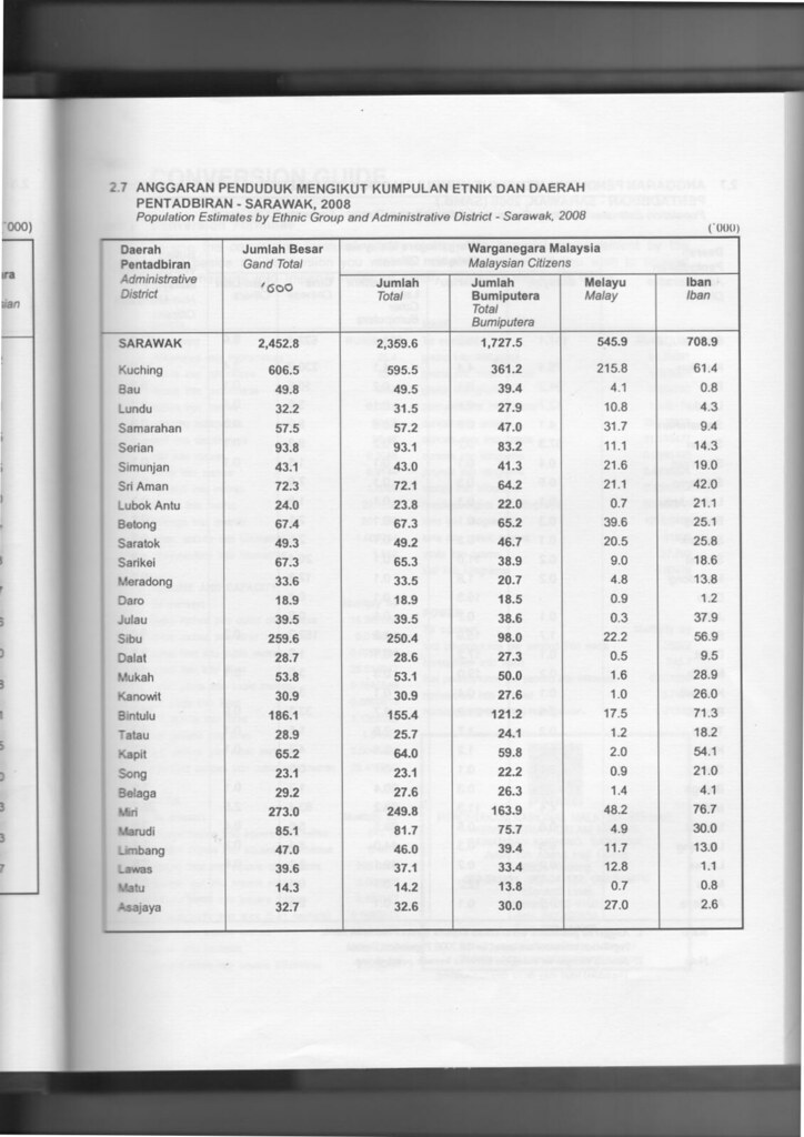
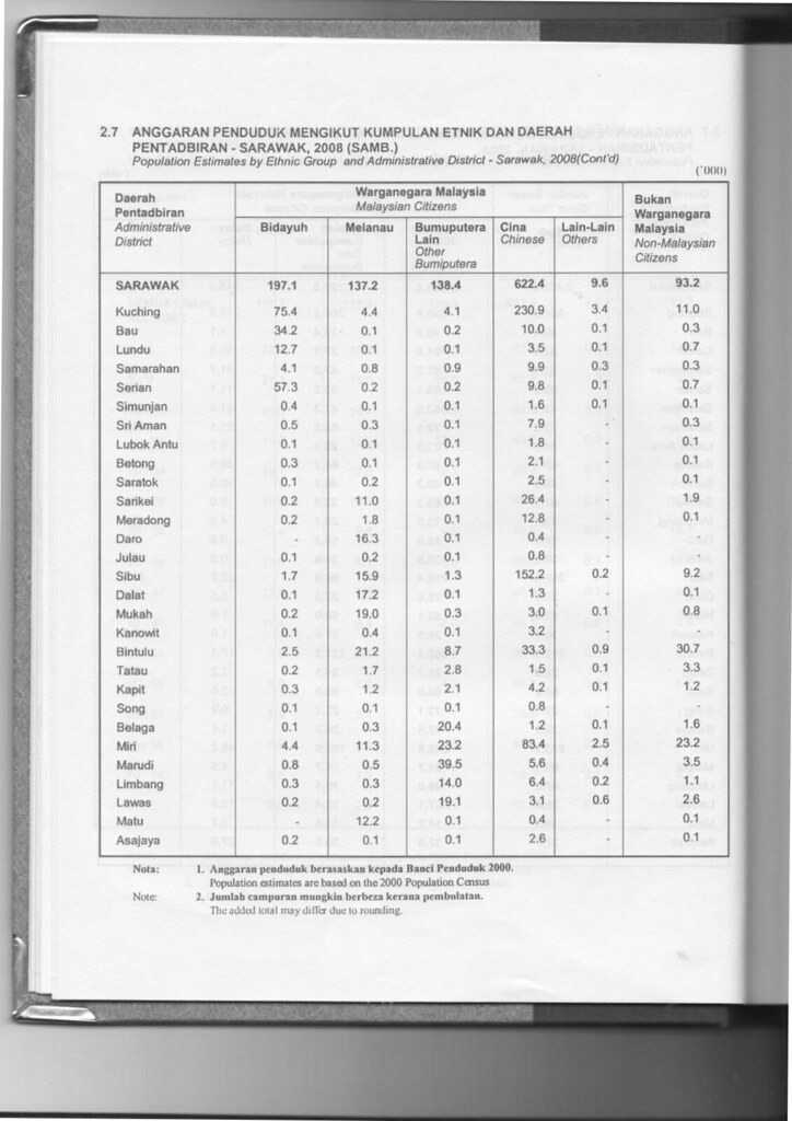
| Ethnicity | Bruneian Malay and Kedayan (30.3%), Iban (24.7%), Chinese (21.3%), Others (23.7%) |
| Historical claimed by | Brunei |
| Website | https://limbangdc.sarawak.gov.my/ |

The Limbang District is one of the two districts of Limbang Division, Malaysia. It has a total area of 3,978.10 square kilometres. [1] The major town is Limbang. It has one sub-district, which is Nanga Medamit Sub-District. It bisects the sovereign state of Brunei Darussalam to the west and east, and borders the Malaysia Lawas District to the southeast and Miri District to the south and southwest. Due to being squeezed in between Brunei at its north and coastal areas, Limbang is accessible by road only through cross-border immigration posts.


