Beluru | |
|---|---|
| Country | |
| State | |
Beluru is a district, in Miri Division, Sarawak, Malaysia. [1] [2]
Beluru | |
|---|---|
| Country | |
| State | |
Beluru is a district, in Miri Division, Sarawak, Malaysia. [1] [2]

Brunei is a country in Southeast Asia, bordering the South China Sea and East Malaysia. Its geographical coordinates are 4°30′N114°40′E. The country is small with a total size of 5,765 km2 (2,226 sq mi). It is similar in size to the UK's Norfolk and slightly smaller than the US state of Delaware. It is close to vital sea lanes through the South China Sea linking the Indian and Pacific Oceans. The country has two parts physically separated by Malaysia, making it almost an enclave within Malaysia.

The Kowloon Peninsula is a peninsula that forms the southern part of the main landmass in the territory of Hong Kong, alongside Victoria Harbour and facing toward Hong Kong island. The Kowloon Peninsula and the area of New Kowloon are collectively known as Kowloon.
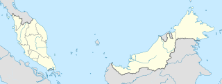
The states and federal territories of Malaysia are the principal administrative divisions of Malaysia. Malaysia is a federation of 13 states (Negeri) and 3 federal territories.

Brunei-Muara is the northernmost district in Brunei. It is the smallest of Brunei's four districts in terms of area but by far the most populous, containing over half the country's population. It is the most important and bustling district because the capital, Bandar Seri Begawan which is also the state capital, is the seat of the government ministries and departmental headquarters as well as the centre of business activities. Other major towns in the Brunei-Muara district include Muara town. The Brunei-Muara district houses the largest and deepest port in Brunei, the Muara Port.

Whitecourt-Ste. Anne was a provincial electoral district in Alberta, Canada mandated to return a single member to the Legislative Assembly of Alberta using the first-past-the-post method of voting from 1993 to 2019.

Kapit Division, formed on 2 April 1973, is one of the twelve administrative divisions in Sarawak, Malaysia. It has a total area of 38,934 square kilometres, and is the largest of the administrative divisions of Sarawak.

Division No. 17 is a census division in Alberta, Canada. It spans the central and northwest portions of northern Alberta and its largest urban community is the Town of Slave Lake. Division No. 17 is the largest census division in Alberta according to area and also has the lowest population density.

Cheras is a town and a district, straddling both the Federal Territory of Kuala Lumpur and Hulu Langat District in Selangor state, Malaysia.

D Park, previously named Discovery Park, is a residential development in Hong Kong, located at 398 Castle Peak Road, Tsuen Wan in the New Territories. The whole estate including the residential flats and the shopping centre spans over 2,700,000 square feet (250,000 m2).
Marudi is a town on the Baram River in Miri Division, Sarawak, Malaysia. Marudi is a quiet town situated inland from Miri, similar in size to Kapit though nowhere near as busy. Its main attraction is another of the Brooke outposts, the beige wooden Fort Hose. It is the cultural heart of Sarawak's highland tribesfolk, collectively called Orang Ulu. Before Miri was founded, Marudi was the administrative centre of the northern region of Sarawak.
Kampong Sungai Teraban, or simply Sungai Teraban, is a small village in Belait District, Brunei. It is located across the mouth of the Belait River from Kuala Belait and may serve as a suburb of the latter. Kampong Sungai Teraban is also a kampong administrative division under the mukim or subdistrict Kuala Belait. The village had a population of 941 in 2007.
Kota Batu is a mukim (subdistrict) in the Brunei-Muara District of Brunei. It is located on the southeastern part of the Brunei-Muara District, bordering the mukims of Mentiri to the north and Lumapas to the south and west, Kianggeh and the Kampong Ayer mukims to the west, as well as the Brunei Bay to the east and Pulau Limpaku Pinang in Limbang in Sarawak, Malaysia, to the east.
Pengkalan Batu or Pangkalan Batu is a mukim in Brunei-Muara District, Brunei. It is the southernmost mukim in the district, bordering the mukims of Sengkurong to the north, Kilanas and Lumapas to the north-east, and Kiudang and Keriam in Tutong District to the south-west and north-west respectively. It also borders Limbang District in Sarawak, Malaysia to the east and south.

Lamunin is a mukim in the Tutong District of Brunei. It is located in the east, centre of the Tutong District, bordering Mukim Kiudang to the north, Limbang, Sarawak (Malaysia) to the east, Mukim Rambai to the south and south-west, Mukim Ukong to the west and Mukim Tanjong Maya to north-west. The community leader for Lamunin is a penghulu and the incumbent is Tujoh bin Talip.
Melilas is a mukim in the Belait District of Brunei. It is located in the southernmost point of the Belait District, bordering Mukim Sukang to the north and Sarawak (Malaysia) to the east, south and west.

The Brunei–Malaysia border dives the territory of Brunei and Malaysia on the island of Borneo. It consists of a 266 km land border and substantial lengths of maritime borders stretching from the coastline of the two countries to the edge of the continental shelf in the South China Sea.

Karnal Division is one of the six divisions of Haryana state of India. It comprises the districts of Karnal, Panipat and Kaithal. It was announced in January 2017 and approved by the Haryana cabinet on 2 February 2017.
The 5th Anti-Aircraft Missile Division of the Air Force was activated on July 1, 1979, in Langfang, Beijing. The division was composed of the 16th, 26th and 27th Anti-aircraft Missile Regiments, being responsible for the anti-air defense of the southern vicinity of Beijing.

Kabong is a district, in Betong Division, Sarawak, Malaysia.
Capital: Kuching | |
| History | |
| Topics |
|
| Society |
|
| Administrative divisions | |
Coordinates: 3°59′03.7″N114°05′59.4″E / 3.984361°N 114.099833°E
| This Malaysian location article is a stub. You can help Wikipedia by expanding it. |