Pakan, Sarawak

Last updated

Pakan
Other transcription(s)
   Chinese 巴干
Replica of Buah Pakan at Pakan Entabai road.jpg
Replica of Buah Pakan at Pakan town
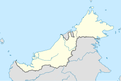
East Malaysia location map.svg
Red pog.svg
Pakan
Location in Borneo
Coordinates: 1°52′00″N111°41′00″E / 1.86667°N 111.68333°E / 1.86667; 111.68333
CountryMalaysia
State Sarawak
Division Sarikei
District Pakan
Government
  District OfficerEn. Seroji Bin Ludin (2017-Now)
Area
[1]
  Total924.6 km2 (357.0 sq mi)
Population
 (2020 [2] )
  Total15,462
  Density16/km2 (40/sq mi)
Time zone UTC+08:00 (MST)
Postal code
96xxx
Website www.sarikei.sarawak.gov.my

Pakan is a small town in Pakan District, Sarikei Division, Sarawak, Malaysia. The district population estimates (as of the 2017 census) was 17,600. [3]

Contents

Most of its inhabitants are ethnic Iban people (95%+) and a few minority Chinese usually concentrated in its town area. A small minority of Malay work in a government sector, such as teachers, nurses, district officers, and police.[ citation needed ]
Etymology

The name Pakan was derived from a local fruit resembling durian, named Buah Pakan. It has yellowish skin and flesh. [4] [note 1] The fruit has since become the symbol of the town with its replica built at the junction of Entabai road. [5]

History

In 1911, a man from Guangdong named Wen Ru Zhu (翁如珠) was the first Chinese to arrive in Sarikei. Four years later in 1915, he together with one of his family member, brought some daily necessities, climbed through the mountains and arrive in Pakan to trade with the Iban people living there for agricultural products. Apart from Iban longhouses and rubber plantations, there were no Chinese houses there. The Iban people welcomed the arrival of Wen as he brought the much needed daily necessities to them. The journey to and from Pakan took about ten days. Wen would build a small hut in Pakan to stay there for some days before going back to Sarikei. Later, he married an Iban woman in Pakan and started a family. Later, more Chinese came here to build shophouses and to trade with Iban people. [4] [note 2]

In 1937, Penghulu Asun staged a rebellion against the Brooke government in Pakan. In 1957, Min Jin primary school (民进小学) was built. In 1968, there was a flood in Pakan. [4] [note 3]

Government

Meradong and Julau District Council, Pakan branch Meradong and Julau District Council Pakan branch.jpg
Meradong and Julau District Council, Pakan branch
The Pakan District Office. Pakan district office.jpg
The Pakan District Office.

Since creation of the Sarikei Division in 1973, the Pakan sub-district was put under the jurisdiction of Julau district. On 1 March 2002, the Pakan sub-district was upgraded into a district. [5] The Pakan District covers a total area of 924.6 km2 (357.0 sq mi), [6] administered by Pakan District Office located in the town of Pakan. [5]

Geography

Pakan is located 45 km (28 mi) from the town of Sarikei. [6]

Longhouses

Climate

Pakan has a tropical rainforest climate (Af) with heavy to very heavy rainfall year-round.

Climate data for Pakan
MonthJanFebMarAprMayJunJulAugSepOctNovDecYear
Mean daily maximum °C (°F)30.0
(86.0)
30.2
(86.4)
31.2
(88.2)
31.9
(89.4)
32.2
(90.0)
32.0
(89.6)
32.0
(89.6)
31.6
(88.9)
31.6
(88.9)
31.5
(88.7)
31.3
(88.3)
30.7
(87.3)
31.4
(88.4)
Daily mean °C (°F)26.0
(78.8)
26.1
(79.0)
26.8
(80.2)
27.2
(81.0)
27.4
(81.3)
27.1
(80.8)
27.0
(80.6)
26.7
(80.1)
26.9
(80.4)
26.9
(80.4)
26.8
(80.2)
26.4
(79.5)
26.8
(80.2)
Mean daily minimum °C (°F)22.1
(71.8)
22.1
(71.8)
22.4
(72.3)
22.5
(72.5)
22.7
(72.9)
22.3
(72.1)
22.0
(71.6)
21.9
(71.4)
22.2
(72.0)
22.3
(72.1)
22.3
(72.1)
22.1
(71.8)
22.2
(72.0)
Average rainfall mm (inches)336
(13.2)
272
(10.7)
291
(11.5)
257
(10.1)
250
(9.8)
181
(7.1)
174
(6.9)
237
(9.3)
280
(11.0)
276
(10.9)
286
(11.3)
364
(14.3)
3,204
(126.1)
Source: Climate-Data.org [7]

Demographics

Ethnicity

Pakan District Ethnic Statistic [8]
Total
Population
Malay Iban Bidayuh Melanau Other
Bumiputera
Chinese Indian Other
Non-Bumiputera
Non-Citizen
15,13912514,4232639136289133553
Ethnic composition in Pakan
Ethnic groupPercent
Iban
95.3%
Chinese
1.9%
Other Bumiputera
0.9%
Malay
0.8%
Non-Citizen
0.4%
Melanau
0.3%
Indian
0.1%

In 2010, Pakan town had a total population of 14,570, where there were 14,023 Iban people, 402 Chinese, 80 Malays, and 65 from other ethnic groups. [4] [note 4]

Places of worship

St Francis Asisi Chapel. St Francis Asisi Chapel, Pakan.jpg
St Francis Asisi Chapel.

Economy

A black pepper plantation near the Pakan road. Another black pepper plantation near the Pakan road.jpg
A black pepper plantation near the Pakan road.

In 2017, Pakan District had 2,000 hectares of pepper farms with 5,800 farmers working on them. [9]

Transport

Local Bus

Route No.Operating RouteOperatorRemark
6Sarikei-PakanBorneo Bus

Alternate road

New road alternative connecting user from Sibu to go directly to Ulu Budu in Saratok district by passing through Pakan provides a shorter time compared to the existing one which passes through T-junction to Sarikei. What used to be about 3 hours journey from Sibu to Saratok will take only about 2 hours. So users on a long journey to Kuching benefit a lot from this road.

Sibu -> Julau -> Bintangor -> Sarikei -> Pakan -> Wak -> Ulu Budu -> Saratok

Other utilities

Pakan public health clinic. Pakan public health clinic.jpg
Pakan public health clinic.
SK Nanga Pakan. SK Nanga Pakan.jpg
SK Nanga Pakan.
SMK Pakan. SMK Pakan front gate.jpg
SMK Pakan.

Education

Primary schools
Secondary school

Culture and leisure

Cultural

Upper river of Sg Julau, Pakan-Ulu Kota road. Kerangan Rantau Enjin, Lubok Kelau, Sg Julau..jpg
Upper river of Sg Julau, Pakan-Ulu Kota road.

Pesta Pakan (Pakan festival) is a yearly festival held in the town of Pakan since 1988 and usually held around August. It consisted of various activities such as sports, entertainment, culture, and arts and various stalls selling food such as Smoke house (Ruman Asap) and drinks. [10]

Historical

Leisure and conservation areas

Notes

  1. Yii, 2010. Page 285
  2. Yii, 2010. Page 285
  3. Yii, 2010. Page 287
  4. Yii, 2010. Page 285

Related Research Articles

<span class="mw-page-title-main">Sarikei</span> Town and district capital in Sarawak, Malaysia

Sarikei is a town, and the capital of Sarikei District in Sarikei Division, Sarawak, Malaysia. It is located on the Rajang River, near where the river empties into the South China Sea. The district population was 56,798.

<span class="mw-page-title-main">Rajang River</span> River in Sarawak, Malaysia

The Rajang River is a river in Sarawak, northwest Borneo, Malaysia. The river originates in the Iran Mountains, flows through Kapit, and then towards the South China Sea. At approximately 565 km long (351 mi), the river is the seventh-longest in Borneo and the longest in Malaysia.

<span class="mw-page-title-main">Kapit</span> Town and district capital in Sarawak, Malaysia

Kapit is a town and the capital of Kapit District in Kapit Division, Sarawak, Malaysia on the south bank of the Rajang River. The district comprises 15,595.6 square kilometres and as of 2020, it has a population of 65,800.

<span class="mw-page-title-main">Tatau</span> Town and district capital in Sarawak, Malaysia

Tatau is a town, and the capital of the Tatau District in Bintulu Division, Sarawak, Malaysia. The district's reported total population for Tatau was 30,383. Tatau became a district in 1987. Before that it was a Sub District under Bintulu District. The main spoken languages are Iban, Kenyah, Beketan and Punan.

<span class="mw-page-title-main">Song, Malaysia</span> Town and district capital in Sarawak, Malaysia

Song is a town, and the capital of the Song District in Kapit Division, Sarawak, Malaysia. The district population was 20,046 according to the 2010 census. Song is situated by the banks of the Katibas River, a tributary of the Rajang River. It is an important stopover for river traffic going up the Rajang River.

<span class="mw-page-title-main">Betong Division</span> Administrative division of Sarawak, Malaysia

Betong Division, formed on 26 March 2002, is one of the twelve administrative divisions in Sarawak, Malaysia. Formerly part of Sri Aman Division, Betong is in the Saribas area. It has a total area of 4,180.8 square kilometres, and is the smallest of the administrative divisions of Sarawak.

<span class="mw-page-title-main">Betong, Sarawak</span> Town in Betong Division in Sarawak, Malaysia

Betong is a town in Betong Division in Sarawak, Malaysia, lying in the Saribas area. It was formerly under the Sri Aman district. Betong is located between three main rivers, Batang Lupar, Batang Saribas and Batang Kelaka, and covers an area of 4,180 km2.

<span class="mw-page-title-main">Sarikei Division</span> Place

Sarikei Division is one of the twelve administrative divisions in Sarawak, Malaysia. Formerly part of the Third Division, which included Sibu and Kapit, Sarikei Division has a total area of 4,332.4 square kilometres (1,672.7 sq mi), and is the second smallest of the administrative divisions of Sarawak.

<span class="mw-page-title-main">Meradong District</span> Place

The Meradong District is located in Sarikei Division, Sarawak, Malaysia. The capital of Meradong District is Bintangor, Sarawak. The official census in 2006 stated Meradong as covering 719 sq km, making it the smallest district of Sarawak in terms of geographic area, and the district population from the 2010 National Census was 28,672. It is situated nearby Sarikei District.

<span class="mw-page-title-main">Julau</span> District in Sarawak, Malaysia

Julau is a town, and the capital of the Julau District in Sarikei Division, Sarawak, Malaysia. The district population is 15, 333. The population is dominated by Iban as well as Chinese especially the Fuzhou.

<span class="mw-page-title-main">Bintangor, Sarawak</span> Town and district capital in Sarawak, Malaysia

Bintangor is a town, and the capital of the Meradong District in Sarikei Division, of Sarawak, Malaysia. Situated along the Rejang River, Bintangor was an express boat services hub connecting between, Sarikei town and Sibu city in the 1970s up to the early 1990s. As road connections between these towns became a more prominent mode of transport, the waterway of the town died down.

<span class="mw-page-title-main">Daro District</span> District in Sarawak, Malaysia

The Daro District is a district in Mukah Division, Sarawak, Malaysia. The district contains the eponymous town of Daro. The nearest town to Daro is Matu. Daro is administered under the Majlis Daerah Matu-Daro, which is also the local authority for Matu District. The population in Daro was 37,900 in 2020, with Melanau making up the majority. There were ferries from Sibu to here, taking around two hours by using the channel of Rejang River.

Rentap, also known as Libau Rentap, was a warrior and a recognized Iban hero in Sarawak during the reign of the first White Rajah, James Brooke. His praisename, Rentap Tanah, Runtuh Menua translates from the Iban language as 'Earth-tremor, World-shaker'. His famous and frequently quoted slogan was "Agi idup, Agi ngelaban" which translates into "Still alive, still fighting".

<span class="mw-page-title-main">Limbang District</span> District in Sarawak, Malaysia

The Limbang District is one of the two districts of Limbang Division, Malaysia. It has a total area of 3,978.10 square kilometres. The major town is Limbang. It has one sub-district, which is Nanga Medamit Sub-District. It borders Brunei Darussalam to the west and east, Lawas District to the southeast and Miri District at the south and southwest. Due to being squeezed in between Brunei at its north and coastal areas, Limbang is accessible by road only by going through immigration posts.

<span class="mw-page-title-main">Selangau</span> Town and district capital in Sarawak, Malaysia

Selangau, Sarawak, is a small town located by the Pan Borneo Highway. It is also located by Batang Mukah, a river which flows to the South China Sea. It is located approximately 74 km (46 mi) from Sibu city, 84 km (52 mi) from Mukah town and 134 km (83 mi) from Bintulu town. Selangau town is the administrative centre for the Selangau District.

<span class="mw-page-title-main">Dalat District</span> Place

The Dalat District is located in Mukah Division, Sarawak, Malaysia. It is situated by the Oya river. The district covers areas from Kg. Penat to Oya, and from Muara Sg. Kut to Ulu Baoh. The district has an area of 905.29 km2, while the Oya sub-district has an area of 147.47 km2.

<span class="mw-page-title-main">Pakan District</span> Place

Pakan District is an administrative district in Sarikei Division, Sarawak, Malaysia, covering an area of 924.6 square kilometres (357.0 sq mi). The town of Pakan is the capital of the Pakan district, located 45 km from the town of Sarikei.

<span class="mw-page-title-main">Julau District</span> District in Sarawak, Malaysia

Julau is a district, in Sarikei Division, Sarawak, Malaysia.

<span class="mw-page-title-main">Tebedu District</span> District in Sarawak, Malaysia

Tebedu District is a district in the state of Sarawak, Malaysia. It is a part of Serian Division that consists of Serian, Siburan, and Tebedu districts. Before this, Tebedu District was a sub-district under Serian District which was then fully upgraded to a district in its own right. The majority of the population of this district is from the Bidayuh ethnic group.

References

  1. "Profail Daerah Pakan". The Official Website of Sarikei Divisional Administration. Retrieved 3 August 2020.
  2. , Jabatan Perangkaan Malaysia, Retrieved 28 February 2022
  3. "SARAWAK FACTS & FIGURES". Population By Administrative District. State Planning Unit. Retrieved 3 August 2020.
  4. 1 2 3 4 余(Yii), 悦胜(Yuk Seng) (November 2010). 泗里街省華族史料集 (Collection of historical material on the chinese community in Sarikei Division) (First ed.). Sibu, Sarawak: 砂拉越华族文化协会(Sarawak Chinese Cultural Association). ISBN   978-983-9360-49-3.
  5. 1 2 3 "Pengenalan Pejabat Daerah Pakan (Introduction to Pakan District Office)". Official Portal of Sarikei Divisional Administration. Sarikei Divisional Office. Retrieved 8 November 2017.
  6. 1 2 "Profail Daerah Pakan (Pakan District Profile)". The Official Portal of Sarikei Divisional Administration Office. Sarikei Divisional Administration Office. Retrieved 8 November 2017.
  7. "Climate: Pakan". Climate-Data.org. Retrieved 29 October 2020.
  8. "Total population by ethnic group, sub-district and state, Malaysia, 2010" (PDF). Jabatan Perangkaan Malaysia. Retrieved 3 August 2020.
  9. "Pepper farmers urged to up production to meet demand". The Borneo Post. 27 October 2017. Archived from the original on 17 March 2018. Retrieved 7 February 2019.
  10. "Pakan Festival". The official portal of Sarikei Divisional administrative office. Sarikei Divisional Administrative Office. Retrieved 8 November 2017.