Song | |
|---|---|
 | |
| Country | |
| State | |
| Division | Kapit |
| Seat | Song |
Song is a district, in Kapit Division, Sarawak, Malaysia. [1] [2]
Song | |
|---|---|
 | |
| Country | |
| State | |
| Division | Kapit |
| Seat | Song |
Song is a district, in Kapit Division, Sarawak, Malaysia. [1] [2]

Kapit Division, formed on 2 April 1973, is one of the twelve administrative divisions in Sarawak, Malaysia. It has a total area of 38,934 km2 (15,033 sq mi), and is the largest of the administrative divisions of Sarawak.

Song is a town, and the capital of the Song District in Kapit Division, Sarawak, Malaysia. The district's population was 20,046 according to the 2010 census. Song is situated by the banks of the Katibas River, a tributary of the Rajang River. It is an important stopover for river traffic going up the Rajang River.
Divisions are the primary subdivisions of Sabah and Sarawak, the states in East Malaysia. Each division is subdivided into districts — this is different in Peninsular Malaysia whereby districts are generally the primary subdivisions of a state. Each division is headed by a resident.

Terengganu Malay is a Malayic language spoken in the Malaysian state of Terengganu all the way southward to coastal Pahang and northeast Johor. It is the native language of Terengganu Malays and highly localized Chinese Peranakan community as well as a second language among the smaller Indian minority.

Kota Samarahan is a federal constituency in Samarahan Division, Serian Division and Kuching Division, Sarawak, Malaysia, that has been represented in the Dewan Rakyat since 1990.

Sri Aman is a federal constituency in Serian Division, Samarahan Division and Sri Aman Division, Sarawak, Malaysia, that has been represented in the Dewan Rakyat since 1990.

Igan is a federal constituency in Mukah Division, Sarikei Division and Sibu Division, Sarawak, Malaysia, that has been represented in the Dewan Rakyat since 2008.

Selangau is a federal constituency in Sibu Division, Mukah Division and Bintulu Division, Sarawak, Malaysia, that has been represented in the Dewan Rakyat since 1990.

Kapit is a federal constituency in Kapit Division, Sarawak, Malaysia, that has been represented in the Dewan Rakyat since 1971.

Sibu is a federal constituency in Sibu Division and Mukah Division, Sarawak, Malaysia, that has been represented in the Dewan Rakyat since 1978.

Ranau is a federal constituency in West Coast Division and Sandakan Division, Sabah, Malaysia, that has been represented in the Dewan Rakyat since 2004.

Puncak Borneo is a federal constituency in Kuching Division and Serian Division, Sarawak, Malaysia, that has been represented in the Dewan Rakyat since 2018.

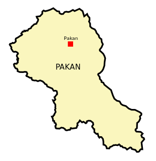
Pakan District is an administrative district in Sarikei Division, Sarawak, Malaysia, covering an area of 924.6 square kilometres (357.0 sq mi). The town of Pakan is the capital of the Pakan district, located 45 km from the town of Sarikei.

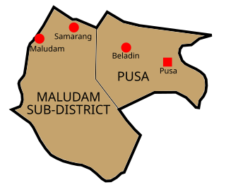
Pusa is a district, in Betong Division, Sarawak, Malaysia.

Betong is a district, in Betong Division, Sarawak, Malaysia. The city of Betong, which is the administrative centre of the larger Betong Division, is located in this district.

Bukit Mabong is a district, in Kapit Division, Sarawak, Malaysia.

Subis is a district of Malaysia in Miri Division, Sarawak.

Telang Usan is a newly established district, in Miri Division, Sarawak, Malaysia. This district was part of Long Lama sub-district which was formerly part of Marudi administrative district.

Serian is a district, in Serian Division, Sarawak, Malaysia.