Keningau is the capital of the Keningau District in the Interior Division of Sabah, Malaysia. It is the fifth-largest town in Sabah, as well one of the oldest. Keningau is between Tambunan and Tenom. The town had an estimated population of 173,130. Dusuns, Muruts and Lundayehs is the major ethnics in Keningau.
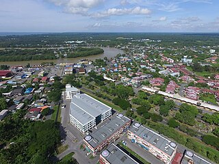
Kanowit is a town and the capital of Kanowit District, Sibu Division, Sarawak, Malaysia, comprising 2,253.5 square kilometres. As of 2010, Kanowit's population is 28,985. It is built on the mouth of Kanowit River at the bank of Rajang River, approximately 174 kilometers from the coast of South China Sea. It takes 45 minutes to reach the town by land transport and an hour by boat from Sibu. The main ethnic groups are Iban, Chinese, Malay, and Melanau.

Mukah Division is one of the twelve administrative divisions in Sarawak, Malaysia. It was established on 1 March 2002 and it has a total area of 6,997.61 square kilometres.

Rawang is a town and a mukim in Gombak District, Selangor, Malaysia, about 23 km northwest of city centre Kuala Lumpur.

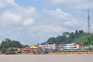
Dalat is the administrative town of the Dalat district in Mukah Division, Sarawak, Malaysia. It is situated by the Oya River.

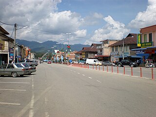
Machang is one of the ten districts in the state of Kelantan, Malaysia. It is situated at the centre of the state, bordering with Kelantanese territories of Kota Bharu to the north, Pasir Puteh to the east,Terengganu State to the southeast, Tanah Merah to the west and Kuala Krai to the south. Its major town and administrative centre is Machang town.
Pengkalan Hulu, formerly known as Kroh or Keroh, is a town and a mukim in Hulu Perak District, Perak, Malaysia, bordering Thailand and Kedah. The nearest town on the Thailand side is Betong in Yala province.

Kuala Krai District is a district (jajahan) in Kelantan, Malaysia. Historically, it was known as Kuala Lebir.

Tanah Merah District is a district (jajahan) in the state of Kelantan in northeast Peninsular Malaysia. The urban area of Tanah Merah is situated along the Kelantan River. It is bordered by Pasir Mas District in the north, Machang District to the east, Kuala Krai District to the south east, Jeli District to the south west and Thailand in the west.
Sekolah Menengah Kebangsaan Pengiran Omar is a secondary school located at the town of Sipitang, in the Interior Division of the state of Sabah, Malaysia. The school is listed as one of 90 pilot smart schools in Malaysia. This school has achieved several awards for their academic and co-curricular performance and have also broken a Malaysian record.
The Dalat District is located in Mukah Division, Sarawak, Malaysia. It is situated by the Oya river. The district covers areas from Kg. Penat to Oya, and from Muara Sg. Kut to Ulu Baoh. The district has an area of 905.29 km2, while the Oya sub-district has an area of 147.47 km2.
Mukah (muːkəh), historically known as Muka is a coastal town which has served as the capital and the administrative center of the Mukah Division since 1 March 2002.

Tebedu District is a district in the state of Sarawak, Malaysia. It is a part of Serian Division that consists of Serian, Siburan, and Tebedu districts. Before this, Tebedu District was a sub-district under Serian District which was then fully upgraded to a district in its own right. The majority of the population of this district is from the Bidayuh ethnic group.
Igan is a village and a subdistrict in Matu District, Mukah Division, Sarawak, Malaysia. It is situated near the mouth of Igan River with the South China Sea. Igan is about 50 kilometres to the west of Mukah, the division's administrative town, where as the nearest town is Oya with a distance of about 23 kilometres. Igan is a type of fish that can only find around the village.
Kampung Medong is a village located within Dalat District in Mukah Division, Sarawak. The village is located about 6.1 kilometres to the south of Dalat town.

Teluk Pulai is a modern residential and township located within the Klang town center in the state of Selangor, Malaysia. Teluk Pulai falls under the jurisdiction of the Klang Municipal Council (MPK) and divided by two DUN state assembly jurisdiction which is Bandar Baru Klang and Selat Klang.