Putrajaya, officially the Federal Territory of Putrajaya, is the administrative centre of Malaysia. The seat of the federal government of Malaysia was moved in 1999 from Kuala Lumpur to Putrajaya because of overcrowding and congestion in Kuala Lumpur, whilst the seat of the judiciary of Malaysia was later moved to Putrajaya in 2003. Kuala Lumpur remains as Malaysia's national capital city per the constitution and is still the seat of the head of state and the national legislature, as well as being the country's commercial and financial centre.

Kuala Terengganu, colloquially referred to as KT, is the administrative, economic and royal capital of the state of Terengganu, Malaysia. Kuala Terengganu is also the capital of Kuala Terengganu District. It is also the only royal capital among the nine royal states of the country to bear its state's name. Kuala Terengganu is located about 440 kilometres northeast of Kuala Lumpur on the East Coast of Peninsular Malaysia. The city is situated at the estuary of Terengganu River, facing the South China Sea.

Kuantan is a city and the state capital of Pahang, Malaysia. It is located near the mouth of the Kuantan River. Kuantan is the 18th largest city in Malaysia based on 2010 population and the largest city on the East Coast of Peninsular Malaysia.

Dungun is a coastal district of the Malaysian state of Terengganu. Kuala Dungun is the capital of the district. Dungun is made up of eleven 'mukim', or subdistricts: Abang, Besol, Jengai, Jerangau, Kuala Dungun, Kuala Paka, Kumpal, Pasir Raja, Rasau, Sura, and Hulu Paka.
Kota Tinggi is a town and capital of Kota Tinggi District, Johor, Malaysia. Kota Tinggi is also the name of the district, Kota Tinggi District, where the town is situated. Kota Tinggi is the largest district in Johor.

Mersing is a town, mukim and the capital of Mersing District, Johor, Malaysia. The town is located at the southern end of the east coast of Peninsular Malaysia. As of 2010, the town has an estimated population of 70,894.

Tumpat is a town, a district (jajahan) and parliamentary constituency in northern Kelantan, Malaysia, at the mouth of Kelantan River.

The Jeli District is a district and a parliamentary constituency in western Kelantan, Malaysia. As of 2010, the district's population is estimated to be 42,150. Jeli is administered by the Jeli District Council. Jeli is bordered by Perak's Hulu Perak District to the west, the Thai district of Waeng to the north, Tanah Merah District to the northeast and Kuala Krai District to the southeast.
The East Coast Expressway is an interstate controlled-access highway running parallel to the northeastern coast of Peninsular Malaysia. The currently operational 433-kilometre (269-mile) segment of the expressway runs through Karak, Pahang and Kuala Nerus, Terengganu.
Jerangau–Jabor Highway, Federal Route 14 is a 179.63-km federal highway running from the city of Kuala Terengganu, Terengganu, Malaysia to Kuantan, Pahang. The highway runs in parallel with the Federal Route 3 - while the FT3 highway is a coastal highway, the Jerangau–Jabor Highway FT14 runs through the interior area instead. Although the distance from Kuala Terengganu to Kuantan via both FT3 and FT14 highways are about the same, the Jerangau–Jabor Highway FT14 significantly shortens the travelling time due to fewer towns being passed. Therefore, the Jerangau–Jabor Highway FT14 became the main route from Pahang to Terengganu before the advent of the East Coast Expressway Phase 2 E8.
Second East–West Highway, also known as Simpang Pulai–Kuala Berang Highway, Federal Route 185 and Federal Route 36, is a highway in Peninsular Malaysia which connects Simpang Pulai in Perak to Kuala Jeneris in Terengganu. It overlaps with Federal Route 8 Federal Route 8 between Gua Musang and Sungai Relau. It is notorious for its many sharp corners which increase the risk of road accidents.

Gerik is a mukim and the district capital of Hulu Perak District, Perak, Malaysia. The town is also known as Rest Town due to its strategic location next to East-West Highway Federal Route 4, the main route linking Kedah, Penang and Kelantan.
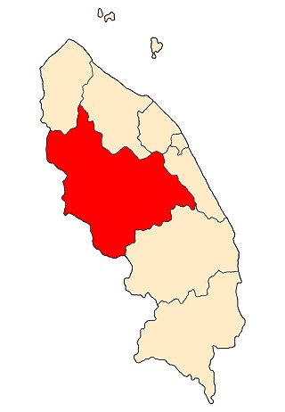
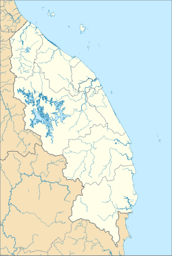
Hulu Terengganu is an interior district of Terengganu, Malaysia. The seat of the district is Kuala Berang, located about 40 km (25 mi) from the state capital, Kuala Terengganu. The local government of this district is Hulu Terengganu District Council.

Floods in Malaysia are one of the most regular natural disasters affecting the country, which occurs nearly every year especially during the monsoon season. The coasts of peninsular Malaysia are the most prone to flooding especially during the northeast monsoon season from October to March.

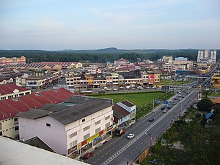
Ajil is a small town in the Penghulu Diman commune in Hulu Terengganu District of Terengganu, Malaysia.
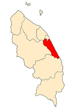
The Marang District is a coastal district in Terengganu, Malaysia. The district seat is the town of Marang. The districts that border Marang are Kuala Terengganu and Kuala Nerus to the north, Hulu Terengganu in the west, while Dungun is in the south. The eastern part of the district is a stretch of coastline facing the South China Sea.
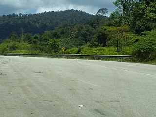
Federal Route 106, or Jalan Ajil-Kuala Berang, is a dual-carriageway federal highway in Terengganu, Malaysia.

The Terengganu Hanelang enters a club in Malaysian football competitions to represent the district of Hulu Terengganu. The team's homebase is located at Tasik Kenyir. They recently played in the third-tier division in Malaysian football, the Malaysia FAM League.
Kuala Berang is a state constituency in Terengganu, Malaysia, that has been represented in the Terengganu State Legislative Assembly.
Jerantut is a town in Jerantut District, Pahang, Malaysia. It is the largest district in the State of Pahang. It covers an area of 2,900 square miles. Bordered by the States of Kelantan and Terengganu in the North, Temerloh and Maran districts in the South, Kuala Lipis and Raub districts in the West and Kuantan district and Terengganu state in the East. It has 10 mukims consisting of 295 villages administered under 58 JKKK. Jerantut District Council was gazetted on 18 February 1982. Jerantut District Council, formerly known as Jerantut Town Board is the local authority of Jerantut town.