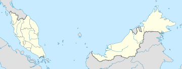
Terengganu, formerly spelled Trengganu or Tringganu, is a sultanate and constitutive state of federal Malaysia. The state is also known by its Arabic honorific, Dāru l-Īmān. The coastal city of Kuala Terengganu, which stands at the mouth of the broad Terengganu River, is both the state and royal capital as well as the largest city in Terengganu. There are many islands located close to the coast of Terengganu state, such as Perhentian Islands and Redang Island.

Kuala Terengganu, colloquially referred to as KT, is the administrative, economic and royal capital of the state of Terengganu, Malaysia. Kuala Terengganu is also the capital of Kuala Terengganu District. It is also the only royal capital among the nine royal states of the country to bear its state's name. Kuala Terengganu is located about 440 kilometres northeast of Kuala Lumpur on the East Coast of Peninsular Malaysia. The city is situated at the estuary of Terengganu River, facing the South China Sea.

Tutong or officially known as Tutong Town is a municipality town in Mukim Pekan Tutong Tutong District, Brunei. It is located about 40 kilometres (25 mi) from the country's capital Bandar Seri Begawan.
The East Coast Expressway East Coast Expressway is an interstate controlled-access highway running parallel to the northeastern coast of Peninsular Malaysia. The currently operational 433-kilometre (269-mile) segment of the expressway runs between Karak, Pahang and Kuala Nerus, Terengganu.

The Malaysia–Thailand border divides the countries of Malaysia and Thailand and consists of a land boundary running for 595 km (370 mi) across the Malay Peninsula and maritime boundaries in the Straits of Malacca and the Gulf of Thailand/South China Sea. The Golok River forms the easternmost 95 km stretch of the land border.

Kemaman is a district in Terengganu, Malaysia. Kemaman District is bordered by Dungun District to the north and the state of Pahang to the south and west. It is the southern gateway to the state of Terengganu.

Puchong is a major town and a parliamentary constituency in Petaling District, Selangor, Malaysia.
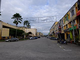
Chukai, also known by the name of Kemaman Town is a mukim and capital of Kemaman District, Terengganu, Malaysia.

Machang is one of the ten districts in the state of Kelantan, Malaysia. It is situated at the centre of the state, bordering with Kelantanese territories of Kota Bharu to the north, Pasir Puteh to the east,Terengganu State to the southeast, Tanah Merah to the west and Kuala Krai to the south. Its major town and administrative centre is Machang town.
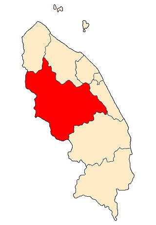
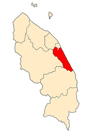
Hulu Terengganu is an interior district of Terengganu, Malaysia. The seat of the district is Kuala Berang, located about 40 km (25 mi) from the state capital, Kuala Terengganu. The local government of this district is Hulu Terengganu District Council.

Besut is a district in Terengganu, Malaysia. It is bordered by the state of Kelantan to the north and west and the South China Sea to the east. It is the northern gateway to Terengganu. Kampung Raja is the district capital, though Jerteh is more developed. Another major town is the fishing port of Kuala Besut. There are other small towns and villages such as Jabi, Apal, Pasir Akar and Tembila.
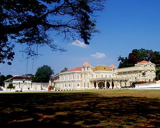
Istana Maziah is the official palace of the Sultan of Terengganu. It is located at the foot of Bukit Puteri in Kuala Terengganu, Terengganu, Malaysia. The palace is the official venue for important functions such as royal birthdays, weddings, conferment of titles and receptions for local and foreign dignitaries.

Anak Bukit is a mukim and the royal town of Kedah, Malaysia, located in Kota Setar District and falls under the jurisdiction of the Alor Setar City Council.

Bukit Jambul is a residential neighbourhood within the Northeast Penang Island District, Penang, Malaysia. Located 9.9 km (6.2 mi) southwest of the centre of George Town, the capital city of Penang, Bukit Jambul is also adjacent to the industrial town of Bayan Lepas to the south.
Ajil is a small town in the Penghulu Diman commune in Hulu Terengganu District of Terengganu, Malaysia.
The Marang District is a coastal district in Terengganu, Malaysia. The district seat is the town of Marang. The districts that border Marang are Kuala Terengganu and Kuala Nerus to the north, Hulu Terengganu in the west, while Dungun is in the south. The eastern part of the district is a stretch of coastline facing the South China Sea.

Pasir Mas District is a district (jajahan) in Kelantan, Malaysia. The district covers an area of 614.15 square kilometers and is bordered by the districts of Tumpat District to the north, Tanah Merah District to the south, Kota Bharu District to the east, and the Thai district of Su-ngai Kolok to the west.
Kuala Berang is a state constituency in Terengganu, Malaysia. It is currently represented in the Terengganu State Legislative Assembly.
Jabi is a state constituency in Terengganu, Malaysia. It is currently represented in the Terengganu State Legislative Assembly.