
Kuala Terengganu, colloquially referred to as KT, is the administrative, economic and royal capital of the state of Terengganu, Malaysia. Kuala Terengganu is also the capital of Kuala Terengganu District. It is also the only royal capital among the nine royal states of the country to bear its state's name. Kuala Terengganu is located about 440 kilometres northeast of Kuala Lumpur on the East Coast of Peninsular Malaysia. The city is situated at the estuary of Terengganu River, facing the South China Sea.

Mersing is a town, mukim and the capital of Mersing District, Johor, Malaysia. The town is located at the southern end of the east coast of Peninsular Malaysia. As of 2010, the town has an estimated population of 70,894.

Bekok is a mukim in Segamat District, Johor, Malaysia. It is the western entrance to Endau Rompin National Park and has a waterfall known as Sungai Bantang Waterfall. Bekok also houses several aborigine settlements (Perkampungan Orang Asli), such as Kampung Kudong and Kampung Kemidak.
Beserah is one of the Pahang state legislative assemblies located in Indera Mahkota, Kuantan District, Pahang, Malaysia and its position between the cities of Kuantan and Chukai with estimated total land area 300 square kilometers about almost same size with Federal Territories of Malaysia and two times larger than Liechtenstein. There are two mukim within this state assembly; mukim Beserah and mukim Sungai Karang.
Hulu Terengganu is an interior district of Terengganu, Malaysia. The seat of the district is Kuala Berang, located about 40 km (25 mi) from the state capital, Kuala Terengganu. The local government of this district is Hulu Terengganu District Council.

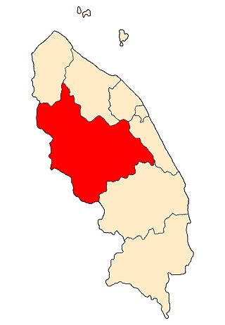
Setiu is one of the districts in Terengganu, Malaysia. This district is bordered by Besut to the north, Hulu Terengganu to the south, and on the east, Kuala Nerus District.

The Bandar Baharu District is a town, district and state assembly constituency at the southernmost end of Kedah, Malaysia. Bandar Baharu is located along the Kedah-Penang–Perak border tripoint, 37 km (23 mi) southeast of George Town, Penang's capital city.

Temenggor Lake is a lake in Hulu Perak District, Perak, Malaysia. It is the second largest lake in Peninsular Malaysia after Kenyir Lake in Hulu Terengganu District, Terengganu. This man-made lake is located south of the 1,533 m high Ulu Titi Basah peak. The lake was created by the construction of Temenggor Dam to generate electric power. The lake is located about 45 km from the Hulu Perak district capital, Gerik. There is a man-made island, Banding Island and Lake Temenggor Bridge on the East-West Highway which crosses the lake.

Kuala Ketil is a small town in Baling District, Kedah, Malaysia. Kuala Ketil is situated within the parliamentary constituency of Baling, in south-eastern Kedah. Kuala Ketil is a major economic area of Baling District.

Kampong Sungai Teraban is a village in Belait District, Brunei, near the district's principal town Kuala Belait. It has an area of 22 square kilometres (8.5 sq mi); the population was 1,082 in 2016. It is one of the administrative villages within Mukim Kuala Belait.

Rasau is an area in Brunei. The area contains one of the two oil fields of Brunei, the Rasau Field, and a small village, Kampong Rasau, which has a population of 103.

Mukim Burong Pingai Ayer is a mukim in Brunei-Muara District, Brunei. It is located within Kampong Ayer, the traditional stilt settlements on the Brunei River in the capital Bandar Seri Begawan. The population was 1,770 in 2016.

Mukim Sungai Kebun is a mukim in Brunei–Muara district, Brunei. It is part of Kampong Ayer, the traditional stilt settlements on the Brunei River in the capital Bandar Seri Begawan. The population was 4,750 in 2016.

Mukim Sukang is a mukim in Belait District, Brunei. The population was 169 in 2016.

Mukim Bangar is a mukim in Temburong District, Brunei. It has a total area of 113 square kilometres (44 sq mi); the population was 2,112 in 2021. The mukim encompasses Bangar, the district's sole town and administrative centre.
Kampung Sungai Memperas is a satellite village located in Sungai Bari, Setiu, Terengganu, Malaysia. The village is under the administration of JKKK Sungai Bari, which has full responsibility for the management and communication of information from the government to the people and to allocate funds and assistance delivered by the state or federal government.

Kampong Serasa is a village in Brunei-Muara District, Brunei, near the port town Muara. The population was 3,200 in 2016. It is home to Serasa Ferry Terminal, the country's primary international ferry terminal.
Tourism in Terengganu deals with attractions, events and facilities in Terengganu, Malaysia of special interest to tourists.

Setiu Wetlands is a wetland in Setiu District, Terengganu, Malaysia. It is part of the Setiu River basin, and also of the larger Setiu-Chalok-Bari-Merang basin wetland complex. Spread over 23,000 hectares, Setiu Wetlands is the largest natural wetlands in the East Coast region of Peninsular Malaysia, combining various ecosystems including freshwater, seawater, brackish water and a 14 km lagoon.

The Kingdom of Besut Darul Iman was a historical Malay Kingdom located in the northeastern coast of the Malay Peninsula, precursor of the present-day Besut District and most of Setiu, Terengganu. A principality of Terengganu, the state was established in 1780 following the crowning of a Terengganuan prince, Tengku Kadir as the Raja Palembang Besut. The House of Palembang, a cadet branch of Terengganu nobility continued to rule the territory before it was unified with Terengganu in 1899.