Setiu District | |
|---|---|
| Daerah Setiu | |
 Flag  Seal | |
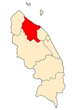 Location of Setiu District in Terengganu | |
 Setiu District Location of Setiu District in Malaysia | |
| Coordinates: 5°35′N102°45′E / 5.583°N 102.750°E | |
| Country | |
| State | |
| Seat | Bandar Permaisuri |
| Local area government(s) | Setiu District Council |
| Government | |
| • District officer | Haji Mohd Sophian bin Abu Bakar [1] |
| Area | |
• Total | 1,304.36 km2 (503.62 sq mi) |
| Population (2010) [3] | |
• Total | 54,405 |
| 61,700 | |
| • Density | 41.710/km2 (108.03/sq mi) |
| Time zone | UTC+8 (MST) |
| • Summer (DST) | UTC+8 (Not observed) |
| Postcode | 22xxx |
| Calling code | +6-09-6 |
| Vehicle registration plates | T |
Setiu is one of the districts in Terengganu, Malaysia. This district is bordered by Besut to the north, Hulu Terengganu to the south, and on the east, Kuala Nerus District.
Contents
- Etymology and history
- Demographics
- Administrative divisions
- Tourist attractions
- Federal Parliament and State Assembly Seats
- See also
- References
Setiu is the second youngest and least populated district in Terengganu. Its capital is Bandar Permaisuri which also serves as its economic and commercial centre. Other towns are Chalok, Sungai Tong, Guntong and Penarik.
