Kota Kinabalu, colloquially referred to as KK, is the state capital of Sabah, Malaysia. It is also the capital of the Kota Kinabalu District as well as the West Coast Division of Sabah. The city is located on the northwest coast of Borneo facing the South China Sea. The Tunku Abdul Rahman National Park lies to its west and Mount Kinabalu, which gave the city its name, is located to its east. Kota Kinabalu has a population of 452,058 according to the 2010 census; when the adjacent Penampang and Tuaran districts are included, the metro area has a combined population of 628,725. The 2020 Census revealed an increase in the municipal population to 500,421, while the wider area including the Penampang and Putatan districts had a population of 731,406.

Christianity is a minority religion in Malaysia. In the 2020 census, 9.1% of the Malaysian population identified themselves as Christians. About two-thirds of Malaysia's Christian population lives in East Malaysia, in the states of Sabah and Sarawak. Adherents of Christianity represent a majority (50.1%) of the population in Sarawak, which is Malaysia's largest state by land area. Christianity is one of four major religions, including Islam, Hinduism, and Buddhism, that have a freedom protected by the law in Malaysia based on diversity law especially in East Malaysia.

The Ranau District is an administrative district in the Malaysian state of Sabah, part of the West Coast Division which includes the districts of Kota Belud, Kota Kinabalu, Papar, Penampang, Putatan, Ranau and Tuaran. The capital of the district is in Ranau Town. The landlocked district bordering the Sandakan Division to the east until it meets the Interior Division border. Ranau sits 108 km (67 mi) east of Kota Kinabalu and 227 km (141 mi) west of Sandakan. As of the 2010 Census, the population of the district was 94,092, an almost entirely Dusun ethnic community.

Tambunan is the capital of the Tambunan District in the Interior Division of Sabah, Malaysia. Its population was estimated to be around 35,667 in 2010. It is located 80 kilometres east of the state capital, Kota Kinabalu, 48 kilometres south of Ranau and 48 kilometres north of Keningau. At an average altitude of 750 metres, this valley town, which is part of the Crocker Range, experiences a mild tropical climate all year long. The valley is peppered with terraced paddy fields and 70 villages. The dense forests of bamboo around Tambunan town are a legacy of the British colonial period, during which an edict stated that 20 bamboo sprouts had to be planted for every bamboo cut.

Inanam is a suburb and sub-district of Kota Kinabalu in Sabah, Malaysia. It is 10 kilometres from the city centre.

Menggatal or Manggatal is a Malaysian town and suburb of Kota Kinabalu District on the west coast of Sabah. It is an outskirt of the state capital, Kota Kinabalu, and is under the jurisdiction of Kota Kinabalu City Hall. It is located along Jalan Tuaran, which is the main road leading north from Kota Kinabalu city centre.
Divisions are the primary subdivisions of Sabah and Sarawak, the states in East Malaysia. Each division is subdivided into districts — this is different in Peninsular Malaysia whereby districts are generally the primary subdivisions of a state. Each division is headed by a resident.
The Beaufort District is an administrative district in the Malaysian state of Sabah, part of the Interior Division which includes the districts of Beaufort, Keningau, Kuala Penyu, Nabawan, Sipitang, Tambunan and Tenom. The population of Beaufort is composed mainly of Bisaya, Brunei Malays, Kadazan-Dusuns, Lun Bawang/Lun Dayeh, Muruts and Chinese.

The Keningau District is an administrative district in the Malaysian state of Sabah, part of the Interior Division which includes the districts of Beaufort, Keningau, Kuala Penyu, Nabawan, Sipitang, Tambunan and Tenom. The capital of the district is in Keningau Town. The town comprises a majority native Dusun as well as Murut population with significant Chinese minorities.
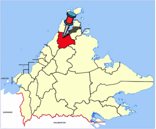
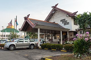
The Kota Marudu District is an administrative district in the Malaysian state of Sabah, part of the Kudat Division which includes the districts of Kota Marudu, Kudat and Pitas. The capital of the district is in Kota Marudu Town.

The Sandakan District is an administrative district in the Malaysian state of Sabah, part of the Sandakan Division which includes the districts of Beluran, Kinabatangan, Sandakan, Telupid, and Tongod. The capital of the district is in Sandakan City.

The Tawau District is an administrative district in the Malaysian state of Sabah, part of the Tawau Division which also includes the districts of Kunak, Lahad Datu, Semporna and Tawau. The capital of the district is in Tawau Town. The district also includes the northern half of Sebatik Island, which is shared with Indonesia's North Kalimantan province.

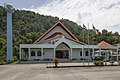
The Kota Belud District is an administrative district in the Malaysian state of Sabah, part of the West Coast Division which includes the districts of Kota Belud, Kota Kinabalu, Papar, Penampang, Putatan, Ranau and Tuaran. The capital of the district is in Kota Belud Town.

The Papar District is an administrative district in the Malaysian state of Sabah, part of the West Coast Division which includes the districts of Kota Belud, Kota Kinabalu, Papar, Penampang, Putatan, Ranau and Tuaran. The capital of the district is in Papar Town.

The Penampang District is an administrative district in the Malaysian state of Sabah, part of the West Coast Division which includes the districts of Kota Belud, Kota Kinabalu, Papar, Penampang, Putatan, Ranau and Tuaran. The capital of the district is in Penampang Town.

The Putatan district is an administrative district in the Malaysian state of Sabah, part of the West Coast Division which includes the districts of Kota Belud, Kota Kinabalu, Papar, Penampang, Ranau and Tuaran. The capital of the district is in Putatan Town.

The Tuaran District is an administrative district in the Malaysian state of Sabah, part of the West Coast Division which includes the districts of Kota Belud, Kota Kinabalu, Papar, Penampang, Putatan, Ranau and Tuaran. The capital of the district is in Tuaran Town.