Bandar Baharu District

Last updated
Bandar Baharu District
Daerah Bandar Baharu
Other transcription(s)
   Chinese 万拉峇鲁县
   Tamil பண்டார் பாரு
The Seal of Bandar Baharu District Council.png
Bandar Baharu highlighted in Kedah, Malaysia.svg
Location of Bandar Baharu District in Kedah
Bandar Baharu District
Malaysia location map with districts.svg
Red pog.svg
Bandar Baharu District
Location of Bandar Baharu District in Malaysia
Coordinates: 5°10′N100°35′E / 5.167°N 100.583°E / 5.167; 100.583
Country Flag of Malaysia 23px.svg  Malaysia
State Flag of Kedah.svg  Kedah
Seat Serdang
Local area government(s)Bandar Baharu District Council
Government
  District officerN/A
Area
[1]
  Total271.27 km2 (104.74 sq mi)
Population
 (2010) [2]
  Total41,659
  Density150/km2 (400/sq mi)
Time zone UTC+8 (MST)
  Summer (DST) UTC+8
Postcode
098xx
Calling code +6-04
Vehicle registration plates K
Bandar Baharu District Council

Majlis Daerah Bandar Baharu
The Seal of Bandar Baharu District Council.png
Type
Type
History
Founded1 March 1979
Leadership
President
Elmi Yusoff
District Secretary
Muhammad Afnan Mohd Roze
Meeting place
09800 Serdang, Kedah Darul Aman
Website
pbt.kedah.gov.my/index.php/majlis-daerah-bandar-baharu/

The Bandar Baharu District (colloquially Bandaq Baqhu or Bandaq Baru; once proposed to be renamed as Bandar Crustacea [3] ) is a district containing a town of the same name and a state assembly constituency at the southernmost end of Kedah, Malaysia. The Bandar Baharu District is located along the Kedah-Penang-Perak border tripoint, 37 km (23 mi) southeast of George Town, Penang's capital city.

Contents

Due to its proximity to Penang, the Bandar Baharu District is considered to be part of Greater Penang, Malaysia's second-largest conurbation. The district's logistical needs are met by Penang's transportation infrastructure.

The Bandar Baharu District Council (Majlis Daerah Bandar Baharu, MDBB) administers the district. This district covers an area of 168.3 km2 and consists of seven sub-districts: Serdang, Kuala Selama, Sungai Batu, Bagan Samak, Permatang Pasir, Sungai Kecil Ilir and Relau. Serdang, a 20 km drive away from the town of Bandar Baharu, is the district capital and administrative center of the Bandar Baharu District. The district is the southernmost and second smallest local government area in Kedah.

The district borders the South Seberang Perai district to the east, the Larut, Matang and Selama and Kerian districts in the south and the Kulim district to the north.

Administrative divisions

Map of Bandar Baharu District Map of Bandar Baharu District, Kedah.svg
Map of Bandar Baharu District

Bandar Baharu District is divided into 6 mukims (administrative divisions), which are: [1]

Sub-districts

Serdang

  1. Serdang
  2. Taman Serdang
  3. Taman Aked
  4. Taman Cempaka
  5. Taman Kenanga
  6. Taman Melur
  7. Perumahan Awam 1
  8. Perumahan Awam 2
  9. Kampung Sungai Punti
  10. Kampung Ayer Itam
  11. Kampung Badlisha
  12. Kampung Bangol Durian
  13. Kampung Bangol Limau
  14. Kampung Baru Serdang
  15. Kampung Batu 8
  16. Kampung Batu 10
  17. Kampung Batu 12
  18. Kampung Batu 16
  19. Kampung Batu 18
  20. Kampung Batu Ayer Putih
  21. Kampung Batu Hampar
  22. Kampung Batu Lintang
  23. Kampung Bendang Sera
  24. Kampung Bukit Aping
  25. Kampung Bulikt Buluh
  26. Kampung Cina
  27. Kampung Chelong
  28. Kampung Durian Burung
  29. Kampung Ee Guan
  30. Kampung Jalan Selama
  31. Kampung Jermai
  32. Kampung Kuala Air Puteh
  33. Kampung Kuala Dingin
  34. Kampung Leret
  35. Kampung Medan
  36. Kampung Paya Salak
  37. Kampung Pekan Lama
  38. Kampung Setali
  39. Kampung Sungai Buluh
  40. Kampung Sungai Kasai
  41. Kampung Sungai Saleh
  42. Kampung Sungai Setol
  43. Kampung Sungai Taka
  44. Kampung Sungai Tegas
  45. Kampung Sungai Tegas Terap
  46. Kampung Telok Kelian
  47. Kampung Telok Sera
  48. Kampung Tengah
  49. Kampung Terap
  50. Kampung Titi Akar
  51. Ladang Chim Khoon
  52. Ladang Somme
  53. Ulu Riau

Bagan Samak

  1. Bandar Baharu
  2. Kampong Permatang Kerat Telunjuk
  3. Kampong Baru Bagan Samak
  4. Kampung Kubu, Parit Nibong
  5. Kampung Sg. Tepus/Pasir Debu
  6. Kampung Bukit Aping
  7. Kampung Parit Teropong
  8. Kampung Sg. Kechil Ulu
  9. Kampung Parit Nibong/Asam Kumbang
  10. Kampung Bagan Samak
  11. Kampung Rumah Murah/Tebuk Mat Rashid
  12. Kampung Lubok Buntar
  13. Kampung Berjaya Batu 26
  14. Kampung Permatang Simpor
  15. Kampung Permatang Pasir
  16. Taman Berlian Indah
  17. Taman Cahaya Nilam
  18. Taman Cahaya Intan
  19. Taman Kelisa Emas
  20. Taman Impian Casa Mutiara
  21. Taman Cahaya Kristal
  22. Taman Sejahtera
  23. Taman Sentosa

Sungai Batu

  1. Kampung Kuala Dingin
  2. Kampung Sg. Itam Dalam
  3. Kampung Sg. Tengas
  4. Kampung Terap Dalam
  5. Kampung Seribu Relong
  6. Kampung Baru Selama
  7. Kampung Selama Luar
  8. Kampung Sungai Tengas Ilir
  9. Kampung Chong Meng

Relau

  1. Kampong Tengah Relau
  2. Kampong Ulu/Relau
  3. Kampong Padang
  4. Kampong Sungai Rambai
  5. Kampong 300 Kaki Relau
  6. Kampong Kilang Batu
  7. Kampong Paya Semambu
  8. Taman Relau Indah

Sungai Kechil Ilir

  1. Kampung Belakang Pekan (Kampung Masjid)
  2. Kampung Keda
  3. Kampung Balai Lama
  4. Kampung Padang

Demographic

Historical population
YearPop.±%
1991 33,006    
2000 37,963+15.0%
2010 41,352+8.9%
2020 44,412+7.4%
Source: [4]

Tourism And Recreation

  1. Seri Tasik Park
    This park in Serdang town was originally an inactive mine that was redeveloped as a recreation garden with a children’s playground and exercise equipment with a budget allocated by the National Landscaping Department. A budget for further development from the Ministry of Culture, Art and Tourism of Malaysia was granted for the construction of a new wakaf (traditional wooden pavilion); providing picnic tables and chairs; building concrete bridges to link two lakes; a new pedestrian pathway; and decorative lights around the park.[ citation needed ]
  2. Batu Hampar Recreation Jungle Air Puteh, Serdang
  3. Kerian River Bank
  4. Sawah Padi
  5. Bagan Samak

Federal Parliament and State Assembly Seats
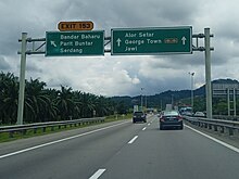
Bandar Baharu district representatives in the Federal Parliament (Dewan Rakyat)
ParliamentSeat NameMember of ParliamentParty
P18 Kulim-Bandar Baharu Roslan Hashim Perikatan Nasional (BERSATU)
Bandar Baharu district representatives in the State Legislative Assembly (Dewan Undangan Negeri)
ParliamentStateSeat NameState AssemblymanParty
P18N35 Kulim Wong Chia Zhen Perikatan Nasional (GERAKAN)
P18N36 Bandar Baharu Muhammad Suffian Yusoff Perikatan Nasional (PAS)

Transportation

Bandar Baharu Interchange (Exit 153). Bandar Baharu Interchange (Exit 153) Northbound, NSE 20230628 130110.jpg
Bandar Baharu Interchange (Exit 153).

Car

PLUS Mes-e1.svg North–South Expressway Northern Route exit 153 serves Bandar Baharu.

Public transportation

KTM Intercity does not directly enter Bandar Baharu. The closest station is in Parit Buntar, Perak.

Related Research Articles

<span class="mw-page-title-main">Kajang</span> City in Selangor, Malaysia

Kajang is a town in Hulu Langat District, Selangor, Malaysia, located southeast of Kuala Lumpur. Kajang, along with much of Hulu Langat District, is governed by the Kajang Municipal Council. Kajang town is located on the eastern banks of the Langat River. It is surrounded by Cheras, Semenyih, Bangi, Putrajaya and Serdang.

<span class="mw-page-title-main">Kedah</span> State of Malaysia

Kedah, also known by its honorific Darul Aman and historically as Queda, is a state of Malaysia, located in the northwestern part of Peninsular Malaysia. The state covers a total area of over 9,000 km2, and consists of a mainland portion and the Langkawi islands. The mainland has relatively flat terrain, which is used to grow rice, while Langkawi is composed of mostly of uninhabited islands.

<span class="mw-page-title-main">Batu Pahat District</span> District in Johor, Malaysia

The Batu Pahat District is a district in the state of Johor, Malaysia. It lies southeast of Muar, southwest of Kluang, northwest of Pontian, south of Segamat and Tangkak District. The capital of the district is Bandar Penggaram.

<span class="mw-page-title-main">North–South Expressway Northern Route</span> Major interstate expressway in Malaysia

The North–South Expressway Northern Route is an interstate controlled-access highway running parallel to the northwestern coast of Peninsular Malaysia. The 460-kilometre (290-mile) expressway forms the north section of the North–South Expressway, passing through the northwestern states of Kedah, Penang, Perak and Selangor. The expressway begins at the Bukit Kayu Hitam checkpoint in Kedah, where the Malaysia–Thailand border lies, and ends at Bukit Lanjan in Selangor state where the expressway interchanges with the New Klang Valley Expressway. The expressway is operated by PLUS Expressways.

<span class="mw-page-title-main">Parit Buntar</span> Town and district capital in Kerian, Perak, Malaysia

Parit Buntar is a town in Kerian District, Perak, Malaysia. It is bordering to Nibong Tebal in Penang and Bandar Baharu in Kedah.It is also the district capital of Kerian District.

<span class="mw-page-title-main">Kerian River</span> River in Kedah and Perak, Malaysia

The Kerian River, alternately Krian, is a river in the northern part of the Malaysian state of Perak. The river originates from the Bintang Range. It flows westerly and discharges into the Strait of Malacca. The main tributaries are the Selama River, Ijok River, Samagagah River and Ulu Mengkuang River.

<span class="mw-page-title-main">Community college (Malaysia)</span>

The community college system in Malaysia provides a wide range of Technical and Vocational Education Training (TVET) courses. Disciplines covered include accounting, architecture, construction, engineering, draughting, entrepreneurship, hospitality, personal services, multimedia, and visual arts.

<span class="mw-page-title-main">Sungai Lalang</span> Town in Kuala Muda, Kedah, Malaysia

Sungai Lalang is a small town in Kuala Muda District, Kedah, Malaysia. It is located 5 kilometer north from Sungai Petani. Sg. Lalang River situated in this town flows into the Merbok River.

<span class="mw-page-title-main">Batu Pahat Municipal Council</span>

Batu Pahat Municipal Council is a local authority which administrates West Batu Pahat District in Johor, Malaysia. This agency is under Johor state government. MPBP are responsible for public health and sanitation, waste removal and management, town planning, environmental protection and building control, social and economic development and general maintenance functions of urban infrastructure. The MPBP main headquarters is located at Jalan Pejabat, Bandar Penggaram, Batu Pahat.

<span class="mw-page-title-main">Greater Penang Conurbation</span> Metropolitan area in Malaysia

The Greater Penang Conurbation, also known as the George Town Conurbation, is the built-up urban or metropolitan area within and around the Malaysian state of Penang. Encompassing all of Penang, and parts of the neighbouring states of Kedah and Perak, the conurbation was home to over 2.84 million people as of 2020, the second largest in the country after the Klang Valley.

Elections in Selangor have been held in the Malaysian state of Selangor since 1954 and have chosen Selangor's elected representatives in the Dewan Rakyat and Dewan Undangan Negeri.

The following is an alphabetical list of articles related to Selangor.

<span class="mw-page-title-main">Sungai Kluang</span> Mukim in Johor, Malaysia

Mukim Sungai Kluang or Sungai Keluang is a mukim located in Batu Pahat District in Johor, Malaysia. Batu Pahat District was divided into 14 mukims, each of which encompasses several villages. The population was 16,591 in 2010. The majority ethics of the population in the Sungai Kluang is Malay (11,854). It border with Mukim Benut, Pontian District in east and Mukim Sungai Punggor in west.

<span class="mw-page-title-main">Kuala Langat Municipal Council</span>

Kuala Langat Municipal Council is the municipal council which administers Kuala Langat District. This agency is under the purview of Selangor state government.

References

  1. 1 2 "Laman Web Rasmi Pejabat Daerah Bandar Baharu - Mengenai Kami". pdbb.kedah.gov.my. Archived from the original on 2017-12-01. Retrieved 2017-11-26.
  2. "Population Distribution and Basic Demographic Characteristics, 2010" (PDF). Department of Statistics, Malaysia. Archived from the original (PDF) on 22 May 2014. Retrieved 19 April 2012.
  3. "Warga Kedah Sifatkan Keputusan MB Tukar Nama Bandar Baharu Sebagai 'Penyundalan' Bahasa Melayu". Suara.tv. Archived from the original on 2 March 2016. Retrieved 18 February 2016.
  4. "Key Findings of Population and Housing Census of Malaysia 2020" (pdf) (in Malay and English). Department of Statistics, Malaysia. ISBN   978-967-2000-85-3.