Mersing Merecing/Ngesing (Terengganu Malay) | |
|---|---|
Town and district capital | |
| Mersing Town Bandar Mersing | |
Mersing Bridge Mersing Harbour Centre Mersing monument Mersing Town Mosque | |
 Coat of arms | |
| Motto(s): Perkhidmatan Untuk Rakyat "Service For The People" (motto of Mersing District Council) | |
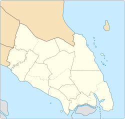 Mersing Mersing in Johor  Mersing Mersing (Peninsular Malaysia)  Mersing Mersing (Malaysia) | |
| Coordinates: 2°26′N103°50′E / 2.433°N 103.833°E | |
| Country | |
| State | |
| District | Mersing |
| Government | |
| • Type | Local government |
| • Body | Mersing District Council |
| • President | Abdul Karim Bakar (since 16 October 2025) |
| Area | |
• Total | 761.47 km2 (294.01 sq mi) |
| Population (2010) | |
• Total | 70,894 |
| • Density | 93.102/km2 (241.13/sq mi) |
| Postcode | 86800 |
| Vehicle registration | J |
| Website | www |


Mersing District Council Majlis Daerah Mersing | |
|---|---|
 Emblem | |
| Type | |
| Type | |
| History | |
| Founded | 26 May 1977 |
| Leadership | |
President | Abdul Karim Bakar (since 16 October 2025) [1] |
Secretary | Muhammad Lufti Abas [2] |
| Structure | |
| Seats | 24 |
Political groups | Councillors: |
Length of term | 1 April 2024–31 December 2025 |
| Motto | |
| Perkhidmatan Untuk Rakyat (Service for the People) | |
| Meeting place | |
 | |
| No. 1 Jalan Tun Dr. Ismail, 86800 Mersing, Johor Darul Takzim | |
| Website | |
| www | |
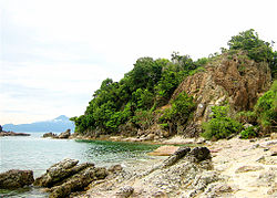
Mersing (Terengganu Malay: Merecing or Ngesing) is a town, mukim and the capital of Mersing District, Johor, Malaysia. The town is located at the southern end of the east coast of Peninsular Malaysia. As of 2010, the town has an estimated population of 70,894. [3]
Mersing town is particularly significant for a number of reasons: it is one of only two major towns in the eastern half of Johor state (the other being Kota Tinggi); it lies on the main trunk road that connects southern as well as eastern Johor with the east coast of Pahang state including Pahang's capital Kuantan (part of Federal Route; and it is the main departure point for ferries to the nearby offshore islands such as Rawa Island of Sultan Iskandar Marine Park (Malay: Taman Laut Sultan Iskandar) and also Tioman Island, Pahang.