Tebrau | |
---|---|
Town in Malaysia | |
Other transcription(s) | |
• Chinese | 地不佬 |
Coordinates: 1°32′N103°45′E / 1.533°N 103.750°E | |
Country | Malaysia |
State | Johor |
District | Johor Bahru |
Time zone | UTC+8 (MYT) |
Postal code | 71500 |
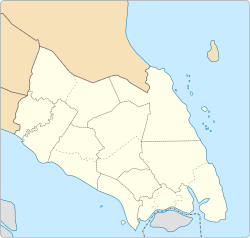
Tebrau or Teberau is a mukim and a town in Johor Bahru District, Johor, Malaysia. [1] It is the third largest mukim in the district. [2]
The mukim is accessible by Causeway Link route 6B from Johor Bahru Sentral railway station. [3]
The Johor Bahru District is a district located in the southern part of Johor, Malaysia. The heavily suburban/suburbanizing district covers an area of 1,063.97 km2 (410.80 sq mi) and has a population of 1.71 million. The district capital is Johor Bahru City and the administrative capital is Iskandar Puteri City. The district borders Pontian District on the west, Kota Tinggi District on the east, Kulai District on the north and Straits of Johor to the south. The urban centres are divided into the cities of Johor Bahru, Iskandar Puteri and Pasir Gudang.
Johor Bahru, Malaysia, has the following notable landmarks.
Skudai is a town in Johor, Malaysia. It is about 13 km northwest from Johor Bahru's central business district.
Ulu Tiram is a suburb in Johor Bahru, Johor, Malaysia. The town lies along Tebrau Highway, a section of Malaysia Federal Route 3, at the junction which leads to Ulu Tiram. As a major trunk road on Peninsular Malaysia's east coast, Federal Route 3 connects Ulu Tiram with major east coast towns and cities such as Mersing, Pekan, Kuantan, Kuala Terengganu and Kota Bharu. Ulu Tiram is easily accessible through the Tebrau Highway, Jalan Kota Tinggi trunk road, and the Senai–Desaru Expressway.
Johor Bahru–Kota Tinggi Highway (Malay: Lebuhraya Johor Bahru–Kota Tinggi), Federal Route 3, also known as Tebrau Highway (Jalan Tebrau) and Jalan Kota Tinggi is a highway that encompasses Federal Route 3 in Johor Bahru, Malaysia. Part of Asian Highway Route AH18, the highway stretches from its southern end at Jalan Wong Ah Fook and Jalan Tun Abdul Razak in the metropolitan area of Johor Bahru to the northern end at the underpass flyover with North–South Expressway Southern Route and Johor Bahru Eastern Dispersal Link Expressway around Pandan. The stretch of Tebrau Highway after this continues as Jalan Pandan and Jalan Kota Tinggi respectively, beyond Pandan. The highway became the backbone of the Johor Bahru road system linking Pandan to the city centre, and to the Johor–Singapore Causeway, before being surpassed by the Johor Bahru Eastern Dispersal Link Expressway in 2012.
Puchong is a major town and a parliamentary constituency in Petaling District, Selangor, Malaysia.
Chaah is a town and mukim in Segamat District, Johor, Malaysia. It is the southernmost mukim in the district, but it is administered as a suburb of Labis.
Setia Indah is a township in Johor Bahru, Johor, Malaysia.
The Bandar Baharu District is a town, district and state assembly constituency at the southernmost end of Kedah, Malaysia. Bandar Baharu is located along the Kedah-Penang–Perak border tripoint, 37 km (23 mi) southeast of George Town, Penang's capital city.
The Pasir Gudang City Council is the city council which administrates Pasir Gudang in Johor Bahru District, Johor, Malaysia. This agency is under Johor state government. MBPG is responsible for public health and sanitation, waste removal and management, town planning, environmental protection and building control, social and economic development and general maintenance functions of urban infrastructure. The MBPG main headquarters is located at Pasir Gudang.
Batu Pahat Municipal Council is a local authority which administrates West Batu Pahat District in Johor, Malaysia. This agency is under Johor state government. MPBP are responsible for public health and sanitation, waste removal and management, town planning, environmental protection and building control, social and economic development and general maintenance functions of urban infrastructure. The MPBP main headquarters is located at Jalan Pejabat, Bandar Penggaram, Batu Pahat.
Iskandar Malaysia, formerly known as Iskandar Development Region (IDR; Malay: Wilayah Pembangunan Iskandar) and South Johor Economic Region (SJER), is the main southern development corridor in Johor, Malaysia. It was established on 8 November 2006. Iskandar Malaysia, which is formed by major cities such as Johor Bahru, Iskandar Puteri and Pasir Gudang, is part of the Johor Bahru Conurbation. It also lies within the original Indonesia–Malaysia–Singapore growth triangle, along with Singapore and Riau, Indonesia.
Gombak is a town and locality in the mukim of Setapak in the coterminous Gombak District, Selangor, Malaysia.
Taman Pulai Mutiara is a township in the Mukim Pulai, city of Iskandar Puteri, district of Johor Bahru, State of Johor Darul Ta'zim, Malaysia. The township is bordered by Pulai Indah and Laman Indah to the north, and Alam Jaya Business Park, Setia Business Park and Tropicana Upland to the south. The rest area on it perimeter is covered in green. This township is being developed since 2016, and ready for occupation from 2018 onward.
Pulai Indah is a township in the north of Mukim Pulai, city of Iskandar Puteri, district of Johor Bahru, State of Johor Darul Ta'zim, Malaysia. The township is bordered by Pulai Hijauan and Bandar Baru Kangkar Pulai to the north, and Pulai Mutiara to the south. The rest area on it perimeter is covered in green. This township is being developed by Huayang Berhad since 2008, and ready for occupation from 2010 onward.
Pulai is a suburban area in the city of Iskandar Puteri, Mukim Pulai, district Johor Bahru, state of Johor, Malaysia
Kuala Langat Municipal Council is the municipal council which administers Kuala Langat District. This agency is under the purview of Selangor state government.