Parit Raja

Last updated
Parit Raja
Township
Parit Raja.JPG
Flag of Johor.svg
Batu Pahat Emblem.svg
Malaysia location map.svg
Red pog.svg
Parit Raja
Location in Malaysia
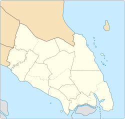
Johor location map.svg
Red pog.svg
Parit Raja
Parit Raja (Johor)
Coordinates: 1°51′45″N103°06′25″E / 1.86250°N 103.10694°E / 1.86250; 103.10694
Country Malaysia
State Johor
City Batu Pahat
Government
  TypeMayor-council government
  BodyBatu Pahat Municipal Council
   Local Authority Ezahar Abu Sairin
Time zone UTC+8 (MST)
Postcode
86400
Dialling code +607
Police Batu Pahat
Fire Batu Pahat / Ayer Hitam

Parit Raja is a town in Batu Pahat District, Johor, Malaysia. The main population of this town and its surrounding areas has been resided by Malay with Javanese descent, besides the Chinese population.

This locality has a unique diversification spanning from foods and cultures. There is lots of restaurant that serves Indian Muslim (colloquially known as "Mamak"), Chinese, Southern Malay and Northern Malay cuisines. This locality also serves as an important marketplace and commercial centre, few examples are, Pasar Isnin-Khamis, Pasar Rabu, making it a hotspot for local farmers, street food hawkers and commercial businesses.

In recent years, the town has seen substantial growth due to the rapid expansion of Universiti Tun Hussein Onn Malaysia (UTHM) and a few other higher education institutions. Thus, Parit Raja observes rapid growth in economic and social quality development. Parit Raja also has been entitled as the “Education Hub” for the southern state of Johor.

Geography

Taman Siswa Jaya is a mix residential and commercial just 1 kilometer from UTHM's main entrance and 1.5 km from downtown Parit Raja. It is situated along the trunk road (KM20 Jalan Kluang) in between UTHM and Parit Raja town.

A few examples of neighbourhood that exist in Parit Raja are Kampung Parit Londang, Kampung Parit Bingan, Kampung Parit Haji Ali, Kampung Sungai Rambutand Kampung Seri Dalam

Approximately 23 km away from Bandar Penggaram, Batu Pahat, capital of Batu Pahat district and 7 kilometres away from Ayer Hitam. It is about 10 minutes from the North South Expressway (NSE) Ayer Hitam Exit (KM80) and 20 minutes from Bandar Penggaram. Along the way to Parit Raja, you will pass by many villages and most of them are named after a "Parit", which means "Trench' in English, due to the relatively flat terrain and abundant waterways.The town spans over an area of 19.6 km2. [1]

Related Research Articles

<span class="mw-page-title-main">Batu Pahat District</span> District in Johor, Malaysia

The Batu Pahat District is a district in the state of Johor, Malaysia. It lies southeast of Muar, southwest of Kluang, northwest of Pontian, south of Segamat and Tangkak District. The capital of the district is Bandar Penggaram.

<span class="mw-page-title-main">Parit Sulong</span> Place in Johor, Malaysia

Parit Sulong is a small town in Batu Pahat District, Johor, Malaysia on the Simpang Kiri River, 30 km (19 mi) east of Muar. The historical Parit Sulong Bridge constructed during World War II is a main feature in that town. Parit Sulong sits approximately 18 km (11 mi) from Bandar Penggaram, Batu Pahat, capital of Batu Pahat district.

<span class="mw-page-title-main">Mersing</span> Town and district capital in Johor, Malaysia

Mersing is a town, mukim and the capital of Mersing District, Johor, Malaysia. The town is located at the southern end of the east coast of Peninsular Malaysia. As of 2010, the town has an estimated population of 70,894.

<span class="mw-page-title-main">Ayer Hitam</span> Town of Malaysia in Johor

Ayer Hitam, nicknamed Bandar Seramik, is a town in Batu Pahat District, Johor, Malaysia. Located just at the junction of Federal Route 1 and Federal Route 50, it is known for its many outlets selling pottery and other crafts. It also is one of the interchange for North–South Expressway.

<span class="mw-page-title-main">Yong Peng</span> Township in Johor, Malaysia

Yong Peng is a town in Mukim Tanjung Semberong, Batu Pahat District, Johor, Malaysia. It has an area of 1911.6 hectares with an estimated population of 29,046.

<span class="mw-page-title-main">Minyak Beku</span>

Minyak Beku is a mukim in Batu Pahat District, Johor, Malaysia.

<span class="mw-page-title-main">Tun Hussein Onn University of Malaysia</span>

Tun Hussein Onn University of Malaysia is a public university in Batu Pahat, Johor, Malaysia. It was formerly known as the Tun Hussein Onn Institute of Technology and the Tun Hussein Onn University College of Technology. Along with other public university colleges, KUiTTHO was promoted to full university status since year 2007. The name UTHM was officially launched by the then education minister, Dato' Seri Hishammuddin Bin Tun Hussein.

<span class="mw-page-title-main">Sri Gading</span> Suburb of Batu Pahat in Johor, Malaysia

Sri Gading or Seri Gading is a mukim and parliamentary constituency in Batu Pahat District, Johor, Malaysia, located along Jalan Batu Pahat-Kluang. It lies south-east of Batu Pahat town, north-west of Ayer Hitam and west of Yong Peng. It is also a name of one of 14 parishes in Johor.

<span class="mw-page-title-main">Taman Flora Utama</span>

Taman Flora Utama is a township in Bandar Penggaram, Batu Pahat, Johor, Malaysia. It was constructed in 2005. Taman Flora Utama is located beside Jalan Tan Siew Hoe. The new township is developing rapidly. This township is mainly for shopping, leisure and commercial activities.

Taman Bukit Pasir is a township in Bandar Penggaram, Batu Pahat, Johor, Malaysia. This township is mainly for finance, banking, and commercial activities. Development of the township began in the early 1990s. Taman Bukit Pasir is located along Jalan Bukit Pasir and Jalan Tan Siew Hoe. The township is developing rapidly. There are many shophouses and houses in this township. A shopping area, Wira Court, is also located in this township.

<span class="mw-page-title-main">Batu Pahat Mall</span> Shopping mall in Batu Pahat, Johor, Malaysia

Batu Pahat Mall is a shopping mall in Batu Pahat Town, Batu Pahat District, Johor, Malaysia. The mall is located at Federal Route 50.

<span class="mw-page-title-main">Muar District</span> District in Johor, Malaysia

The Muar District is a district in Johor, Malaysia. Muar is located at the mouth of the Muar River, on the coast of the Straits of Malacca. The Muar District covers 1,354 km2 (523 sq mi), with a population of 233,779 (2010).

<span class="mw-page-title-main">Muar (town)</span> Royal capital and district capital in Johor, Malaysia

Muar or Bandar Maharani, is a historical town and the capital of Muar District, Johor, Malaysia. It is one of the most popular tourist attractions in Malaysia to be visited and explored for its food, coffee and historical prewar buildings. It was recently declared as the royal town of Johor by Sultan Ibrahim Sultan Iskandar and is the fourth largest urban area in Johor. It is the main and biggest town of the bigger entity region or area of the same name, Muar which is sub-divided into the Muar district and the new Tangkak district, which was upgraded into a full-fledged district from the Tangkak sub-district earlier. Muar district as the only district covering the whole area formerly borders Malacca in the northern part. Upon the upgrading of Tangkak district, the Muar district now covers only the area south of Sungai Muar, whilst the northern area beyond the river is in within Tangkak district. However, both divided administrative districts are still collectively and fondly called and referred to as the region or area of Muar as a whole by their residents and outsiders. Currently, the new township of Muar is located in the Bakri area.

Batu Pahat (BP) is a town and capital of Batu Pahat District, Johor, Malaysia. It lies south-east of Muar, south-west of Kluang, north-west of Pontian and south of Segamat. The town area is located inside Simpang Kanan parishes.

<span class="mw-page-title-main">Batu Pahat Municipal Council</span>

Batu Pahat Municipal Council is a local authority which administrates West Batu Pahat District in Johor, Malaysia. This agency is under Johor state government. MPBP are responsible for public health and sanitation, waste removal and management, town planning, environmental protection and building control, social and economic development and general maintenance functions of urban infrastructure. The MPBP main headquarters is located at Jalan Pejabat, Bandar Penggaram, Batu Pahat.

<span class="mw-page-title-main">Linau, Johor</span> Parish / Mukim in Johor, Malaysia

Linau Mukim is a mukim located in Batu Pahat district in Johor. Batu Pahat district is divided into 14 parishes, each of which encompasses several villages.

<span class="mw-page-title-main">Kampung Bahru</span> Mukim in Johor, Malaysia

Mukim Kampung Bahru or Kampong Bahru is a mukim located in Batu Pahat District in Johor, Malaysia. Batu Pahat District was divided into 14 mukims, each of which encompasses several villages. The population was 11,997 in 2010. The majority ethics of the population in the Kampung Bahru is Malay (9,286).

<span class="mw-page-title-main">Sungai Punggor</span> Mukim in Johor, Malaysia

Mukim Sungai Punggor or Sungai Punggur is a mukim located in Batu Pahat District in Johor, Malaysia. Batu Pahat District was divided into 14 mukims, each of which encompasses several villages. The population was 10,417 in 2010. The majority ethics of the population in the Sungai Punggor is Malay (8,887). The nearby towns is Bandar Rengit (east) and Bandar Senggarang (west).

<span class="mw-page-title-main">Sungai Kluang</span> Mukim in Johor, Malaysia

Mukim Sungai Kluang or Sungai Keluang is a mukim located in Batu Pahat District in Johor, Malaysia. Batu Pahat District was divided into 14 mukims, each of which encompasses several villages. The population was 16,591 in 2010. The majority ethics of the population in the Sungai Kluang is Malay (11,854). It border with Mukim Benut, Pontian District in east and Mukim Sungai Punggor in west.

References

  1. Handbook johor.gov.my