Benut بنوت | |
|---|---|
 | |
| Country | Malaysia |
| State | Johor |
| District | Pontian |
| Area | |
| • Total | 140 km2 (50 sq mi) |
| Population | |
| • Total | 15,389 |
| • Density | 110/km2 (280/sq mi) |
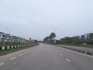
Benut is a mukim in Pontian District, Johor, Malaysia. [1]
Benut بنوت | |
|---|---|
| | |
| Country | Malaysia |
| State | Johor |
| District | Pontian |
| Area | |
| • Total | 140 km2 (50 sq mi) |
| Population | |
| • Total | 15,389 |
| • Density | 110/km2 (280/sq mi) |
Benut is a mukim in Pontian District, Johor, Malaysia. [1]

The mukim spans over an area of 140 km2 (54 sq mi). [2]
Benut has a population of 15,389 people. The Malays make up the majority in Benut, however there is a large percentage of Orang Kuala, Buginese, Javanese, Chinese, and Indian population as well. [3]
The mukim is served by TransJohor public buses linking to Pontian Kechil. [4]

UEP Subang Jaya is a major affluent township located in Subang Jaya, Selangor, Malaysia. It is located within the Mukim (sub-district) of Damansara in the district of Petaling.

Banting is a town and the seat of Kuala Langat District, Selangor, Malaysia. Banting has a population of 93,497. The postal code for Banting is 42700 and is administered by the Zone of 15 and 19 of the Kuala Langat Municipal Council. It is situated on the banks of Langat River. It is a Rest Town or Bandar Persinggahan of Federal Route 5. The historical Jugra, a former royal town of Selangor is situated near Banting. Banting is located near the beaches of Morib, as well as hills, forest and farms. Banting is an agricultural hub. Its main agricultural resources include oil palm plantations, poultry farms, betel leaves and it has a number of industrial areas. It is also the home town of the Malaysian badminton player Rashid Sidek.

Endau is a small town in Mersing District, Johor, Malaysia. It lies on the northern tip of east Johor, on the border with the Pahang state.

Jementah is a mukim in Segamat District, Johor, Malaysia.

Bakri or often Bukit Bakri is a town in Muar District, Johor, Malaysia. It is located along Federal Route 24 in Muar district, just ten kilometres east of Muar town. In 1991, it had a population of 10,000, which doubled by the 2000 census to 20,123. Now Bukit Bakri population is 30,280.

Simpang Renggam is a town in Kluang region in central Johor, Malaysia. It is 75 km from Johor Bahru via Federal route 1.
Bandar Tenggara is a town in Kulai District, Johor, Malaysia.

Perling is a neighbourhood and an upcoming state constituency in Pulai, Iskandar Puteri, Johor Bahru District, Johor, Malaysia. A development project of the company Pelangi Berhad in 1981, it covers 922 acres (3.73 km2) and contains close to 10,000 housing units. The main landmark of the housing area is Perling Mall, which has 2 floors of almost 100 shops. It is located twenty minutes from Johor Bahru. The iconic building at Taman Perling is Pangsapuri MIDAS with its black and white colours at the peak hill of Taman Perling.

Chaah is a town and mukim in Segamat District, Johor, Malaysia. It is the southernmost mukim in the district, but it is administered as a suburb of Labis.

Bekok is a mukim in Segamat District, Johor, Malaysia. It is the western entrance to Endau Rompin National Park and has a waterfall known as Sungai Bantang Waterfall. Bekok also houses several aborigine settlements (Perkampungan Orang Asli), such as Kampung Kudong and Kampung Kemidak.

Kahang is a mukim in Kluang District, Johor, Malaysia. It is particularly known as the final stop before heading to the Endau Rompin National Park and located along the Malaysia Federal Route 50.

Sekinchan is a small town located in Sabak Bernam District, Selangor, Malaysia. It is located along the coastal Federal Route 5. In history, the original name of Sekinchan is Sungai Sekinchang.
Bandar Seri Alam is a township in Mukim Plentong, Johor Bahru District, Johor, Malaysia. It is an initiative by Seri Alam Properties Sdn Bhd, a subsidiary of United Malayan Land Bhd. The township covers approximately 15 square kilometers and houses an ecology educational facilities from school age to campuses of some universities.

Batu Caves is a mukim and town in Gombak District, Selangor, Malaysia. Named after the limestone caves and Hindu shrine Batu Caves, the town is experiencing an increase in residences due to a housing boom in the center of the city.

Indahpura or Asiatic Indahpura is a township in Kulai District, Johor, Malaysia. Indahpura is translated as "Beautiful City" in Malay. Indahpura sprawls over 7,000 acres (28 km2). Sprawling over 6,800 acres of freehold land in Kulai @ Iskandar Malaysia, is a masterpiece of Genting Property. It was crafted since 2007 and contains various development including residential, commercial, light industrial, shopping malls, an education hub, and a healthcare center, to create sustainable township living.

Kota Masai is a township in Pasir Gudang, Johor Bahru District, Johor, Malaysia. This township is located between Masai and Pasir Gudang.
Larkin is a suburb in Johor Bahru, Johor, Malaysia.
Bandar Baru kangkar Pulai is a township at the border of mukim Senai, district of Kulai, State of Johor Darul Ta'zim and mukim Pulai, city of Iskandar Puteri, district of Johor Bahru, State of Johor Darul Ta'zim, Malaysia. The township is bordered by Pulai Hijauan to the west, Kangkar Pulai and Taman Pulai Mas to the east, and Pulai Indah to the south. The rest area on it perimeter is covered in green. This township is being developed by Keck Seng since 2008, and ready for occupation from 2010 onward.

Mukim Sungai Kluang or Sungai Keluang is a mukim located in Batu Pahat District in Johor, Malaysia. Batu Pahat District was divided into 14 mukims, each of which encompasses several villages. The population was 16,591 in 2010. The majority ethics of the population in the Sungai Kluang is Malay (11,854). It border with Mukim Benut, Pontian District in east and Mukim Sungai Punggor in west.
| |||||||||||||||
| General topics |
|  | |||||||||||||
| Administrative divisions |
| ||||||||||||||
| City councils (Majlis Bandaraya) |
| ||||||||||||||
| Municipal councils (Majlis Perbandaran) |
| ||||||||||||||
| District councils (Majlis Daerah) |
| ||||||||||||||
1°38′N103°16′E / 1.633°N 103.267°E
| | This Johor location article is a stub. You can help Wikipedia by expanding it. |