Bukit Gambir | |
|---|---|
 | |
| Country | Malaysia |
| State | Johor |
| District | Tangkak District |
| Population | |
| • Total | 40,000 |
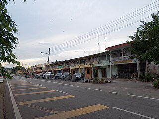
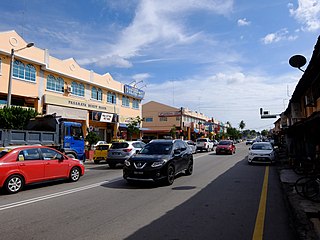
Bukit Gambir is a small town in Tangkak District, Johor, Malaysia. [1]
Bukit Gambir | |
|---|---|
| | |
| Country | Malaysia |
| State | Johor |
| District | Tangkak District |
| Population | |
| • Total | 40,000 |
Bukit Gambir is a small town in Tangkak District, Johor, Malaysia. [1]
The area was declared a town in 2003.
The town consists of 40,000 residents.
| School Code | School Name | Postcode | Coordinates |
|---|---|---|---|
| JBA9006 | Sekolah Kebangsaan Simpang 5 Pekan | 84800 | 2°11′56″N102°38′13″E / 2.1988°N 102.6369°E |
| JBA9007 | Sekolah Kebangsaan Simpang 5 Darat | 84800 | 2°14′01″N102°36′58″E / 2.2335°N 102.6162°E |
| JBA9012 | Sekolah Kebangsaan Sengkang | 84800 | 2°17′16″N102°41′29″E / 2.2878°N 102.6915°E |
| JBA9024 | Sekolah Kebangsaan Bukit Gambir | 84800 | 2°12′36″N102°39′06″E / 2.2099°N 102.6517°E |
| JBA9035 | Sekolah Kebangsaan Parit Kasan | 84800 | 2°13′57″N102°37′45″E / 2.2326°N 102.6293°E |
| JBC9002 | Sekolah Jenis Kebangsaan (Cina) Chian Kuo | 84800 | 2°12′48″N102°39′14″E / 2.2133°N 102.6540°E |
| JBC9011 | Sekolah Jenis Kebangsaan (Cina) Kok Beng | 84800 | 2°15′43″N102°40′55″E / 2.2620°N 102.6819°E |
| JBC9017 | Sekolah Jenis Kebangsaan (Cina) San Yu | 84800 | 2°11′41″N102°37′51″E / 2.1946°N 102.6308°E |
| School Code | School Name | Postcode | Coordinates |
|---|---|---|---|
| JEA9010 | Sekolah Menengah Kebangsaan Bukit Gambir | 84800 | 2°13′05″N102°39′57″E / 2.2180°N 102.6658°E |
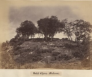
Bukit China is a hillside of historical significance in the capital of Malaysian state of Malacca, Malacca Town. It is located several kilometres to the north from the historical centre of Malacca, but these days, it's surrounded by the modern city on all sides.
Bakri or often Bukit Bakri is a town in Muar District, Johor, Malaysia. It is located along Federal Route in Muar district, just five kilometers east of Muar town. In 1991, it had a population of 10,000, which doubled by the 2000 census to 20,123. Now Bukit Bakri population is 30,280.

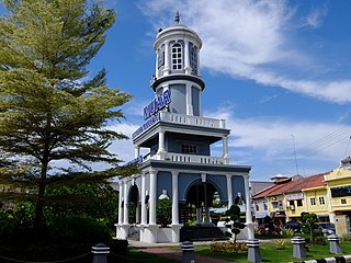
Tangkak is the principal town and capital of Tangkak District in Johor, Malaysia. The town is nicknamed "Fabric Town" or "Syurga Kain" in honour of its many textile shops. It is also well known as being a major entry point to Mount Ophir, the highest mountain in Johor.
Bukit Kepong is a mukim in Muar District, Johor, Malaysia. It is located near the Muar River.

Sagil is a small settlement in Tangkak District, Johor, Malaysia. Sagil is near the border of Johor with Malacca. Air Panas Waterfall is located here, and to access to the peak of Gunung Ledang. Gunung Ledang is around 5 minute driving distance from Sagil town.
Bukit Pasir is a small town in Muar District, Johor, Malaysia. Chinese is the majority ethnic group in this town and follow by Malays and Indians.

Bukit Kangkar is a small town in Mukim Serom, Tangkak District, Johor, Malaysia. The town is approximately 16 km from Muar and 12 km from Tangkak. The town is centered on villages and modern housing areas. The 2 main villages are Kampung Parit Pelampong and Kampung Gelugur.
Bukit Naning is a main town in Muar District, Johor, Malaysia. It is situated in the parliamentary constituency of Bakri.

Gelugor is a southern suburb of George Town in Penang, Malaysia. Named after a plant species, Gelugor lies along the eastern seaboard of Penang Island, between Jelutong and Sungai Dua, and nearly 5 km (3.1 mi) south of the city centre.

The Tangkak District is a district in western Johor, Malaysia, bordering Melaka. The district also shares a 2 kilometre border with Negeri Sembilan to the northwest. The district capital and largest city is Tangkak Town.

Čerević is a village in Serbia. It is situated in the Beočin municipality, in the Vojvodina province. Although, the village is geographically located in Syrmia, it is part of the South Bačka District. The village has a Serb ethnic majority and its population numbers 2,798 people.
Air Kuning Selatan is a small town between Gemencheh and Gemas in the state of Negeri Sembilan in Malaysia. The nearby towns are Batang Melaka in the state of Malacca and FELDA Bukit Jalor.
Mukim Tanjong Maya is a mukim in Tutong District, Brunei. The population was 4,062 in 2016. The mukim is named after Kampong Tanjong Maya, one of the villages it encompasses.

El Attaf is a town in northern Algeria, located in the wilaya (province) of Aïn Defla.

Kulai Municipal Council is the local authority of Kulai District in Johor, Malaysia. It was formerly known as Kulai District Council (Majlis Daerah Kulai ). The council has been established since 18 September 2004.

Bukit Batu is a mukim (subdivision) in Kulai District, Johor, Malaysia. Bukit Batu means "Hill of Rock" in Malay. Kulai Municipal Council administer the town.

Villa Hidalgo is a town and municipality in the state of Jalisco in Mexico.
Muar or Bandar Maharani, is a historical town and the capital of Muar District, Johor, Malaysia. It is one of the most popular tourist attractions in Malaysia to be visited and explored for its food, coffee and historical prewar buildings. It was recently declared as the royal town of Johor by Sultan Ibrahim Sultan Iskandar and is the fourth largest city in Johor. It is the main and biggest town of the bigger entity region or area of the same name, Muar which is sub-divided into the Muar district and the new Tangkak district, which was upgraded into a full-fledged district from the Tangkak sub-district earlier. Muar district as the only district covering the whole area formerly borders Malacca in the northern part. Upon the upgrading of Tangkak district, the Muar district now covers only the area south of Sungai Muar, whilst the northern area beyond the river is in within Tangkak district. However, both divided administrative districts are still collectively and fondly called and referred to as the region or area of Muar as a whole by their residents and outsiders. Currently, the new township of Muar is located in the Bakri area.
Gümürdülü is a village in the District of Ceyhan, Adana Province, Turkey.
| Wikivoyage has a travel guide for Bukit Gambir . |
Coordinates: 2°13′N102°40′E / 2.217°N 102.667°E
| | This Johor location article is a stub. You can help Wikipedia by expanding it. |
