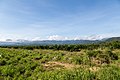
Sabah is a state of Malaysia located in northern Borneo, in the region of East Malaysia. Sabah has land borders with the Malaysian state of Sarawak to the southwest and Indonesia's North Kalimantan province to the south. The Federal Territory of Labuan is an island just off Sabah's west coast. Sabah shares maritime borders with Vietnam to the west and the Philippines to the north and east. Kota Kinabalu is the state capital and the economic centre of the state, and the seat of the Sabah State government. Other major towns in Sabah include Sandakan and Tawau. The 2020 census recorded a population of 3,418,785 in the state. It has an equatorial climate with tropical rainforests, abundant with animal and plant species. The state has long mountain ranges on the west side which forms part of the Crocker Range National Park. Kinabatangan River, the second longest river in Malaysia runs through Sabah. The highest point of Sabah, Mount Kinabalu is also the highest point of Malaysia.

The Sultanate of Sulu was a Sunni Muslim state that ruled the Sulu Archipelago, coastal areas of Zamboanga City and certain portions of Palawan in the today's Philippines, alongside parts of present-day Sabah and North Kalimantan in north-eastern Borneo.

Sandakan formerly known at various times as Elopura, is the capital of the Sandakan District in Sabah, Malaysia. It is the second largest city in Sabah after Kota Kinabalu. It is located on the Sandakan Peninsula and east coast of the state in the administrative centre of Sandakan Division and was the former capital of British North Borneo. In 2010, the city had an estimated population of 157,330 while the overall municipal area had a total population of 396,290. The population of the municipal area had increased to 439,050 by the 2020 Census.

Kudat Division is an administrative division in the state of Sabah, Malaysia. It occupies the northern tip of Sabah. Its total area of 4,623 square kilometres makes it the smallest of the five divisions of Sabah. The division covers the districts of Kudat, Pitas and Kota Marudu, as well as the islands of Balak, Balambangan, Banggi, Bankawan, Guhuan Utara, Kalampunian and Malawali.
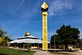
Kota Marudu is the capital of the Kota Marudu District in the Kudat Division of Sabah, Malaysia. Its population was estimated to be around 81,300 in 2019. It is located 130 kilometres north of the state capital, Kota Kinabalu, along the federal highway linking Kota Kinabalu with the town of Kudat, near the northern tip of Borneo.
Divisions are the primary subdivisions of Sabah and Sarawak, the states in East Malaysia. Each division is subdivided into districts — this is different in Peninsular Malaysia whereby districts are generally the primary subdivisions of a state. Each division is headed by a resident.

The history of Sabah can be traced back to about 23–30,000 years ago when evidence suggests the earliest human settlement in the region existed. The history is interwoven with the history of Brunei and the history of Malaysia, which Sabah was previously part of and is currently part of respectively. The earliest recorded history of Sabah being part of any organised civilisation began in the early 15th century during the thriving era of the Sultanate of Brunei. Prior to this, early inhabitants of the land lived in predominantly tribal societies, although such tribal societies had continued to exist until the 1900s. The eastern part of Sabah was ceded to the Sultan of Sulu by the Sultan of Brunei in 1658 for the former helping a victory over Brunei enemies, but many sources stated it had not been ceded at all. By the late 19th century, both territories previously owned by Sultan of Brunei and Sultan of Sulu was granted to British syndicate and later emerged as British North Borneo under the management of the North Borneo Chartered Company. Sabah became a protectorate of the United Kingdom in 1888 and subsequently became a Crown colony from 1946 until 1963, during which time it was known as Crown Colony of North Borneo. On 16 September 1963, Sabah merged with Malaya, Sarawak and Singapore to form Malaysia.

The Kuala Penyu District is an administrative district in the Malaysian state of Sabah, part of the Interior Division which includes the districts of Beaufort, Keningau, Kuala Penyu, Nabawan, Sipitang, Tambunan and Tenom. The capital of the district is in Kuala Penyu Town.

The Kudat District is an administrative district in the Malaysian state of Sabah, part of the Kudat Division which includes the districts of Kota Marudu, Kudat and Pitas. The capital of the district is in Kudat Town.

The Pitas District is an administrative district in the Malaysian state of Sabah, part of the Kudat Division which includes the districts of Kota Marudu, Kudat and Pitas. The capital of the district is in Pitas Town.

The Beluran District is an administrative district in the Malaysian state of Sabah, part of the Sandakan Division which includes the districts of Beluran, Kinabatangan, Sandakan, Telupid and Tongod. The capital of the district is in Beluran Town.
The Kunak District is an administrative district in the Malaysian state of Sabah, part of the Tawau Division which includes the districts of Kunak, Lahad Datu, Semporna and Tawau. The capital of the district is in Kunak Town. Kunak district were part of Lahad Datu before 1990.

The Lahad Datu District is an administrative district in the Malaysian state of Sabah, part of the Tawau Division which includes the districts of Kunak, Lahad Datu, Semporna and Tawau. The capital of the district is in Lahad Datu Town.

The Semporna District is an administrative district in the Malaysian state of Sabah, part of the Tawau Division which includes the districts of Kunak, Lahad Datu, Semporna and Tawau. The capital of the district is in Semporna Town.

The Kota Belud District is an administrative district in the Malaysian state of Sabah, part of the West Coast Division which includes the districts of Kota Belud, Kota Kinabalu, Papar, Penampang, Putatan, Ranau and Tuaran. The capital of the district is in Kota Belud Town.

The Kota Kinabalu District is an administrative district in the Malaysian state of Sabah, part of the West Coast Division which includes the districts of Kota Belud, Kota Kinabalu, Papar, Penampang, Ranau and Tuaran. The capital of the district is in Kota Kinabalu City.

The Papar District is an administrative district in the Malaysian state of Sabah, part of the West Coast Division which includes the districts of Kota Belud, Kota Kinabalu, Papar, Penampang, Putatan, Ranau and Tuaran. The capital of the district is in Papar Town.

The Tuaran District is an administrative district in the Malaysian state of Sabah, part of the West Coast Division which includes the districts of Kota Belud, Kota Kinabalu, Papar, Penampang, Putatan, Ranau and Tuaran. The capital of the district is in Tuaran Town.

Marudu Bay is a large bay on the north coast of the island of Borneo. It is located in the state of Sabah, Malaysia and opens to the Sulu Sea. Administratively, it is a part of Kudat Division. Kota Marudu District is on the south side of the bay, Kudat District on the west and Pitas District on the east side.