Kota Belud gained its name from the combination of two words in Bajau language. Kota means "fort" while Belud means a "hill" which consequently giving the meaning of "fort in a hill".[1]
History
In the past before the existence of a government body, there was often hostility between the races of different villages in the area. In order to defending themselves, they had to find a place to survive their opposition attacks. Hence, the Bajaus have chosen a hill as their fortress which subsequently known as "Kota Belud".[1]
According to the last census in 2010, the population of Kota Belud district is estimated to be around 91,27,[2] mainly Bajau (including Illanun) people and also Dusun (Tindal and Tobilung tribes). As in other districts of Sabah, there are a significant number of illegal immigrants from the nearby southern Philippines, mainly from the Sulu Archipelago and Mindanao, many of whom are not included in the population statistics.
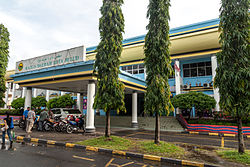
Mukim in Kota Belud District
1 Mukim Ambong 2 Mukim Bandar Kota Belud 3 Mukim Dudar 4 Mukim Kaguraan 5 Mukim Nabalu 6 Mukim Kadamaian 7 Mukim Kebayau 8 Mukim Kedatuan 9 Mukim Kelawat 10 Mukim Kulambai 11 Mukim Kinasaraban 12 Mukim Lasau 13 Mukim Mangkulat 14 Mukim Pirasan 15 Mukim Rampayan 16 Mukim Rosok 17 Mukim Sembirai 18 Mukim Taginambur 19 Mukim Taun Gusi 20 Mukim Tempasuk
Gary Chaw – The only Malaysian who became the winner of the 19th Golden Melody Awards 'Best Male Mandarin Singer', one of the most prestigious award in the Chinese music industry
1 2 "Latar Belakang Daerah"[District Background] (in Malay). Kota Belud District Office. Archived from the original on 10 November 2017. Retrieved 10 November 2017.
This page is based on this Wikipedia article Text is available under the CC BY-SA 4.0 license; additional terms may apply. Images, videos and audio are available under their respective licenses.