Kampung Raja

Last updated
Kampung Raja
Kapong Ghajo
Town
Other transcription(s)
   Jawi كامڤوڠ راج
   Chinese 甘榜拉惹(Simplified)
Gānbǎng Lārě(Hanyu Pinyin)
Map of Besut District, Terengganu.svg
Kampung Raja in Besut District
Terengganu location map.svg
Red pog.svg
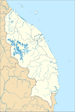
Kampung Raja
Location of Kuala Besut in Terengganu
Malaysia location map.svg
Red pog.svg
Kampung Raja
Kampung Raja (Malaysia)
Coordinates: 5°47′43″N102°33′51″E / 5.79528°N 102.56417°E / 5.79528; 102.56417
Country Flag of Malaysia.svg Malaysia
State Flag of Terengganu.svg Terengganu
District Besut
Government
  Type District council
  BodyBesut District Council
Time zone UTC+8 (Malaysian Standard Time)

Kampung Raja (Kelantan Malay: Kapong Ghajo), also known as Kota Putera is a mukim and capital of Besut District, Terengganu, Malaysia. It is one of the mukim in Besut and also the central administration here. A long time ago, a king lived here and his castle was built here, but now the castle has been moved to Muzium Kuala Terengganu and only an old castle that remained here called Istana Tengku Long. Although located in Terengganu, the people there speak Kelantanese Malay and are culturally Kelantanese, owing to its close proximity to Kelantan. [1]

Contents

Climate

Kampung Raja has a tropical rainforest climate (Af) with moderate rainfall from February to May and heavy to very heavy rainfall in the remaining months.

Climate data for Kampung Raja
MonthJanFebMarAprMayJunJulAugSepOctNovDecYear
Mean daily maximum °C (°F)28.6
(83.5)
29.5
(85.1)
30.9
(87.6)
32.0
(89.6)
32.4
(90.3)
32.0
(89.6)
31.6
(88.9)
31.4
(88.5)
31.3
(88.3)
30.6
(87.1)
29.3
(84.7)
28.6
(83.5)
30.7
(87.2)
Daily mean °C (°F)25.4
(77.7)
25.9
(78.6)
26.8
(80.2)
27.7
(81.9)
28.1
(82.6)
27.8
(82.0)
27.4
(81.3)
27.3
(81.1)
27.2
(81.0)
26.9
(80.4)
26.2
(79.2)
25.8
(78.4)
26.9
(80.4)
Mean daily minimum °C (°F)22.3
(72.1)
22.4
(72.3)
22.7
(72.9)
23.5
(74.3)
23.8
(74.8)
23.6
(74.5)
23.2
(73.8)
23.2
(73.8)
23.1
(73.6)
23.2
(73.8)
23.2
(73.8)
23.0
(73.4)
23.1
(73.6)
Average rainfall mm (inches)264
(10.4)
118
(4.6)
126
(5.0)
79
(3.1)
124
(4.9)
142
(5.6)
128
(5.0)
196
(7.7)
233
(9.2)
292
(11.5)
537
(21.1)
621
(24.4)
2,860
(112.5)
Source: Climate-Data.org [2]

References

  1. "Besut dalam lipatan sejarah". Archived from the original on 2016-03-05. Retrieved 2015-10-29.
  2. "Climate: Kampung Raja". Climate-Data.org. Retrieved 28 October 2020.