List of districts in Malaysia by population

Last updated

The following is a list of districts in Malaysia by population according to the latest national census, which was conducted in 2010.

Contents

West Malaysia

   Federal Territory (Not District)
  City-status District
  Municipal-status District
Federal Territory/StateDistrict NameCapital/Largest settlementLocal GovernmentPopulation (2010 [1] )Area (km²)Density
Flag of the Federal Territories of Malaysia.svg  Federal Territory (Malaysia)
Flag of Kuala Lumpur Malaysia.svg  Kuala Lumpur Kuala Lumpur H 16746212436,891.4
Flag of Putrajaya.svg  Putrajaya Putrajaya P 72413491,477.8
Flag of Johor.svg  Johor
Flag of Batu Pahat, Johor.svg Batu Pahat District Batu Pahat Batu Pahat M
Yong Peng D
4174581873222.9
Flag of Johor Bahru, Johor.svg Johor Bahru District Johor Bahru Johor Bahru C
Iskandar Puteri C
Pasir Gudang C
138656910641,303.2
Flag of Kluang, Johor.svg Kluang District Kluang Kluang M
Simpang Renggam D
2983322865104.1
Flag of Kota Tinggi, Johor.svg Kota Tinggi District Kota Tinggi Kota Tinggi D
Pengerang M
193210348955.4
Flag of Kulai, Johor.svg Kulai District Kulai Kulai M 251650754333.8
Flag of Mersing, Johor.svg Mersing District Mersing Mersing D 70894283825.0
Flag of Muar, Johor.svg Muar District Muar Muar M 2479571354183.1
Flag of Pontian, Johor.svg Pontian District Pontian Kechil Pontian M 155541933166.7
Flag of Segamat, Johor.svg Segamat District Segamat Segamat M
Labis D
189820280767.6
Flag of Tangkak, Johor.svg Tangkak District Tangkak Tangkak D 136852970141.1
Flag of Kedah.svg  Kedah
Baling District Baling Baling D 135646153088.7
Bandar Baharu District Serdang Bandar Baharu D 42341271156.2
Kota Setar District Alor Setar Alor Setar C 366787423867.1
Kuala Muda District Sungai Petani Sungai Petani M 456605928492.0
Kubang Pasu District Jitra Kubang Pasu M 220740946233.3
Kulim District Kulim Kulim M
Kulim Hi-Tech
Industrial Park LA
287694765376.1
Langkawi District Kuah Langkawi M 94777478198.3
Padang Terap District Kuala Nerang Padang Terap D 62896135746.3
Pendang District Pendang Pendang D 94962629151.0
Pokok Sena District Pokok Sena Alor Setar C 49506242204.6
Sik District Sik Sik D 67378163641.2
Yan District Yan Besar Yan D 68319242282.3
Flag of Kelantan.svg  Kelantan
Flag of Bachok, Kelantan.svg Bachok District Bachok Bachok D 133152264504.4
Flag of Gua Musang, Kelantan.svg Gua Musang District Gua Musang Gua Musang D 90057798011.3
Flag of Jeli, Kelantan.svg Jeli District Jeli Jeli D 40637128031.7
Flag of Kota Bharu, Kelantan.svg Kota Bharu District Kota Bharu Kota Bharu M
Ketereh D
4912374091,201.1
Flag of Kuala Krai, Kelantan.svg Kuala Krai District Kuala Krai Kuala Krai D
Dabong D
109461232947.0
Flag of Machang, Kelantan.svg Machang District Machang Machang D 93087546170.5
Flag of Pasir Mas, Kelantan.svg Pasir Mas District Pasir Mas Pasir Mas D 189292614308.3
Flag of Pasir Puteh, Kelantan.svg Pasir Puteh District Pasir Puteh Pasir Puteh D 117383434270.5
Flag of Tanah Merah, Kelantan.svg Tanah Merah District Tanah Merah Tanah Merah D 121319868139.8
Flag of Tumpat, Kelantan.svg Tumpat District Tumpat Tumpat D 153976170905.7
Flag of Malacca.svg  Melaka
Alor Gajah District Alor Gajah Alor Gajah M
Hang Tuah Jaya M
182666660276.8
Central Melaka District Melaka City Melaka C
Hang Tuah Jaya M
5031273141,602.3
Jasin District Jasin Jasin M
Hang Tuah Jaya M
135317676200.2
Flag of Negeri Sembilan.svg  Negeri Sembilan
Jelebu District Kuala Klawang Jelebu D 39200135029.0
Jempol District Bandar Seri Jempol Jempol M 116576149178.2
Kuala Pilah District Kuala Pilah Kuala Pilah D 66092109060.6
Port Dickson District Port Dickson Port Dickson M 115361572201.7
Rembau District Rembau Rembau D 43011415103.6
Seremban District Seremban Seremban C 555935935594.6
Tampin District Tampin Tampin D 8488987996.6
Flag of Pahang.svg  Pahang
Bentong District Bentong Bentong C 119817183165.4
Bera District Bandar Bera Bera D 97882221444.2
Cameron Highlands District Tanah Rata Cameron Highlands M 3847171254.0
Jerantut District Jerantut Jerantut D 91096720812.6
Kuantan District Kuantan Kuantan C 4619062960156.0
Lipis District Kuala Lipis Lipis D 89730516817.4
Maran District Maran Maran D 115424199657.8
Pekan District Pekan Pekan D 110633384628.8
Raub District Raub Raub D 95506226842.1
Rompin District Kuala Rompin Rompin D
Tioman DA
114901573520.0
Temerloh District Temerloh Temerloh M 165451225173.5
Flag of Penang (Malaysia).svg  Penang
Central Seberang Perai District Bukit Mertajam Seberang Perai C 3719752381,562.9
North Seberang Perai District Kepala Batas Seberang Perai C 2959792671,108.5
Northeast Penang Island District George Town Penang Island C 5202421244,195.5
South Seberang Perai District Sungai Jawi Seberang Perai C 171045242706.8
Southwest Penang Island District Balik Pulau Penang Island C 2021421751,155.1
Flag of Perak.svg  Perak
Bagan Datuk District Bagan Datuk Teluk Intan M 70300951.5273.9
Batang Padang District Tapah Tapah D 1236001794.1868.9
Hilir Perak District Teluk Intan Teluk Intan M 138270792.07174.6
Hulu Perak District Gerik Gerik D
Lenggong D
Pengkalan Hulu D
912186560.4313.9
Kampar District Kampar Kampar D 98978669.8147.8
Kerian District Parit Buntar Kerian D 179706921.47195.0
Kinta District Batu Gajah Ipoh C
Batu Gajah D
7677941305588.3
Kuala Kangsar District Kuala Kangsar Kuala Kangsar M 1595052563.6162.2
Larut, Matang and Selama District Taiping Taiping M
Selama D
3340732112.61158.1
Manjung District Seri Manjung Manjung M 2322771113.58208.6
Daerahmualimflag.jpg Muallim District Tanjung Malim Tanjong Malim D 69639934.3574.5
Perak Tengah District Seri Iskandar Perak Tengah D 1011281279.4679.0
Flag of Perlis.svg  Perlis Kangar Kangar M 231541821282.0
Flag of Selangor.svg  Selangor
Gombak District Bandar Baru Selayang Selayang M
Ampang Jaya C
6822266501,049.6
Hulu Langat District Bandar Baru Bangi Kajang M
Ampang Jaya C
11565858291,395.2
Hulu Selangor District Kuala Kubu Bharu Hulu Selangor M 1981321740113.9
Klang District Klang Klang M
Shah Alam C
8611896271,373.5
Kuala Langat District Teluk Datok Kuala Langat M 224648858261.8
Kuala Selangor District Kuala Selangor Kuala Selangor M 2095901195175.4
Petaling District Subang Petaling Jaya C
Shah Alam C
Subang Jaya C
18126334843,745.1
Sabak Bernam District Sabak Sabak Bernam D 105777997106.1
Sepang District Salak Tinggi Sepang M 211361600352.3
Flag of Terengganu.svg  Terengganu
Flag of Besut, Terengganu.svg Besut District Kampung Raja Besut D 1409521234114.2
Flag of Dungun, Terengganu.svg Dungun District Kuala Dungun Dungun M 154932273556.6
Flag of Hulu Terengganu, Terengganu.svg Hulu Terengganu District Kuala Berang Hulu Terengganu D 72052387518.6
Flag of Kemaman, Terengganu.svg Kemaman District Chukai Kemaman M 171383253667.6
Flag of Kuala Nerus, Terengganu.svg Kuala Nerus District Kuala Nerus Kuala Terengganu C 173800399435.6
Flag of Kuala Terengganu, Terengganu.svg Kuala Terengganu District Kuala Terengganu Kuala Terengganu C 184600210879.0
Flag of Marang, Terengganu.svg Marang District Marang Marang D 97857667146.7
Flag of Setiu, Terengganu.svg Setiu District Bandar Permaisuri Setiu D 55517130442.6

East Malaysia

   Federal Territory (Not District)
  City-status District
  Municipal-status District
Federal Territory/StateDivisionNameCapitalCouncilPopulation (2010 [1] )Area (km²)Density
Flag of the Federal Territories of Malaysia.svg  Federal Territory (Malaysia)
Flag of Labuan.svg  Labuan Victoria Labuan C 8690892944.7
Flag of Sabah.svg  Sabah
Interior Beaufort District Beaufort Beaufort D 64350173537.1
Sandakan Beluran District Beluran Beluran D 104484834512.5
Interior Keningau District Keningau Keningau D 173103353349.0
West Coast Kota Belud District Kota Belud Kota Belud D 91272138665.9
Sandakan Kinabatangan District Kinabatangan Kinabatangan D 146987800018.4
West Coast Kota Kinabalu District Kota Kinabalu Kota Kinabalu C 4629633501,322.8
Kudat Kota Marudu District Kota Marudu Kota Marudu D 66374191734.6
Interior Kuala Penyu District Kuala Penyu Kuala Penyu D 1895845341.8
Kudat Kudat District Kudat Kudat D 83140128764.6
Tawau Kunak District Kunak Kunak D 61094113453.9
Tawau Lahad Datu District Lahad Datu Lahad Datu D 199830650130.7
Interior Nabawan District Nabawan Nabawan D 3180760895.2
West Coast Papar District Papar Papar D 1244201234100.8
West Coast Penampang District Penampang Penampang D 121934466261.7
West Coast Putatan District Putatan Putatan D 5473329.71,842.9
Kudat Pitas District Pitas Pitas D 37808141926.6
West Coast Ranau District Ranau Ranau D 94092297831.6
Sandakan Sandakan District Sandakan Sandakan M 3962902266174.9
Tawau Semporna District Semporna Semporna D 1331641145116.3
Interior Sipitang District Sipitang Sipitang D 348622732.512.8
Interior Tambunan District Tambunan Tambunan D 35667134726.5
Tawau Tawau District Tawau Tawau M 397673612564.9
Sandakan Telupid District Telupid Telupid D
Interior Tenom District Tenom Tenom D 55553240923.1
Sandakan Tongod District Tongod Kinabatangan D 35341100523.5
West Coast Tuaran District Tuaran Tuaran D 102411116587.9
Flag of Sarawak.svg  Sarawak
Betong Betong District Betong Betong D 62131
Kabong District Kabong Saratok D
Pusa District Pusa Betong D
Saratok District Saratok Saratok D 46094
Bintulu
Bintulu District Bintulu Bintulu DA 189146
Tatau District Tatau Bintulu DA 30383
Kapit Belaga District Belaga Kapit D [2] 36114
Kapit District Kapit Kapit D 56053
Song District Song Kapit D 20595
Bukit Mabong District [3] Bukit Mabong Kapit D
Kuching Bau District Bau Bau D 54246
Kuching District Kuching Kuching North C
Kuching South C
Padawan M
617887
Lundu District Lundu Lundu D 33413
Limbang Lawas District Lawas Lawas D 38385
Limbang District Limbang Limbang D 48186
Miri Beluru District Beluru Marudi D
Marudi District Marudi Marudi D 64018
Miri District Miri Subis D
Miri C
300543
Subis District Subis Subis D
Telang Usan District Subis Subis D
Mukah Dalat District Dalat Dalat and Mukah D 19062
Daro District Daro Matu and Daro D 30671
Matu District Matu Matu and Daro D 17369
Mukah District Mukah Dalat and Mukah D 42922
Tanjung Manis District Tanjung Manis Matu and Daro D
Samarahan
Asajaya District Asajaya Kota Samarahan M 31874
Samarahan District Samarahan Kota Samarahan M [4] [5] 87923
Simunjan District Simunjan Simunjan D 39226
Sarikei Julau District Julau Meradong and Julau D 15816
Meradong District Meradong Meradong and Julau D 29441
Pakan District Pakan Meradong and Julau D 15480
Sarikei District Sarikei Sarikei D 58021
Serian [6] Serian District Serian Serian D 91599
Tebedu District Tebedu Serian D
Sibu Kanowit District Kanowit Kanowit D 28954
Sibu District Sibu Sibu D
Sibu Rural D
247995
Selangau District Selangau Sibu Rural D 22819
Sri Aman Lubok Antu District Lubok Antu Lubok Antu D 27984
Sri Aman District Sri Aman Sri Aman D 66790

Largest urban agglomerations

The following is a list of 10 largest urban agglomerations, metropolitan areas or conurbations, based on data from the 2010 National Census within district areas. Also included for comparison are the populations within the local governments which are fully or partially covered by the urban agglomerations.

Largest Urban Agglomerations by Population
RankConurbationLocal government [7] Local government populationTotal population (local government areas)District [8] District populationTotal population (districts)
1 Greater Kuala Lumpur/
Klang Valley
Kuala Lumpur City Hall 1,588,7506,278,998 Kuala Lumpur 1,674,6216,471,028
Petaling Jaya City Council 613,977 Petaling 1,812,633
Shah Alam City Council 541,306
Subang Jaya City Council 708,296
Klang Royal City Council 744,062 Klang 861,189
Kajang Municipal Council 795,522 Ulu Langat 1,156,585
Selayang Municipal Council 542,409 Gombak 682,226
Ampang Jaya City Council 468,961
Sepang Municipal Council207,354 Sepang 211,361
Putrajaya Corporation 68,361 Putrajaya 72,413
2 Greater Penang Penang Island City Council 708,1272,412,616 Northeast Penang Island 520,2022,473,462
Southwest Penang Island 202,142
Seberang Perai City Council 818,197 North Seberang Perai 295,979
Central Seberang Perai 371,975
South Seberang Perai 171,045
Sungai Petani Municipal Council 443,488 Kuala Muda 456,605
Kulim Municipal Council281,260 Kulim 287,694
Bandar Baharu District Council41,352 Bandar Baharu 47,628
Kerian District Council120,192 Kerian (partial)120,192
3 Iskandar Malaysia Johor Bahru City Council 497,0671,313,527 Johor Bahru 1,072,7121,359,327
Iskandar Puteri City Council 529,074
Pasir Gudang City Council 46,571
Kulai Municipal Council 234,532 Kulai 251,650
Pontian Municipal Council (south)6,283 Pontian (partial)34,965
4Greater Kuching Kuching North City Hall 165,642804,380 Kuching 617,887797,409
Kuching South City Council 159,490
Padawan Municipal Council 273,485
Kota Samarahan Municipal Council116,685 Samarahan 87,923
Serian District Council89,078 Serian 91,599
5 Ipoh Ipoh City Council 657,892737,861 Kinta (partial)737,861737,861
Batu Gajah District Council79,969
6 Greater Kota Kinabalu Kota Kinabalu City Hall 452,058628,725 Kota Kinabalu 462,963644,740
Putatan 55,864
Penampang District Council176,667 Penampang 125,913
7 Malacca Historical Malacca City Council 484,885484,885 Central Malacca 503,127503,127
Hang Tuah Jaya Municipal Council
8 Kuantan Kuantan City Council427,515427,515 Kuantan (partial)427,515427,515
9 Alor Setar Alor Setar City Council 405,523405,523 Kota Setar 366,787416,293
Pokok Sena 49,506
10 Kota Bharu Kota Bharu Islamic City Municipal Council314,964314,964 Kota Bharu (partial)314,964314,964

See also

Related Research Articles

<span class="mw-page-title-main">Kluang District</span> District in Johor, Malaysia

The Kluang District is a district in Johor, Malaysia. Its district capital is Kluang Town. Kluang district is one of the three landlocked districts in Johor, the other being Segamat and Kulai.

<span class="mw-page-title-main">Petaling District</span> District of Malaysia in Selangor

The Petaling District is a district located in the heart of Selangor in Malaysia. Petaling is not to be confused with the city of Petaling Jaya located in it, nor the mukim of Petaling under Subang Jaya City. The district office is located in Subang.

<span class="mw-page-title-main">Pasir Gudang</span> City in Johor, Malaysia

Pasir Gudang is a city in Johor Bahru District, Johor, Malaysia. The main industries are transportation and logistics, shipbuilding, petrochemicals and other heavy industries, and oil palm storage and distribution, which is located in Johor Port and Tanjung Langsat.

<span class="mw-page-title-main">Hulu Selangor District</span> Administrative district in Selangor, Malaysia

Hulu Selangor is a district in Selangor, Malaysia. It contains the towns of Serendah, Batang Kali and Kuala Kubu Bharu. Its principal town is Kuala Kubu Bharu. The district is located in the northeastern part of Selangor and borders the state of Perak to the north, Pahang to the east, Sabak Bernam district to the northwest, Kuala Selangor district to its southwest and Gombak district to the south. Selangor River sources from this area, hence giving the district's name.

<span class="mw-page-title-main">Kota Samarahan</span> Town and district capital in Sarawak, Malaysia

Kota Samarahan, formerly known as Muara Tuang, is a town and the administrative seat of the Samarahan District in Samarahan Division, Sarawak, Malaysia. It is also a satellite town for Kuching due to its proximity to the city part of Greater Kuching area. The Sarawak government position Kota Samarahan as the medical and education hub of the state. Kota Samarahan can be considered as the 'heart' of Malay/Muslims in Sarawak which forms approximately over 56% of the population, thus make it as another "Putrajaya" version of Sarawak.

<span class="mw-page-title-main">Kinta District</span> District of Malaysia in Perak

The Kinta District is a district in Perak, Malaysia. It contains the state capital Ipoh. Kinta is the most populated district in Perak and also the seventh most populated district in Malaysia. Kinta houses Ipoh, Perak's largest city and state capital while Batu Gajah is a seat in Kinta district.

<span class="mw-page-title-main">Gombak District</span> District of Malaysia in Selangor

The Gombak District is an administrative district located in the state of Selangor, Malaysia. The district was created on February 1, 1974, the same day when Kuala Lumpur was declared a Federal Territory. Until 1997, Rawang was the district capital; the capital has been moved to Bandar Baru Selayang. Gombak borders Kuala Lumpur to the southeast and the Genting Highlands to the east. Both Gombak and Kuala Lumpur, along with some other districts in Selangor, are situated within the Klang Valley. Other localities in Gombak district include Batu Arang, Kuang, Rawang, Kundang, Gombak Town, Selayang, Batu Caves and Hulu Kelang.
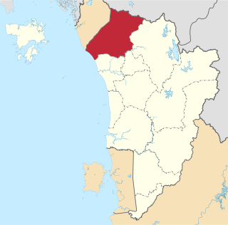
<span class="mw-page-title-main">Kubang Pasu District</span> District of Malaysia in Kedah

The Kubang Pasu District is a district in northern Kedah, Malaysia. It contains the border town of Bukit Kayu Hitam as well as the educational hub of Changlun, while Jitra is the largest town and administrative centre of the district. The district council had been upgraded into municipal council on 22 October 2018, becoming the fifth city or municipal in the state.

Divisions are the primary subdivisions of Sabah and Sarawak, the states in East Malaysia. Each division is subdivided into districts — this is different in Peninsular Malaysia whereby districts are generally the primary subdivisions of a state. Each division is headed by a resident.
<span class="mw-page-title-main">Asajaya District</span> Town and district capital in Sarawak, Malaysia

Asajaya is a small rural town located in Samarahan Division, Sarawak, Malaysia.

<span class="mw-page-title-main">Kulai District</span> District in Johor, Malaysia

The Kulai District is a district in the state of Johor, Malaysia. Its district capital is Kulai Town. It covers Kulai Town, Ayer Bemban, Bandar Putra Kulai, Bukit Batu, Indahpura, Bandar Baru Kangkar Pulai, Kelapa Sawit, Saleng, Sedenak, Seelong, Senai, and Sengkang. Kulai is also within Iskandar Malaysia economic zone.
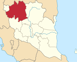
<span class="mw-page-title-main">Lipis District</span> District of Malaysia in Pahang

The Lipis District is a district located in the northwest of Pahang, Malaysia. The district covers an area of 5,198 km2. Lipis District is bordered by Cameron Highlands the northwest, Batang Padang District, Perak on the west, Jerantut District on the east, Gua Musang District, Kelantan to the north and Raub District to its south. Lipis has 10 mukim or subdistricts, the largest being Ulu Jelai. The district capital is Kuala Lipis. During the British colonization, Kuala Lipis was made the state's capital city. Kuala Lipis was the administrative capital of Pahang for 57 years from 1898 until 27 August 1955, when Kuantan was picked as the new capital. Lipis had many types of minerals such as tin and gold, and products from the surrounding forests.

<span class="mw-page-title-main">Kota Tinggi District</span> District in Johor, Malaysia

Kota Tinggi District is a district in the Malaysian state of Johor. It is the largest district in the state with an area of 3,488.7 square kilometres (1,347.0 sq mi). The population was 222,382 in 2020. The principal town is Kota Tinggi.

<span class="mw-page-title-main">Klang District</span> District of Malaysia in Selangor

The Klang District is a district in Selangor, Malaysia. It is located in the western part of Selangor. It borders the Kuala Selangor District to the north, Petaling to the east, Kuala Langat district to the south and Malacca Straits to the west. The district was further divided into two mukims which is Klang and Kapar that covers 626.78 square km of land with 53.75 km of coastline.
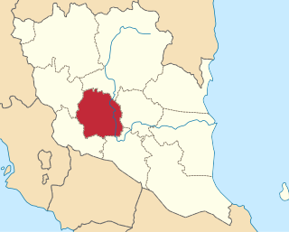
<span class="mw-page-title-main">Temerloh District</span> District of Malaysia in Pahang

Temerloh District is a district in Pahang, Malaysia. The district consists of two areas, the 1,442-square-kilometre (557 sq mi) Municipal Council Area (64.08%) and the 808-square-kilometre (312 sq mi) outer Municipal Council Area (35.92%). Temerloh district is bordered by Maran District on the east, Bentong District on the west, Jerantut District on the north, and Bera District on the south.

<span class="mw-page-title-main">Sipitang District</span> District in Sabah, Malaysia

The Sipitang District is an administrative district in the Malaysian state of Sabah, part of the Interior Division which also includes the districts of Beaufort, Keningau, Kuala Penyu, Nabawan, Tambunan and Tenom. The capital of the district is in Sipitang Town. The ecotourism village of Long Mio and Long Pasia is located in this district, while the small town of Sindumin serves as a gateway to the state of Sarawak.

References

  1. 1 2 "TABURAN PENDUDUK MENGIKUT PBT & MUKIM 2010". Department of Statistics, Malaysia. Retrieved 15 December 2017.
  2. "Call for Belaga to have own district council". The Bprneo Post. 22 January 2016.
  3. "Launch of Bukit Mabong, Tunoh, Kapit by the Chief Minister of Sarawak". Sarawak Regional Corridor Development Authority. 3 November 2015. Retrieved 28 December 2016.
  4. "It's Kota Samarahan Municipal Council effective today". 10 November 2016.
  5. "Laman Web Rasmi Majlis Daerah Samarahan". www.mpks.sarawak.gov.my.
  6. Samuel Aubrey (12 April 2015). "Serian now a division". The Borneo Post . Retrieved 15 May 2015.
  7. "Population Distribution by Local Authority Areas and Mukims, 2010 (page 1 & 8)" (PDF). Department of Statistics, Malaysia. Archived from the original (PDF) on 5 February 2015. Retrieved 19 July 2013.
  8. "Population Distribution and Basic Demographic Characteristics, 2010" (PDF). Department of Statistics, Malaysia. Archived from the original (PDF) on 22 May 2014. Retrieved 19 April 2012.